- Mount Coree
-
 Mount CoreeMount Coree (Australian Capital Territory)
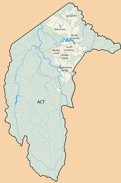
Mount Coree is a mountain located on the border between the Australian Capital Territory and New South Wales, Australia. It is located in Brindabella National Park on the NSW side, and Namadgi National Park on the ACT side. It has an elevation of 1421 metres (4662 feet). The mountain marks the point where the ACT border changes from a straight north-easterly line to being judged by the watershed of the Cotter River, and the Coree Trigonometrical Station on top of it is officially mentioned as such in the Seat of Government Acceptance Act 1909 which established the borders of the ACT.
Before European settlement, the mountain was used by Indigenous Australian tribes to hunt for bogong moths. [1] Coree is an aboriginal name for moth.[2]
References
- ^ Australian Alps National Parks, Brindabella
- ^ ACT Planning & Land Authority
External links
Coordinates: 35°18′23″S 148°48′39″E / 35.30639°S 148.81083°E
Categories:- Mountains of the Australian Capital Territory
- Mountains of New South Wales
- Borders of the Australian Capital Territory
- Borders of New South Wales

Wikimedia Foundation. 2010.