Ciudad Constitución Airport

Ciudad Constitución Airport
Aeropuerto de Ciudad Constitución
IATA: CUAICAO: MMDA
CUA is located in Baja California Sur
{{{alt}}}
CUA
Location of airport in Baja California Sur
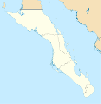
Summary
Airport type Public
Operator Municipality of Comondú
Location Ciudad Constitución
Elevation AMSL 213 ft / 65 m
Coordinates 25°03′14″N 111°36′54″W / 25.05389°N 111.615°W / 25.05389; -111.615
Runways
Direction Length Surface
ft m
12/30 5,250 1,600 Asphalt

Ciudad Constitución Airport (IATA: CUAICAO: MMDA) is a small airfield located 6 km East of the central business district (CBD) of Ciudad Constitución, Baja California Sur, Mexico, a city located in the Santo Domingo Valley, in the middle of the state.

The airport is operated by the Municipality of Comondú Government, but in October the 9th 2007 the airline Aéreo Servicio Guerrero was authorized to use and manage the airport land and facilities. The airport handles both commercial and general aviation, mostly within the region.

Airlines and destinations

Airlines Destinations
Aéreo Calafia Cabo San Lucas, Ciudad Obregón, Culiacán, Guasave, Los Mochis
Aéreo Servicio Guerrero Los Mochis

External links


Wikimedia Foundation. 2010.

Игры ⚽ Поможем решить контрольную работу

Look at other dictionaries:

  • Ciudad Constitución — road sign on Highway 1, south of the city …   Wikipedia

  • Villa Constitución Airport — Infobox Airport name = Villa Constitución Airport nativename = nativename a = nativename r = image width = caption = IATA = VIB ICAO = type = Public owner = operator = city served = location = Ciudad Constitución elevation f = 163 elevation m =… …   Wikipedia

  • Ciudad Obregón International Airport — IATA: CEN – ICAO: MMCN …   Wikipedia

  • Constitución railway station — Estación Plaza Constitución Constitution Square Station City Buenos Aires, Argentina …   Wikipedia

  • Federal de Bachigualato International Airport — Infobox Airport name = Federal Bachigualato International Airport nativename = Culiacán International Airport nativename a = Aeropuerto Internacional de Culiacán nativename r = image width = caption = IATA = CUL ICAO = MMCL type = Military/Public …   Wikipedia

  • Federal del Valle del Fuerte International Airport — Infobox Airport name = Federal del Valle del Fuerte International Airport nativename = nativename a = nativename r = image width = caption = IATA = LMM ICAO = MMLM type = Public owner = operator = Grupo Aeroportuario del Pacifico city served =… …   Wikipedia

  • Aéreo Calafia — Infobox Airline airline=Aéreo California logo= logo size= fleet size= destinations=11 IATA= ICAO= callsign=AÉREO CALIFORNIA parent= founded=1993 headquarters=Cabo San Lucas, Mexico key people= hubs=Cabo San Lucas International Airfield focus… …   Wikipedia

  • Liste der IATA-Codes/C — Diese Teilliste führt alle IATA Flughafen Codes auf, die mit „C“ beginnen, und enthält Informationen zu den bezeichneten Verkehrsknotenpunkten. IATA Codes   A B C D E F G H I …   Deutsch Wikipedia

  • Liste Des Codes AITA Des Aéroports/C — Liste des codes AITA des aéroports internationaux. Le code de deux lettres qui suit la ville est la subdivision du pays (région, État…) selon la norme ISO 3166 2. Liste des codes AITA des aéroports : A B C D E F G H I J K L M N O P Q R S T …   Wikipédia en Français

  • Liste des codes AITA des aeroports/C — Liste des codes AITA des aéroports/C Liste des codes AITA des aéroports internationaux. Le code de deux lettres qui suit la ville est la subdivision du pays (région, État…) selon la norme ISO 3166 2. Liste des codes AITA des aéroports : A B… …   Wikipédia en Français

Share the article and excerpts

Direct link
Do a right-click on the link above
and select “Copy Link”