- Marquette Interchange
-
Marquette Interchange Location Milwaukee, Wisconsin Coordinates: 43°02′08″N 87°55′25″W / 43.035615°N 87.923713°W Roads at
junction: I-43
I-43
 I-94
I-94
 I-794
I-794 US 41
US 41Construction Type: Hybrid Opened: 1956 Maintained by: Wisconsin Department of Transportation Map 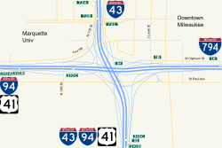
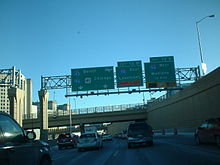
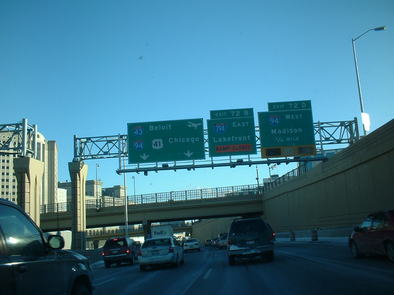
The Marquette Interchange is a major freeway interchange in downtown Milwaukee, Wisconsin, located near Marquette University where Interstate 43, Interstate 94, Interstate 794, and U.S. Highway 41 meet. Originally built in the 1960s, the interchange was rebuilt between 2004 and 2008, and was officially opened on August 19th, 2008, after what was at the time the largest construction project in state history.
Contents
History
The history of the Marquette Interchange, originally called the Central Interchange, stretches back more than half a century. The idea of a north/south freeway with an interchange in downtown Milwaukee was first proposed in 1952 for an area south and east of Marquette University. An artist’s sketch in a local newspaper in December 1952 provided a first glimpse of the future.
The following year, the Milwaukee County Expressway Commission was created by state law to plan, design, construct and maintain a freeway system in Milwaukee County. Land acquisition soon began. In 1955, the Milwaukee County Board adopted A General Plan of Expressways for Milwaukee County, which included a downtown interchange near the present location of the Marquette Interchange.
All of this activity in Milwaukee was in no way unique. Many cities across the United States were drawing up plans for new expressways during the mid-1950s. Nationally, there were big plans, too. In 1956, President Dwight D. Eisenhower signed the Federal Aid Highway Act of 1956, creating the United States' modern interstate highway system.
Preliminary design on the Marquette Interchange began in 1956, with final design beginning in 1960. In 1964, construction began, and so did a difficult balancing act. For the next 4-1/2 years, traffic flow on city streets had to be maintained while new expressways and the new interchange were built in their midst. Bypasses and temporary street connections were used extensively to route heavy volumes of traffic around construction areas.
Between 1964 and 1968, twenty-one construction contracts totaling over $33 million were awarded.
 In 2007 during reconstruction
The Marquette Interchange was dedicated and opened to traffic on Monday, December 23, 1968. The interchange was, and still is in its rebuilt form, one of downtown Milwaukee’s most prominent architectural landmarks. In the years to follow, millions of motorists would come to know the interchange as part of their route to work, around town or across the state. The Marquette Interchange has no affiliation with Marquette University, to which it is adjacent. Marquette University officials like to joke about how the university receives complaints from disgruntled motorists who erroneously believe the Interchange is owned by the University.
The interchange was experiencing severe deterioration and traffic problems due to major design flaws, including poorly designed left exits and vehicles having to weave across travel lanes to reach exit ramps, causing accidents and bottlenecks. It underwent a total rebuild dubbed the Marquette Interchange Project between 2004 and 2008, and was officially opened on August 19, 2008, several weeks ahead of schedule. At a cost of less than $810 million, which was well below the projected $1 billion price tag, the project involved 46 cranes and more than 4,000 workers in what was at the time the largest construction project in state history. The project rebuilt the viaduct section of I-794 between the interchange and the Milwaukee River, I-43 from the interchange to North Avenue (including the bridges carrying city streets that spanned the freeway), the Hillside Interchange that connected I-43 to Highway 145, and I-94 from the interchange to 26th Street (including rebuilding the north end of the 16th Street Viaduct, officially known as the James E. Groppi Unity Bridge). The project also demolished the Milwaukee County Courthouse Annex parking structure that stood over the northbound lanes of I-43 just north of the interchange.
The new interchange
The new Marquette Interchange was designed to ensure the safe and efficient flow of traffic. Though the new interchange occupies the same amount of land as the old one, it feels much more spacious. Design features include:
- Two lane ramps in both directions between I-94 and I-43
- More gradual curves on ramps, with longer sight distances
- More distance between ramps, to eliminate traffic conflicts from lane changes
- Elimination of all left-hand entrances and exits
- Design features allow for future expansion to an eight-lane freeway
See also
- Interchange
- Marquette University
- Freeway
- Interstate 43
- Interstate 94
- Interstate 794
- U.S. Route 41
- Eclipse Park
External links
Coordinates: 43°02′11″N 87°55′29″W / 43.036252°N 87.924726°W
City of Milwaukee Geography • Climate • Government • Flag • Fire • History • Landmarks • Skyscrapers • Colleges and Universities • Police • Public Schools • Sports • Music • Neighborhoods • Parks • Public Art • Metropolitan Area Categories:
- Transportation in Milwaukee, Wisconsin
- Interstate 94
- Road interchanges in the United States


Wikimedia Foundation. 2010.