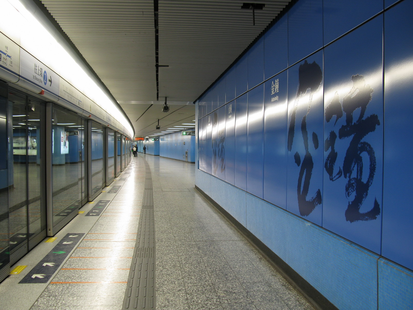
- Admiralty Station
MTR infobox
livery=Blue
namecolour=White
line=Island
line2=Tsuen Wan
caption=Admiralty station platform of Island Line
district=Central and Western
area=Admiralty
open=February 12, 1980
type=Underground
platformtype=Island
platformno=4
exitno=8
code=ADM
hours=0605/0100
connections= Bus, Minibus, Tram
engname=Admiralty
chiname=金鐘
coordinatesN=22.278816
coordinatesE=114.164586 Chinese
t=金鐘
s=金钟
l=Golden Bell
j=gam1 zung1
y=gam1 jung1
p=JīnzhōngAdmiralty station is an
MTR station located onHong Kong Island , in an area often referred to as Admiralty. The station'slivery is dodger blue. The station connects the HK-MTR lines|Tsuen Wan with the HK-MTR lines|Island incross-platform interchange type.The station is named after HMS "Tamar" (a place of land now known as
Tamar site ), once the headquarters of theRoyal Navy in Hong Kong - this, even though HMS "Tamar" had never actually been theAdmiralty . It was built on the former site of the Hong Kongnaval dockyard s, which was built in 1878 and demolished in the 1970s.Development
The Government had given the
MTR Corporation first refusal on the 60,000 square foot site, which was subsequently sold to it in 1976 for around HK$200 million for cash and equity consideration.Malcolm Surry, [http://sunzi1.lib.hku.hk/newspaper/view/16_05.01/65736.pdf Metro's role in the property game] , South China Morning Post, 16-Jul-1976]The Admiralty Centre, United Centre and Queensway Plaza formed part of development, and sit directly above the station.
Usage
As the primary interchange station for most HK-MTR lines|Tsuen Wan and the HK-MTR lines|Island riders, Admiralty is heavily congested during rush hours. Currently, Admiralty and North Point are the only cross-platform interchange stations between
Kowloon andHong Kong Island lines in the entireMTR system. Despite trains departing at capacity (every 2.1 minutes), commuters frequently have to board the second or even the third train when interchanging. The situation has deteriorated following fare cuts due to theMTR -KCRC merger.Passengers feel the crush after fare reductions, Anita Lam, Mar 10, 2008,SCMP [http://www.scmp.com/portal/site/SCMP/menuitem.2af62ecb329d3d7733492d9253a0a0a0/?vgnextoid=ec05e75249398110VgnVCM100000360a0a0aRCRD&ss=Hong+Kong&s=News] ]Arson attack in 2004
On 5 January 2004, 14 passengers suffered minor injuries when a 55-year-old delusional man ignited a bottle of
thinner in an Admiralty-bound train from Tsim Sha Tsui. The driver decided to complete the journey and passengers were evacuated from the train in Admiralty [ [http://legalref.judiciary.gov.hk/lrs/common/ju/ju_body.jsp?DIS=54402&AH=&QS=&FN=&currpage=T Prosecution against arsonist on MTR train 2006 no.50] -High Court (Hong Kong) (Traditional Chinese)] . To date it is the only arson attempt in MTR history. For those who were going to Central Station, they should go down to the westbound Island Line platform and take the train to Central or Sheung Wan (if they need to interchange at Central).Future development
The
Sha Tin to Central Link and theSouth Island Line projects are under development, possibly reaching completion in a decade. The former will allow commuters from North-EastNew Territories direct interchange from theEast Rail Line , whereas the latter, terminating at Admiralty, will give residents in the Southern District much quicker access to the CBD. A new underground concourse will be built, with escalators connecting it directly to the existing platforms.tation layout
There are very wide passageway between 2 platforms on each floor, they are also curve platforms with opposite directions, the platforms form a
trapezium . Because all the platforms are curve and it is a major interchange station, there are large stickers in front of the screen doors with "Mind the gap" text, which can be only found in this station.Entrances/exits
Admiralty is part of the Central Business District of Hong Kong Island. There are many office buildings around the station. A major shopping mall,
Pacific Place , is accessed through a long pedestrian walkway from Exit F.*A: Admiralty Centre
*B: Lippo Centre
*C1/C2: Queensway
*D: United Centre
*E1/E2: Harcourt Garden/Hong Kong Academy of Performing Arts
*F: Pacific PlaceTransport Connections
There is a bus terminus stretching across the length of Admiralty that can be reached by Exits B, C2 and D. This buses connect to many different parts of Hong Kong Island, Kowloon and the New Territories.
Bus Routes
*Bus
**KMB, serving only cross-harbour routes onHong Kong Island
**First Bus
**CitybusNeighbouring stations
Future neighbouring stations
s-line|system=HK-MTR|line=North-south|previous=|next=Exhibition|type2=North|branch=SCL compete in 2019 and work from 2010
References
Wikimedia Foundation. 2010.
