- Georgetown, Arkansas
Infobox Settlement
official_name = Georgetown, Arkansas
settlement_type =Town
nickname =
motto =
imagesize = 260 px
image_caption =
image_
imagesize = 260 px
image_caption =
image_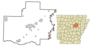
mapsize = 250x200px
map_caption = Location of Georgetown in Arkansas
mapsize1 =
map_caption1 =
subdivision_type = Country
subdivision_type1 = State
subdivision_type2 = County
subdivision_name =United States
subdivision_name1 =Arkansas
subdivision_name2 = White
government_type =
leader_title =Mayor
leader_name = Rickie Stephenson
established_title = Founded
established_title2 = Incorporated
established_date =1789
established_date2 =1986
area_magnitude =
area_total_sq_mi = 0.3
area_total_km2 = 0.7
area_land_sq_mi = 0.3
area_land_km2 = 0.7
area_water_sq_mi = 0.0
area_water_km2 = 0.0
area_urban_sq_mi =
area_urban_km2 =
area_metro_sq_mi =
area_metro_km2 =
population_as_of = 2000
population_note =
population_total = 126
population_metro =
population_urban =
population_density_km2 = 460.7
population_density_sq_mi = 180.2
timezone = CST
utc_offset = -6
timezone_DST = CDT
utc_offset_DST = -5
latd = 35 |latm = 7 |lats = 40 |latNS = N
longd = 91 |longm = 21 |longs = 12 |longEW = W
elevation_m = 62
elevation_ft = 203
website =
postal_code_type =ZIP code
postal_code = 72143
area_code = 501
blank_name = FIPS code
blank_info = 05-26440
blank1_name = GNIS feature ID
blank1_info = 0057810
footnotes =Georgetown is a town in southeastern
White County, Arkansas , overlooking the White River. First settled in1789 before theLouisiana Purchase , the community is the oldest continuously settled area inArkansas . [ [http://www.rootsweb.com/~arwhite/history/The_One_Stop_Cafe.htm Georgetown history] from the "Arkansas Democrat-Gazette ", via the White County Historical Society] The settlement of Arkansas Post, which began in1686 [ [http://www.nps.gov/arpo/historyculture/index.htm Arkansas Post history] from theUnited States National Park Service ] , came more than a century earlier, though that community dissolved in the years following theAmerican Civil War . The state's next oldest community after Georgetown — Batesville — was founded approximately 21 years later.The
United States Census Bureau counted a population of 126 as of the 2000 census.Geography
Georgetown is located on the White River at coor dms|35|7|40|N|91|27|12|W|city (35.127827, -91.453459)GR|1.
According to the
United States Census Bureau , the town has a total area of 0.7km² (0.3 mi²), all land.Demographics
As of the
census GR|2 of 2000, there were 126 people, 55 households, and 33 families residing in the town. Thepopulation density was 180.2/km² (460.7/mi²). There were 71 housing units at an average density of 101.5/km² (259.6/mi²). The racial makeup of the town was 96.83% White and 3.17% Black or African American. 0.79% of the population were Hispanic or Latino of any race.There were 55 households out of which 21.8% had children under the age of 18 living with them, 49.1% were married couples living together, 5.5% had a female householder with no husband present, and 38.2% were non-families. 34.5% of all households were made up of individuals and 16.4% had someone living alone who was 65 years of age or older. The average household size was 2.29 and the average family size was 2.94.
In the town the population was spread out with 24.6% under the age of 18, 4.0% from 18 to 24, 24.6% from 25 to 44, 23.8% from 45 to 64, and 23.0% who were 65 years of age or older. The median age was 43 years. For every 100 females there were 110.0 males. For every 100 females age 18 and over, there were 97.9 males.
The median income for a household in the town was $12,500, and the median income for a family was $25,357. Males had a median income of $22,500 versus $15,625 for females. The
per capita income for the town was $8,283. There were 25.0% of families and 38.0% of the population living below thepoverty line , including 50.0% of under eighteens and 37.1% of those over 64.References
External links
Wikimedia Foundation. 2010.