- Woodhill (RTA Rapid Transit station)
Infobox Station
name=Woodhill
type=RTAlight rail station

image_size=
image_caption=
address=2800 Woodhill Road
Cleveland, Ohio 44104
coordinates=coord|41|28|58|N|81|37|7|W|type:railwaystation_region:US-OH|display=inline,title
line=RTA Rapid Transit rail color box|system=GCRTA|line=Greenrail color box|system=GCRTA|line=Blue
other=Bus # 10 (East 105th)
Bus # 11 (Quincy)
Bus # 13 (Buckeye)
structure=At-grade
platform=Side platforms
tracks=
parking=60 spaces [2007 Park-and-Ride Inventory/Survey, [http://www.noaca.org/06transitguide.pdf NOACA 2006 Transit Network Guide] , June 2007, p. 29.]
bicycle=
passengers=
pass_year=
pass_percent=
pass_system=
opened=April 11 ,1920
closed=
rebuilt=October 30 ,1981
ADA=
code=
owned=Greater Cleveland Regional Transit Authority
zone=
former=
services=
mpassengers=
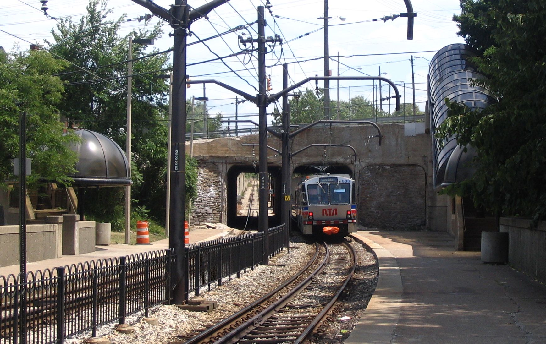
Woodhill is a station on the RTA Blue and Green Lines inCleveland, Ohio , USA. It is located at the intersection of Woodhill Road, Buckeye Road and Shaker Boulevard.The station comprises
side platforms below grade west of the intersection. Two concretestairways with tintedacrylic glass canopies lead from the street down to the platforms. There is a smallparking lot north of the platforms off Buckeye Road.__NOTOC__Notable places nearby
* Woodland Hills neighborhood
History
The station opened on
April 11 ,1920 when service commenced on the line west of Shaker Square to East 34th Street and via surface streets to downtown.cite book
last = Toman
first = James
authorlink =
coauthors =
title = The Shaker Heights Rapid Transit
publisher = Interurban Press
date = 1990
location = Glendale, Cal.
pages = p. 22
url =
doi =
isbn = 0-916374-95-5 ]The station was located at the mouth of a cut over a mile in length from
Shaker Square . The cut averages 25 feet in depth, but just before Woodhill station it is as deep as 40 feet, and it provides a 2.44 percent incline down from the Square, the steepest grade on the line. The line was constructed with a tunnel under the intersection of Buckeye Road and Woodhill Road, which was built without disturbing the automobile and streetcar traffic above. The location of the tunnel dictated the placement of the line. [Toman (1990). p. 20.]The material excavated from the cut was used to create an embankment to carry the tracks over the railroad tracks and streets west of Woodhill station. The embankment is high as 50 feet at places. The cut and fill provide the means for the trains to traverse the Portage
Escarpment that separates much of the city of Cleveland from suburbs such as Shaker Heights and Cleveland Heights.In 1980 and 1981, the trunk line of the Green and Blue Lines from East 55th Street to Shaker Square was completely renovated with new track, ballast, poles and wiring, and new stations were built along the line. At Woodhill station, new platforms were installed, and the wooden stairways were replaced by the present covered concrete stairways. The renovated line opened on
October 30 ,1981 . [Toman (1990). p. 115.]References
External links
* [http://www.riderta.com/rapidtransit_loc_buckeye.asp Buckeye-Woodhill Light Rail Rapid Transit Station page from RTA Website]
Wikimedia Foundation. 2010.
