- Mill Avenue Bridges
-
Mill Avenue Bridges 
Mill Avenue Bridges at duskCarries Motor vehicles, pedestrians, and bicycles Crosses Tempe Town Lake Locale Tempe, Arizona Maintained by City of Tempe Opened Mill Avenue Bridge in August 1931 and the New Mill Avenue Bridge in 1994 Toll Free both ways Coordinates 33°26′00″N 111°56′30″W / 33.433335°N 111.941575°WCoordinates: 33°26′00″N 111°56′30″W / 33.433335°N 111.941575°W The Mill Avenue Bridges consist of two bridges that cross the Salt River in Tempe, Arizona at the north end of the shopping district on Mill Avenue. The first bridge opened in August 1931 and the second bridge opened in 1994.
Contents
Original Span
The original bridge was built in 1931 but was not dedicated until 1 May 1933. The dedication celebration lasted for two days. Attending the celebration was Benjamin Baker Moeur, a former Tempe doctor and the governor at that time. The creation of this bridge replaced the Ash Avenue Bridge which was a dilapidated, one-lane, wagon bridge just to the west. It was demolished in 1991. In the Phoenix area, it was the sole crossing at the Salt River for some time.
Water flowed down the Salt River until the 1940s, when dams were constructed upstream. The water flow almost ceased, creating a dry river bed to support the growing Southwest. For years, southbound traffic used both lanes of the bridge, while northbound traffic utilized an unbridged crossing in the riverbed.
Despite the Salt's being a dry river, water occasionally flowed. When reservoir levels got too high, the dams were required to release water, causing water to flow once more. Due to monsoon storms heavy rains would fall, and washes and street runoff emptied into the river. At such times the unbridged crossing was closed, and the bridge was opened to north- and southbound traffic, one lane in each direction.
The bridge faced many strong floods that raged through the Salt River Valley. In 1980 all but two of the bridged crossings on the Salt River were closed for safety reasons (principally erosion of the approaches) due to severe flooding. The Mill Avenue Bridge and one other bridge in Phoenix were the only bridges that remained open. This was because they were structurally sound to stand up to the raging currents. Water hit the bridge at 200,000 cubic feet per second (5,700 m3/s), which far surpassed the expected strength of the bridge. In one 24 hour period during this flood, 92,000 vehicles crossed the bridge.
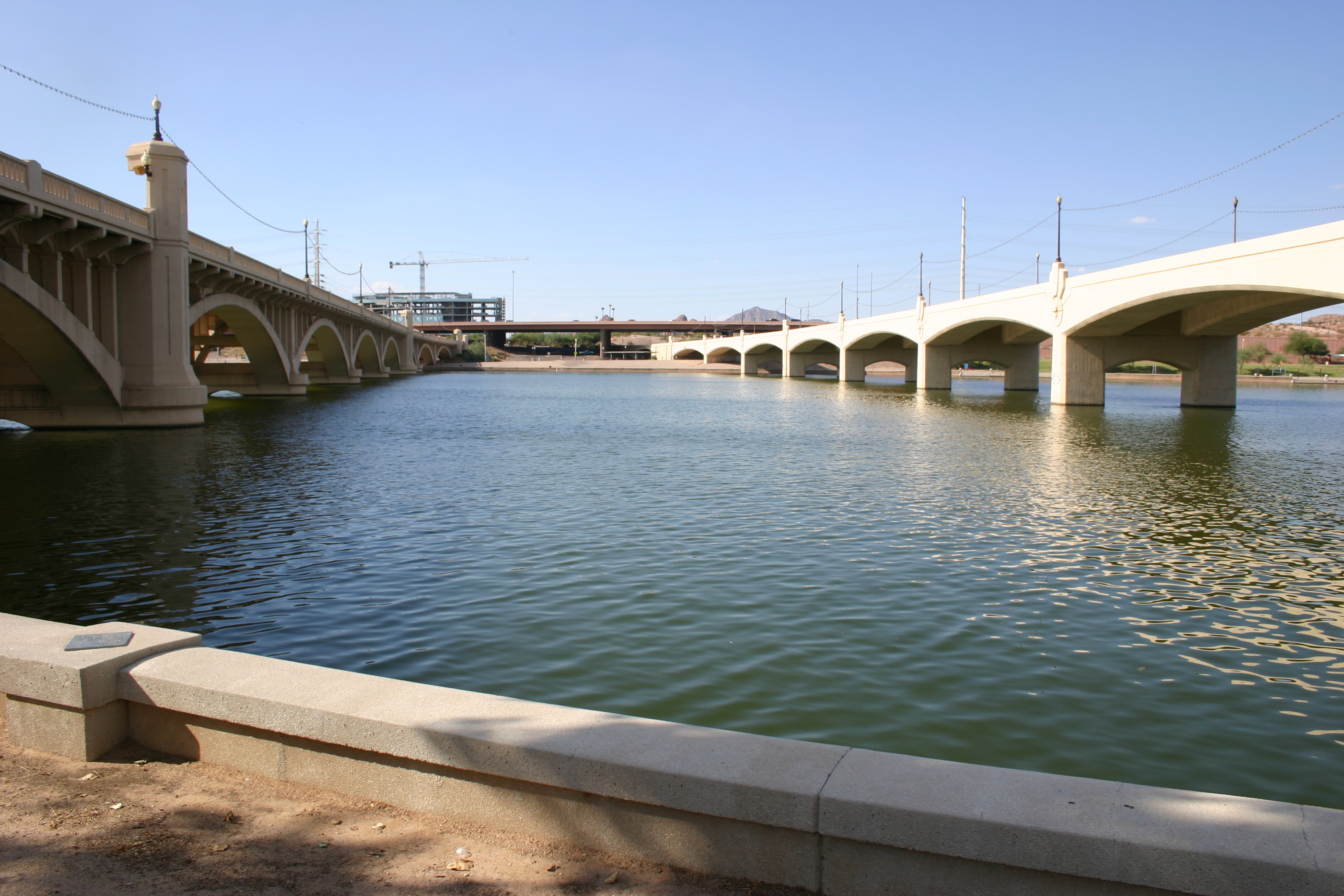
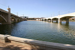 Between the Mill Avenue Bridges with the original span on the left and the newer span on the right
The Old Mill Avenue Bridge is listed on the Tempe Historic Property Register. It was the 8th property to be added to that list, receiving designation on November 4, 1999.
New Span
As traffic congestion increased, the city began preparations for a new bridge crossing parallel to the existing. In the early 1990s construction began on the new crossing. In the spring of 1993, floods returned to the valley again and hampered construction efforts on the new bridge as flood waters tore down scaffolding and form work on the new bridge project. Opening was delayed but eventually the project was completed.
The New Mill Avenue Bridge (located directly to the east, upstream) opened in 1994 to relieve the original bridge from the increasing traffic. This allowed for two lanes to travel in each direction (North and South), instead of the previous single, two-lane bridge. With the opening of the northbound bridge, the unbridged crossing was permanently closed. With two lanes now running in each direction no matter the weather, monsoon storms and releases from dams no longer lead to traffic obstructions.
Tempe Town Lake Era
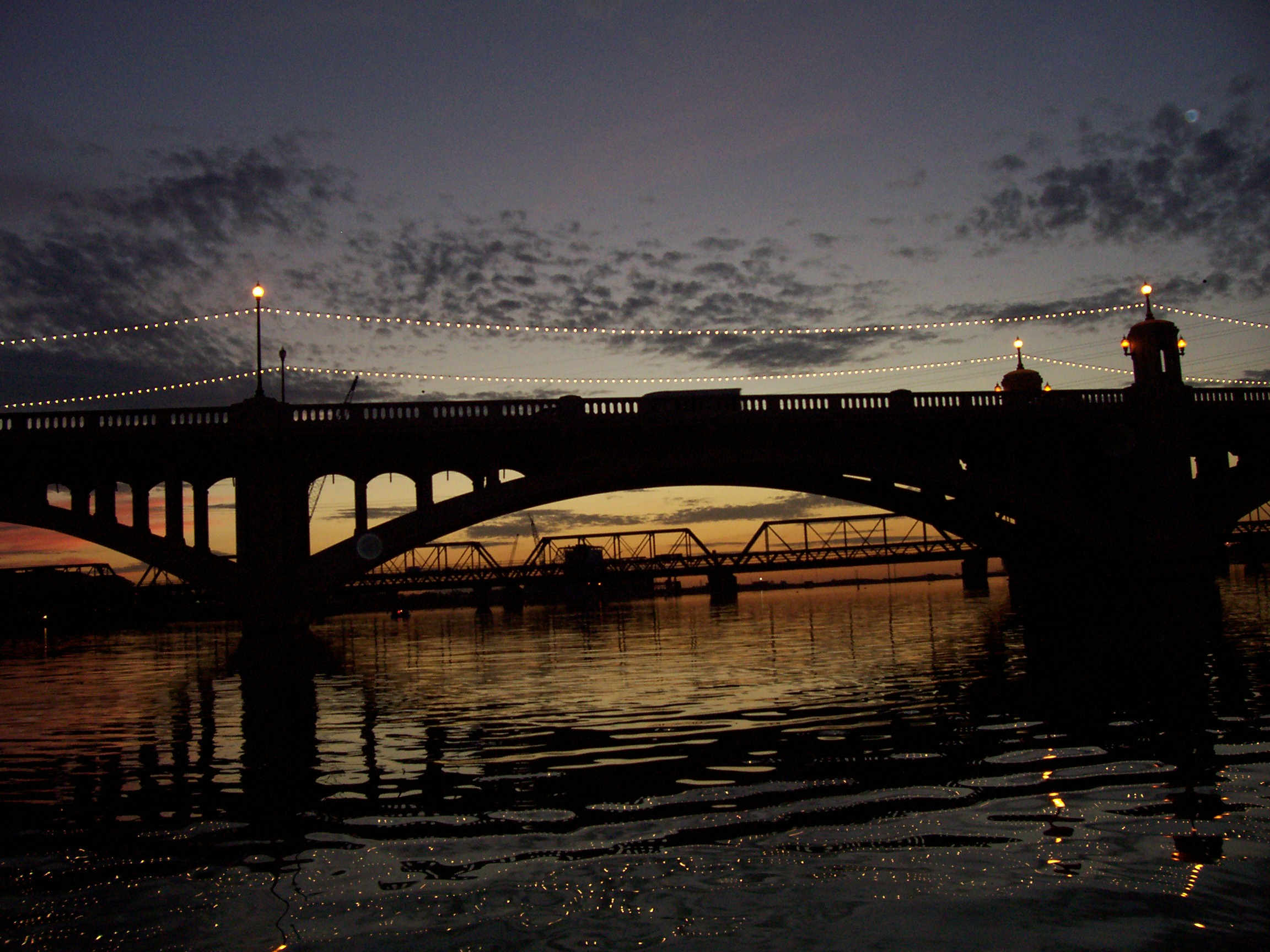
 The Mill Avenue Bridges crossing Tempe Town Lake during sunset on the Fourth of July with crowd waiting for the annual fireworks display.
In 1999 the dry river bed was transformed into a dammed artificial lake. Tempe Town Lake was a key success to the revitalization of Downtown Tempe. Formerly just a crossing over the (usually) dry river, these bridges became a centerpiece of the new lake. This prompted a lot of development along the lake. Today, mid-rise offices rise above the southeast portion of the bridges.
Every Fourth of July the CBS 5 July 4 Tempe Town Lake Festival is held at the lake. The fireworks for the celebration are launched from the bridges.
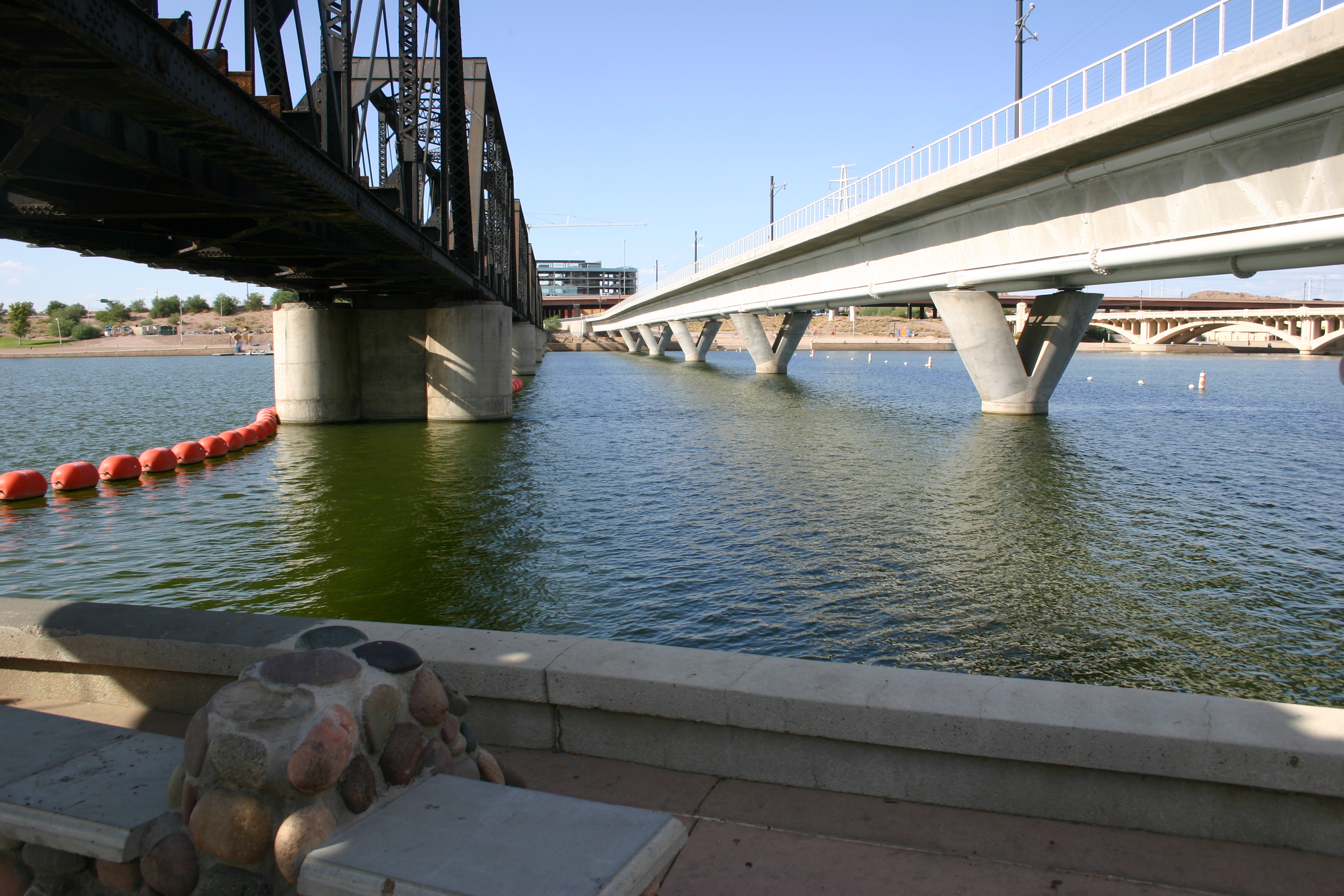
The Mill Avenue Bridges complex also includes two rail bridges slightly downstream from the motor-traffic bridges: a railroad bridge of many decades' standing, and parallel to it a new bridge to accommodate the Phoenix Light Rail system, which opened in late 2008.
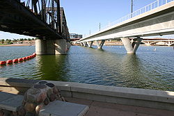 Rail bridges located just west of the Mill Avenue Bridges crossing Town Lake
See also
Bibliography
- Scharbach, Paul, and John H. Akers. Phoenix: Then and Now. San Diego: Thunder Bay Press, 2005.
Categories:- Bridges completed in 1931
- Bridges completed in 1994
- Buildings and structures completed in 1994
- Buildings and structures in Tempe, Arizona
- Road bridges in Arizona
- Transportation in Tempe, Arizona
- Transportation in Maricopa County, Arizona

Wikimedia Foundation. 2010.