- Mount Moran
-
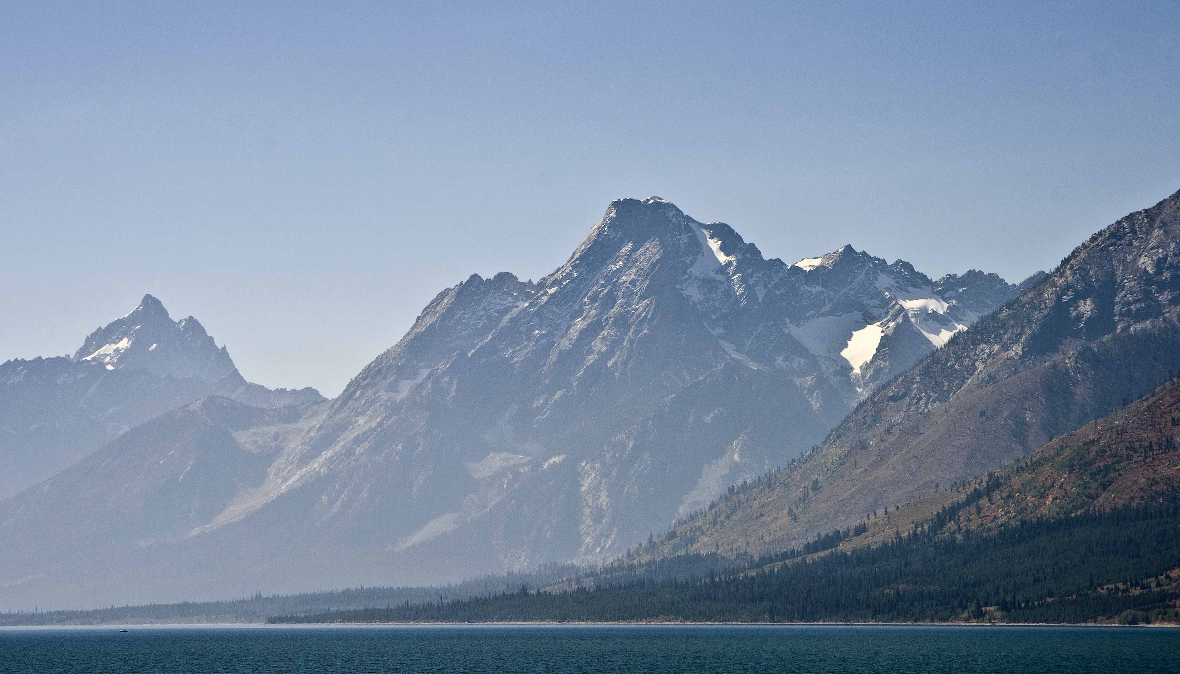
Mount Moran 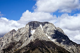
Mount Moran summit with Falling Ice Glacier at left and Skillet Glacier at rightElevation 12,605 ft (3,842 m) [1] Prominence 2,605 ft (794 m) [1] Location Location Grand Teton National Park, Teton County, Wyoming, USA Range Teton Range Coordinates 43°50′07″N 110°46′35″W / 43.83528°N 110.77639°WCoordinates: 43°50′07″N 110°46′35″W / 43.83528°N 110.77639°W[2] Topo map USGS Mount Moran Climbing First ascent Hardy/Rich/McNulty July 22, 1922 Easiest route CMC Face class 5.4 Mount Moran (12,605 feet (3,842 m)) is a mountain in Grand Teton National Park of western Wyoming, USA.[3] The mountain is named for Thomas Moran, an American western frontier landscape artist. Mount Moran dominates the northern section of the Teton Range rising 6,000 feet (1,800 m) above Jackson Lake.[4] Several active glaciers exist on the mountain with Skillet Glacier plainly visible on the monolithic east face. Like the Middle Teton in the same range, Mount Moran's face is marked by a distinctive basalt intrusion known as the Black Dike.
Contents
Climbing
Mount Moran is a massive and impressive mountain which would make it attractive to mountaineers. However, the comparative difficulty of the approach to the climbs makes it a much less popular climb than the Grand Teton and other peaks to the south. No trails to Mount Moran have been maintained for over twenty years, and any approach overland requires a great deal of bushwhacking through vegetation, deadfalls and bogs along the perimeter of Leigh Lake. Instead, most climbers choose to canoe from String Lake, across Leigh Lake and then pick their way to their respective route; but even this may require some overland route finding. As a result, most climbs on Mount Moran tend to take several days even when the technical portion of the climb is comparatively brief.
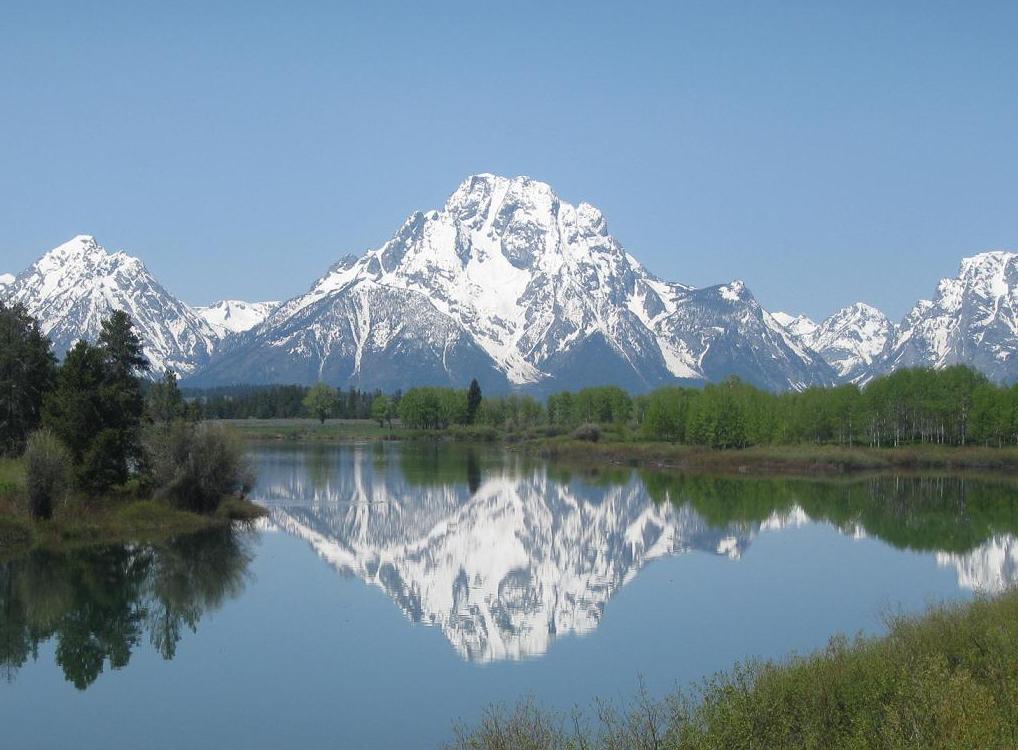
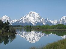 Mount Moran with the Snake River in the foreground
The first ascent of Mount Moran was made on July 22, 1922 by LeGrand Hardy, Bennet McNulty and Ben C. Rich of the Chicago Mountaineering Club via the Skillet Glacier route. The Skillet Glacier still provides perhaps the easiest and most direct route to the summit and is rated 5.4. As the name implies, most of the climb is on the steep snow and ice of Skillet Glacier, and an ice axe and crampons should be used in the ascent.
The most popular route up Mount Moran is the CMC route, named for the Chicago Mountaineering Club. The CMC is rated 5.5, and ascends the east face just south of the Black Dike. The CMC climbs good rock and is essentially free of snow and ice. It also has the advantage of a good camp high on the flank of the mountain.[5]
The Direct South Buttress route, rated 5.7 A3, is recognized in the historic climbing text Fifty Classic Climbs of North America and considered a classic around the world.[6]
History
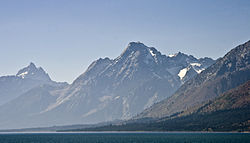 Mount Moran rises abruptly above Jackson Hole. Grand Teton can be seen in the background at left
On November 21, 1950, a C-47 cargo plane owned by the New Tribes Mission crashed on Mount Moran during a storm, killing all 21 on board. A rescue party organized by Paul Petzoldt located the wreckage on November 25, but the extreme location of the crash made it impossible to recover the plane or the bodies.[7] The wreckage remains on the mountain today, but the Park Service discourages direct climbs to the site.
See also
References
- ^ a b "Mount Moran, Wyoming". Peakbagger.com. http://www.peakbagger.com/peak.aspx?pid=5204. Retrieved 2011-05-28.
- ^ "Mount Moran". Geographic Names Information System, U.S. Geological Survey. http://geonames.usgs.gov/pls/gnispublic/f?p=gnispq:3:::NO::P3_FID:1601557. Retrieved 2011-05-28.
- ^ TopoQwest (United States Geological Survey Maps). Mount Moran, WY (Map). http://www.topoquest.com/map.php?lat=43.83521&lon=-110.77632&datum=nad83&zoom=4. Retrieved 2011-05-28.
- ^ "Hayden Expedition". Wyoming Tales and Trails. http://www.wyomingtalesandtrails.com/photos2.html. Retrieved 10 October 2010.
- ^ Ortenburger, Leigh N.; Reynold G. Jackson (1996). A Climber's Guide to the Teton Range Third Edition (3 Sub ed.). Mountaineers Books. ISBN 0898864801.
- ^ Roper, Steve; Allen Steck (1979). Fifty Classic Climbs of North America. San Francisco: Sierra Club Books. pp. 165–170. ISBN 0-87156-292-8.
- ^ "Downed New Tribes Plane". http://chi.gospelcom.net/DAILYF/2002/11/daily-11-22-2002.shtml.
External links
- Mt. Moran on SummitPost.org
- A climb of Mount Moran trip report with photos and video.
- Mt. Moran Photo Gallery of CMC route
- NASA Astronomy Photo of the Day - Great Fireball of 10-Aug-1972 over Mount Moran
Categories:- Mountains of Grand Teton National Park

Wikimedia Foundation. 2010.