- Elgin, Arizona
Infobox Settlement
official_name = Elgin, Arizona
settlement_type = CDP
imagesize =
image_caption =
imagesize =
image_caption =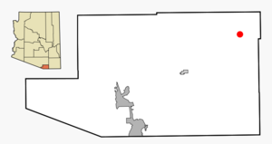
mapsize = 250px
map_caption = Location in Santa Cruz County and the state ofArizona
mapsize1 =
map_caption1 =
subdivision_type = Country
subdivision_type1 = State
subdivision_type2 = County
subdivision_name =United States
subdivision_name1 =Arizona
subdivision_name2 = Santa Cruz
established_title =
established_date =
government_type =
leader_title =
leader_name =
area_magnitude =
area_total_km2 = 125.6
area_total_sq_mi = 48.5
area_land_km2 = 125.7
area_land_sq_mi = 48.5
area_water_km2 = 0.0
area_water_sq_mi = 0.0
elevation_ft = 4728
elevation_m = 1441
population_as_of = 2000
population_footnotes =
population_total = 309
population_density_km2 = 2.46
population_density_sq_mi = 6.37
timezone = MST (no DST)
utc_offset = -7
latd = 31 |latm = 37 |lats = 45 |latNS = N
longd = 110 |longm = 34 |longs = 19 |longEW = W
website =
timezone_DST =
utc_offset_DST =
postal_code_type =ZIP code
postal_code = 85611
area_code = 520
blank_name = FIPS code
blank_info = 04-22150
blank1_name = GNIS feature ID
blank1_info = 0028852
footnotes =Elgin is a
census-designated place (CDP) in Santa Cruz County,Arizona ,United States . The population was 309 at the 2000 census.Geography
Elgin is located at coor dms|31|37|45|N|110|34|19|W|city (31.629095, -110.571951)GR|1.
According to the
United States Census Bureau , the CDP has a total area of 48.5square mile s (125.6km² ), all of it land.Demographics
As of the
census GR|2 of 2000, there were 309 people, 123 households, and 86 families residing in the CDP. Thepopulation density was 6.4 people per square mile (2.5/km²). There were 153 housing units at an average density of 3.2/sq mi (1.2/km²). The racial makeup of the CDP was 91.59% White, 2.91% Native American, 3.24% from other races, and 2.27% from two or more races. 13.59% of the population were Hispanic or Latino of any race.There were 123 households out of which 28.5% had children under the age of 18 living with them, 64.2% were married couples living together, 4.1% had a female householder with no husband present, and 29.3% were non-families. 24.4% of all households were made up of individuals and 3.3% had someone living alone who was 65 years of age or older. The average household size was 2.51 and the average family size was 3.00.
In the CDP the population was spread out with 26.9% under the age of 18, 3.6% from 18 to 24, 24.9% from 25 to 44, 32.0% from 45 to 64, and 12.6% who were 65 years of age or older. The median age was 43 years. For every 100 females there were 116.1 males. For every 100 females age 18 and over, there were 100.0 males.
The median income for a household in the CDP was $64,167, and the median income for a family was $66,250. Males had a median income of $38,500 versus $21,250 for females. The
per capita income for the CDP was $27,909. About 9.8% of families and 13.3% of the population were below thepoverty line , including 21.2% of those under the age of eighteen and 7.4% of those sixty five or over.Film
The train station sequence in the 1955 film classic "Oklahoma!", with
Gene Nelson singing and dancing the song "Kansas City" partly atop a moving train, was filmed in Elgin.References
External links
Wikimedia Foundation. 2010.