Oldbury, Western Australia
- Oldbury, Western Australia
-
Coordinates: 32°15′47″S 115°54′58″E / 32.263°S 115.916°E / -32.263; 115.916
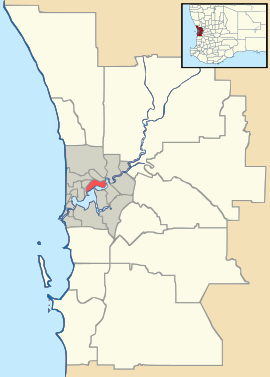
Oldbury is a district to the south of Perth, Western Australia, within the Peel region. It has no central township, and lies west of the South Western Highway, close to Byford and Mundijong. Part of the Pinjarra Plain, the district is a productive environment featuring dairy and rural engagements, although consisting of sandy soils and largely felled. The area was part of the drainage scheme that contributed to the Peel Estuary environmental task and the consequent Dawesville Cut. Oldbury is part of a major realigning process in the Perth metro area, as divisions of regional land and urban districts develop; boundaries maintained since European settlement.
Categories: - Suburbs of Perth, Western Australia
- Perth, Western Australia geography stubs
Wikimedia Foundation.
2010.
Look at other dictionaries:
Mundijong, Western Australia — Mundijong Perth, Western Australia Paterson Street, Mundijong … Wikipedia
Oakford, Western Australia — Oakford Perth, Western Australia … Wikipedia
Casuarina, Western Australia — Infobox Australian Place | type = suburb name = Casuarina city = Perth state = wa caption = lga = Town of Kwinana postcode = 6167 est = pop = 1389 (2006 census)Census 2006 AUS|id=SSC51271|name=Casuarina (State Suburb)|quick=on|accessdate=2008 10… … Wikipedia
Wellard, Western Australia — Infobox Australian Place | type = suburb name = Wellard city = Perth state = wa caption = lga = Town of Kwinana postcode = 6170 est = pop = 1660 (2006 census)Census 2006 AUS|id=SSC52491|name=Wellard (State Suburb)|quick=on|accessdate=2008 10 05]… … Wikipedia
Baldivis, Western Australia — Infobox Australian Place | type = suburb name = Baldivis city = Perth state = wa caption = lga = City of Rockingham postcode = 6171 est = pop = 5,952 pop footnotes = (2006 census)Census 2006 AUS|id=SSC53081|name=Baldivis (State… … Wikipedia
Oldbury — may refer to: Oldbury, Western Australia, a district south of Perth, Australia Oldbury, Shropshire, a village near Bridgnorth, England, UK Oldbury, South Gloucestershire, a village south of Bridgnorth, England, UK Oldbury, West Midlands, a town… … Wikipedia
List of major roads in Perth, Western Australia — This page details the major roads in the greater Perth conurbation, in Western Australia.A list of the routes (most involving multiple roads) is available at List of road routes in Perth, Western Australia.Freeways in Perth (by road route… … Wikipedia
Darling Downs, Western Australia — Darling Downs Perth, Western Australia … Wikipedia
Oldbury, West Midlands — Coordinates: 52°30′18″N 2°00′57″W / 52.505°N 2.0159°W / 52.505; 2.0159 … Wikipedia
List of companies in the nuclear sector — Here is a list of all large companies which are active along the nuclear chain, from uranium mining, processing and enrichment, to the actual operating of nuclear power plant and waste processing. Company name Country of origin Category Brief… … Wikipedia

