38th Street (Metro Transit station)
- 38th Street (Metro Transit station)
Infobox Station
name=38th Street
image_size=250
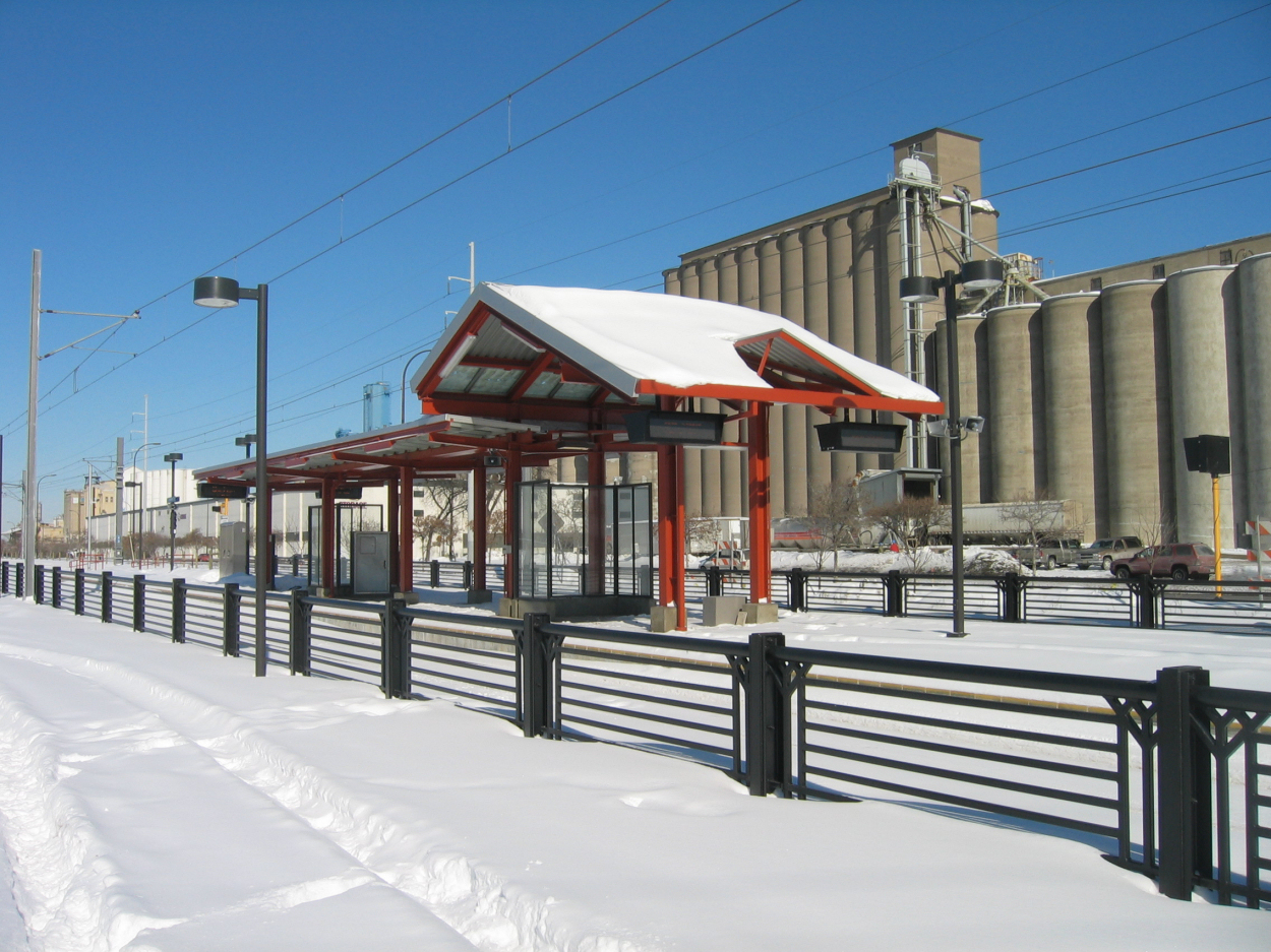
image_caption=Old-economy grain elevators loom over the 38th Street station prior to light rail service during the winter of 2003
address=2902 38th Street East
line=rail color box|system=MNMT|line=Hiawatha
other=Routes 14, 22, and 23.
platform=Island platform
tracks=
parking=
bicycle=
baggage_check=
passengers=
pass_year=
pass_percent=
pass_system=
opened=June 26, 2004
closed=
rebuilt=
ADA=Yes
code=
owned=Metro Transit
zone=
services=
mpassengers=38th Street is a light rail station on the Hiawatha Line in Minneapolis, Minnesota. It is the eighth stop southbound.
This station is located at the intersection of 38th Street and Minnesota State Highway 55 (Hiawatha Avenue), in Minneapolis. This is a center-platform station. Service began at this station when the Hiawatha Line opened on June 26, 2004.
Bus connections
From 38th Street station, there are direct bus connections to routes 14, 22, and 23.
Notable places nearby
* Corcoran, Howe, Longfellow and Standish neighborhoods
* Roosevelt High School (Minneapolis School District)
* Roosevelt Library
External links
* [http://www.metrocouncil.org/transportation/lrt/stations/38street.htm Metropolitan Council: 38th Street Station]
Wikimedia Foundation.
2010.
Look at other dictionaries:
Lake Street/Midtown (Metro Transit station) — Infobox Station name=Lake Street/Midtown image size= image caption=Hiawatha Light Rail car approaching Midtown Station address=2310 Lake Street East line=rail color box|system=MNMT|line=Hiawatha other=Routes 7, 21, 27 and 53 platform=Island… … Wikipedia
List of Metro Transit routes — The following is a list of Metro Transit Routes or routes operated by partners of Metro Transit in the Twin Cities metropolitan area. Bold text indicates EXPRESS routes. Italic text indicates Limited Stop Routes. Routes 5, 16, and 19 run 24 hours … Wikipedia
List of current Metro Local routes — A Metro Local bus on Line 81 (Figueroa Street) with its trademark orange color Current Los Angeles Metropolitan Transportation Authority Metro Local routes in Los Angeles County, California. This list does not include the routes of Metro s Rapid… … Wikipedia
Hiawatha Line — This article is about the light rail corridor. For the Amtrak (and historically Milwaukee Road) interstate train route, see Hiawatha (passenger train). Hiawatha Line Blue line light rail train in Minneapolis … Wikipedia
Minneapolis Streetcar System — This article is about the proposed modern streetcar system in Minneapolis. For the streetcar system in the Twin Cities up to 1954, see Twin City Rapid Transit Company. The Minneapolis Streetcar System is a proposed streetcar system for the city… … Wikipedia
Grand Rapids, Michigan — Grand Rapids redirects here. For other uses, see Grand Rapids (disambiguation). City of Grand Rapids City Images from top to bottom … Wikipedia
Erie, Pennsylvania — Erie redirects here. For other uses, see Erie (disambiguation). Coordinates: 42°7′46.42″N 80°5′6.77″W / 42.1295611°N 80.0852139°W … Wikipedia
Yerevan — For other uses, see Yerevan (disambiguation). Coordinates: 40°11′00″N 44°31′00″E … Wikipedia
Hiawatha Line — Pour les articles homonymes, voir Hiawatha. La Hiawatha Line à la station Cedar Riverside La Hiawatha Line (« ligne Hiawatha ») est une ligne de tramway à Minneapolis … Wikipédia en Français
Interstate 35W (Minnesota) — Interstate 35W Interstate 35W highlighted in red Route information … Wikipedia