- Pima, Arizona
Infobox Settlement
official_name = Pima, Arizona
settlement_type =Town
image_caption =
imagesize =
image_caption =
imagesize =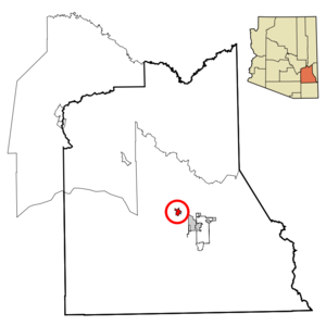
mapsize = 250px
map_caption = Location in Graham County and the state ofArizona
mapsize1 =
map_caption1 =
subdivision_type = Country
subdivision_type1 = State
subdivision_type2 = County
subdivision_name =United States
subdivision_name1 =Arizona
subdivision_name2 = Graham
established_title =
established_date =
government_type =
leader_title =
leader_name =
area_magnitude =
area_total_km2 = 6.6
area_total_sq_mi = 2.5
area_land_km2 = 6.5
area_land_sq_mi = 2.5
area_water_km2 = 0.0
area_water_sq_mi = 0.0
elevation_ft = 2838
elevation_m = 865
population_as_of = 2007
population_footnotes = cite web|url=http://www.census.gov/popest/cities/tables/SUB-EST2007-04-04.csv|title=Annual Estimates of the Population for Incorporated Places in Arizona|publisher=United States Census Bureau |date=2008-07-10|accessdate=2008-07-14]
population_total = 2068
population_density_km2 = 297.7
population_density_sq_mi = 786.0
timezone = MST (no DST)
utc_offset = -7
latd = 32 |latm = 53 |lats = 19 |latNS = N
longd = 109 |longm = 49 |longs = 42 |longEW = W
website =
timezone_DST =
utc_offset_DST =
postal_code_type =ZIP code s
postal_code = 85535, 85543
area_code = 928
GNIS_id = 9433
blank_name = FIPS code
blank_info = 04-55560
blank1_name =
blank1_info =
footnotes =Pima is a town in Graham County,
Arizona ,United States . According to 2006 Census Bureau estimates, the population of the town is 1,965.cite web | date =June 21 2006 | url = http://www.census.gov/popest/cities/tables/SUB-EST2005-04-04.csv | title = Annual Estimates of the Population for All Incorporated Places in Arizona | format = CSV | work = 2005 Population Estimates | publisher = U.S. Census Bureau, Population Division | accessdate = November 15 | accessyear = 2006] It is part of the Safford Micropolitan Statistical Area.History
Pima was founded by Mormon settlers in 1879. It was originally named Smithville. [ [http://www.azcommerce.com/doclib/commune/graham%20county.pdf Microsoft Word - Graham County.doc ] ] The first settlers had been living in Forrest Dale, but then were told they had to leave because the location was on Indian land. Unlike other Mormon settlements of the era, Smithville was not planned by the leaders of the church. [ [http://www.logoi.com/notes/mormon-arizona/on-the-upper-gila.html On the Upper Gila ] ]
Joseph K. Rogers was the first branch president at Pima, being appointed to this office before any of the settlers arrived. [Jenson, Andrew. "Encyclopedic History of the Church of Jesus Christ of Latter-day Saints" (Salt Lake City: Deseret Book, 1941) p. 654]
The branch was organized into a ward in 1880. [Jenson. "Encyclopedic History". p. 654.]
In 1930 the ward had 666 members. Pima had a population of 980, and a total of 1,260 people resided within the boundaries of the Pima ward. [Jenson. "Encyclopedic History". p. 654]
In 1990 Pima had 1,725 residents. [ [http://factfinder.census.gov/servlet/SAFFPopulation?_event=ChangeGeoContext&geo_id=16000US0455560&_geoContext=01000US&_street=&_county=Pima&_cityTown=Pima&_state=04000US04&_zip=&_lang=en&_sse=on&ActiveGeoDiv=geoSelect&_useEV=&pctxt=fph&pgsl=010&_submenuId=population_0&ds_name=null&_ci_nbr=null&qr_name=null®=null%3Anull&_keyword=&_industry= Pima town, Arizona - Population Finder - American FactFinder ] ]
Geography
Pima is located at coor dms|32|53|19|N|109|49|42|W|city (32.888631, -109.828279)GR|1.
According to the
United States Census Bureau , the town has a total area of 2.5square mile s (6.6km² ), all of it land.Demographics
2006 Census estimates placed Pima's population at 1,970. [ [http://factfinder.census.gov/servlet/SAFFPopulation?_event=ChangeGeoContext&geo_id=16000US0455560&_geoContext=01000US&_street=&_county=Pima&_cityTown=Pima&_state=04000US04&_zip=&_lang=en&_sse=on&ActiveGeoDiv=geoSelect&_useEV=&pctxt=fph&pgsl=010&_submenuId=population_0&ds_name=null&_ci_nbr=null&qr_name=null®=null%3Anull&_keyword=&_industry= Pima town, Arizona - Population Finder - American FactFinder ] ]
As of the
census GR|2 of 2000, there were 1,989 people, 663 households, and 521 families residing in the town. Thepopulation density was 787.0 people per square mile (303.5/km²). There were 735 housing units at an average density of 290.8/sq mi (112.2/km²). The racial makeup of the town was 87.03% White, 0.15% Black or African American, 0.75% Native American, 0.10% Asian, 9.85% from other races, and 2.11% from two or more races. 20.06% of the population were Hispanic or Latino of any race.There were 663 households out of which 42.5% had children under the age of 18 living with them, 63.3% were married couples living together, 10.6% had a female householder with no husband present, and 21.4% were non-families. 18.4% of all households were made up of individuals and 10.3% had someone living alone who was 65 years of age or older. The average household size was 3.00 and the average family size was 3.43.
In the town the population was spread out with 34.3% under the age of 18, 9.8% from 18 to 24, 23.4% from 25 to 44, 18.3% from 45 to 64, and 14.2% who were 65 years of age or older. The median age was 30 years. For every 100 females there were 97.3 males. For every 100 females age 18 and over, there were 89.8 males.
The median income for a household in the town was $30,985, and the median income for a family was $34,900. Males had a median income of $31,765 versus $21,042 for females. The
per capita income for the town was $12,896. About 15.0% of families and 19.4% of the population were below thepoverty line , including 25.3% of those under age 18 and 15.6% of those age 65 or over.References
External links
Wikimedia Foundation. 2010.