- Fish Hook River
Geobox River
name = Fish Hook River
native_name =
other_name =
other_name1 =
image_size = 300
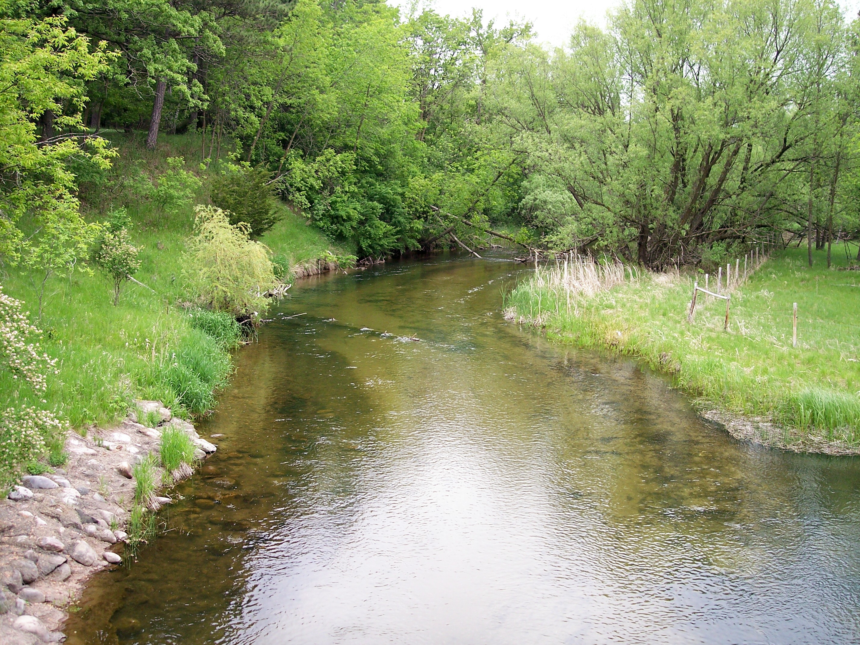
image_caption = The Fish Hook River in Park Rapids in 2007
country = United States
state = Minnesota
region =
region1 =
district =
district1 =
city =
city1 =
length_imperial = 8.54
length_note = cite web |url= http://iaspub.epa.gov/waters/w305b_report_control.get_report?p_state=MN |title= National Assessment Database: Assessment Data for the State of Minnesota Year 2004. |pages= [http://iaspub.epa.gov/tmdl/w305b_report_V4.huc?p_huc=07010106&p_state=MN Crow Wing Watershed] |publisher=United States Environmental Protection Agency |accessdate= 2007-06-24]
watershed_imperial =
watershed_note =
discharge_location =
discharge_imperial =
discharge_max_imperial =
discharge_min_imperial =
discharge_note =
discharge1_location =
discharge1_imperial =
source_name =Fish Hook River Reservoir
source_location = Park Rapids
source_district = Hubbard County
source_region =
source_lat_d = 46
source_lat_m = 55
source_lat_s = 10
source_lat_NS = N
source_long_d = 95
source_long_m = 03
source_long_s = 10
source_long_EW = W
source_coordinates_note = cite web |url=Gnis3|643710 |title=Geographic Names Information System entry for Fishhook River (Feature ID #643710) |work=Geographic Names Information System |publisher=United States Geological Survey |accessdate=2007-06-24]
source_elevation_imperial = 1424
source_elevation_note =Google Earth elevation forGNIS coordinates. Retrieved on2007-06-24 .]
mouth_name = Shell River
mouth_location = Hubbard Township
mouth_district = Hubbard County
mouth_region =
mouth_lat_d = 46
mouth_lat_m = 49
mouth_lat_s = 49
mouth_lat_NS = N
mouth_long_d = 95
mouth_long_m = 01
mouth_long_s = 55
mouth_long_EW = W
mouth_coordinates_note =
mouth_elevation_imperial = 1362
mouth_elevation_note =
tributary_left =
tributary_left1 =
tributary_right = Straight River
tributary_right1 =
free_name =
free_value =
map_size =
map_caption =The Fish Hook River, also spelled Fishhook River, is a
tributary of the Shell River, nine miles (14 km) long, in north-centralMinnesota in theUnited States . The river's source, Fish Hook Lake, collects short tributaries known as the Portage River and the Potato River. Via the Shell and Crow Wing Rivers, the Fish Hook River is part of the watershed of theMississippi River . The river flows for its entire length in southwestern Hubbard County; its watershed extends into northeastern Becker County.cite book| title= Minnesota Atlas & Gazetteer |year=1994 |publisher=DeLorme |location=Yarmouth, Me. |isbn= 0-89933-222-6 |pages= pp. 60-61]Its name is a translation of the Ojibwe name for the river and Fish Hook Lake, "Pugidabani".cite web |url=http://mnplaces.mnhs.org/upham/index.cfm |title=Minnesota Place Names: A Geographical Encyclopedia. |accessdate=2007-06-24 |last=Upham |first=Warren |publisher=
Minnesota Historical Society |pages= [http://mnplaces.mnhs.org/upham/waterway.cfm?PlaceNameID=9960&BookCodeID=53&County=29&SendingPage=Results.cfm Hubbard County: Park Rapids] ]Geography
The Fish Hook River is considered to begin in the city of Park Rapids, at a
dam forming the two-mile-long (3 km) Fish Hook River Reservoir, which was constructed to supplyhydropower at the site ofrapids on the river. [cite web |url=Gnis3|1776302 |title=Geographic Names Information System entry for Fish Hook River Reservoir (Feature ID #1776302) |work=Geographic Names Information System |publisher=United States Geological Survey |accessdate=2007-06-24] From Park Rapids the Fish Hook River flows south-southeastwardly through Todd, Straight River, and Hubbard Townships, collecting the Straight River from the west. It flows into the Shell River from the north in Hubbard Township.The Fish Hook River Reservoir flows from Fish Hook Lake, which collects the river's northern watershed. The Portage and Potato Rivers flow short distances to the lake from Portage and Potato Lakes, respectively. Potato Lake collects Hay Creek, which flows from northeastern Becker County, draining a region of lakes. [cite web |url=Gnis3|643708 |title=Geographic Names Information System entry for Fishhook Lake (Feature ID #643708) |work=
Geographic Names Information System |publisher=United States Geological Survey |accessdate=2007-06-24] [cite web |url=Gnis3|649672 |title=Geographic Names Information System entry for Portage River (Feature ID #649672) |work=Geographic Names Information System |publisher=United States Geological Survey |accessdate=2007-06-24] [cite web |url=Gnis3|649690 |title=Geographic Names Information System entry for Potato River (Feature ID #649690) |work=Geographic Names Information System |publisher=United States Geological Survey |accessdate=2007-06-24] [cite web |url=Gnis3|1776215 |title=Geographic Names Information System entry for Portage Lake (Feature ID #1776215) |work=Geographic Names Information System |publisher=United States Geological Survey |accessdate=2007-06-24] [cite web |url=Gnis3|1776217 |title=Geographic Names Information System entry for Potato Lake (Feature ID #1776217) |work=Geographic Names Information System |publisher=United States Geological Survey |accessdate=2007-06-24] [cite web |url=Gnis3|644769 |title=Geographic Names Information System entry for Hay Creek (Feature ID #644769) |work=Geographic Names Information System |publisher=United States Geological Survey |accessdate=2007-06-24]The Fish Hook River flows in the Northern Lakes and Forests
ecoregion , which is characterized byconifer andhardwood forests on flat and rollingtill plain s and outwash plains. [cite web |url= http://www.pca.state.mn.us/water/basins/uppermiss/index.html |title= Upper Mississippi River Basin. |pages= [http://www.pca.state.mn.us/water/basins/uppermiss/bid-section3.pdf Upper Mississippi River Basin Water Quality Plan, Headwaters to the Rum River - Anoka, Section III: Upper Mississippi River Basin] |publisher= Minnesota Pollution Control Agency |year= 2000 |accessdate= 2007-06-17] The river's fish population is dominated by suckers, butwalleye andnorthern pike are also present.cite book| last= Waters |first= Thomas F. | title= The Streams and Rivers of Minnesota |year= 2006 |publisher=University of Minnesota Press |location=Minneapolis |isbn= 0-8166-0960-8 |pages= pp. 184-194 |chapter= The Crow Wing: Oxcart to Canoe]ee also
*
List of rivers in Minnesota References
Wikimedia Foundation. 2010.