Deopham and Hackford — Coordinates: 52°34′21″N 1°01′48″E / 52.5725°N 1.03°E / 52.5725; 1.03 … Wikipedia
RAF Deopham Green — Infobox Military Structure name= Royal Air Force Station Deopham Green USAAF Station 142 location= Located Near Attleborough, Norfolk, England coordinates=coord|52|30|10.54|N|001|03|36.87|E| caption= Aerial Photo of Deopham Green Airfield 9 July… … Wikipedia
Eighth Air Force — emblem Part of Air … Wikipedia
William de Warenne, 1st Earl of Surrey — William de Warenne, 1st Earl of Surrey, (died 1088) was one of the Norman nobles who fought at the Battle of Hastings and became great landowners in England.He was a son of Rodulf II de Warenne and Emma and a grandnephew of duchess Gunnor, wife… … Wikipedia
452d Air Mobility Wing — Infobox Military Unit unit name= 452d Air Mobility Wing caption= 452d Air Mobility Wing emblem dates= 1950 Present country= United States branch= United States Air Force type= role= size= command structure= current commander= Brigadier General… … Wikipedia
Ditchingham — Coordinates: 52°28′00″N 1°26′37″E / 52.46676°N 1.44351°E / 52.46676; 1.44351 … Wikipedia
List of RAF stations — This List of RAF stations is a comprehensive list of all stations, airbases, airfields and administrative headquarters of the Royal Air Force past and present.:Note Current RAF Stations will be listed under the currently recognised county of the… … Wikipedia
Attleborough — Infobox UK place official name= Attleborough country= England region= East of England shire county= Norfolk shire district= South Norfolk constituency westminster= South Norfolk population= 9,702 (2001) os grid reference= TM049954 latitude=… … Wikipedia
South Norfolk — is a local government district in Norfolk, England. Its council is based in Long Stratton.HistoryThe district was formed on April 1, 1974, under the Local Government Act 1972, as a merger of Diss Urban District, Wymondham Urban District, Depwade… … Wikipedia
Diss — Not to be confused with Dis. This article is about the English town called Diss. For music created for the purpose of verbally attacking others, see diss track. Coordinates: 52°22′52″N 1°06′28″E / … Wikipedia
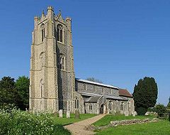

 Deopham
 Media related to Deopham at Wikimedia CommonsCategories:
