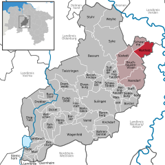
- Martfeld
-
Martfeld Coordinates 52°52′N 9°04′E / 52.86667°N 9.06667°ECoordinates: 52°52′N 9°04′E / 52.86667°N 9.06667°E Administration Country Germany State Lower Saxony District Diepholz Municipal assoc. Bruchhausen-Vilsen Mayor Marlies Plate (Greens) Basic statistics Area 35.06 km2 (13.54 sq mi) Elevation 12 m (39 ft) Population 2,775 (31 December 2010)[1] - Density 79 /km2 (205 /sq mi) Other information Time zone CET/CEST (UTC+1/+2) Licence plate DH Postal code 27327 Area code 04255 Website www.martfeld.de Martfeld is a municipality in the district of Diepholz, in Lower Saxony, Germany. It is part of the Bruchhausen-Vilsen (Samtgemeinde) Collective Municipality.
Contents
Geography
Geographic Location
Martfeld is located approximately 36 km southeast of Bremen.
Neighbors
Neighboring communities are Schwarme and Bruchhausen-Vilsen
Community Breakdown
The following places belong administratively to Martfeld:
- Hollen
- Hustedt
- Kleinenborstel
- Loge
- Martfelder Heide
- Tuschendorf
History
The village was first mentioned in a papal document personally signed by Pope Alexander III in 1179.
Politics
Municipal Councile
Partner Towns
- La Bazoge in France
Culture and the Arts
Structures
- Martfeld Mill: The Martfeld mill was first mentioned in the year 1583. Originally built as a block windmill, in 1840 it was rebuilt in three story Dutch-style. The mill burned to the ground after a lightning strike in 1851 and was rebuilt the same year. Between 1992 and 1999 the mill was completey renovated. The mill is the oldest windmill in the area.
- Fehsenfeldsche Mill: Built in 1871 in the three story Dutch-style, the mill operated until 1971. In 1991 the mill was restored and is now used for weddings.
Public Art
- On the village square can be found the stainless steel sculpture titled, “Entfaltund” (Development) by the Syke artists Elsa Töbelmann and Henning Greve. The sculpture was created in 1999 as part of the competition, “Our Village Beautiful.”
Affinghausen · Asendorf · Bahrenborstel · Barenburg · Barnstorf · Barver · Bassum · Borstel · Brockum · Bruchhausen-Vilsen · Dickel · Diepholz · Drebber · Drentwede · Ehrenburg · Eydelstedt · Freistatt · Hemsloh · Hüde · Kirchdorf · Lembruch · Lemförde · Maasen · Marl · Martfeld · Mellinghausen · Neuenkirchen · Quernheim · Rehden · Scholen · Schwaförden · Schwarme · Siedenburg · Staffhorst · Stemshorn · Stuhr · Sudwalde · Sulingen · Süstedt · Syke · Twistringen · Varrel · Wagenfeld · Wehrbleck · Wetschen · Weyhe
References
- ^ "Bevölkerungsfortschreibung" (in German). Landesbetrieb für Statistik und Kommunikationstechnologie Niedersachsen. 31 December 2009. http://www1.nls.niedersachsen.de/statistik/html/parametereingabe.asp?DT=K1000014&CM=Bev%F6lkerungsfortschreibung.
Categories:- Municipalities in Lower Saxony
- Hanover region geography stubs
Wikimedia Foundation. 2010.


