- Bettles, Alaska
Infobox Settlement
official_name = Bettles
native_name =
settlement_type =City
motto =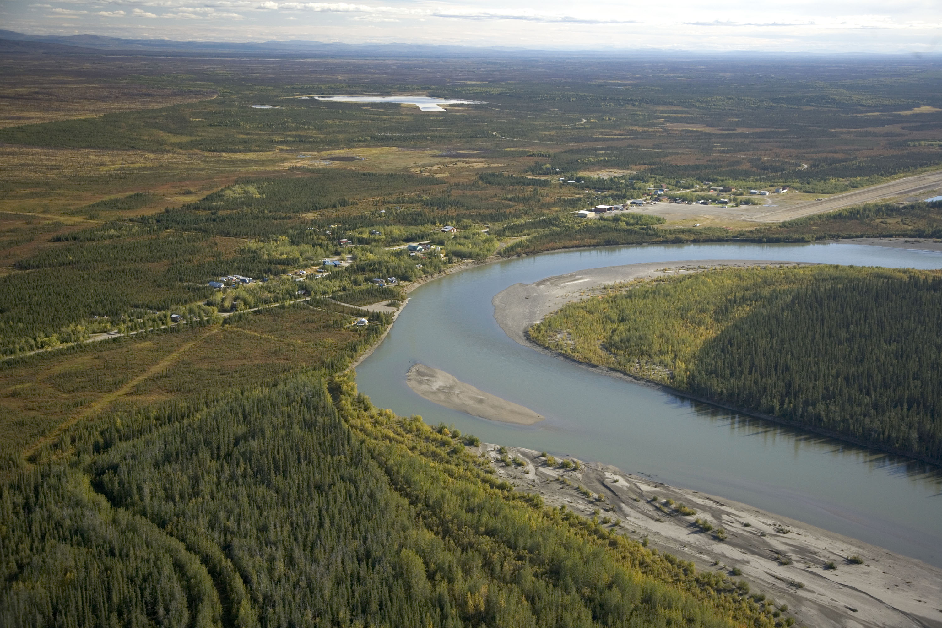
imagesize =
image_caption = Aerial view of Bettles (right) and its neighbor Evansville (left)
image_shield =
mapsize = 250x200px
map_caption =
mapsize1 =
map_caption1 =
subdivision_type = Country
subdivision_name =United States
subdivision_type1 = State
subdivision_name1 =Alaska
subdivision_type2 = Census Area
subdivision_name2 = Yukon-Koyukuk
government_type =
leader_title =
leader_name =
leader_title1 =
leader_name1 =
leader_title2 =
leader_name2 =
leader_title3 =
leader_name3 =
established_title =
established_date =
established_title2 =
established_date2 =
established_title3 =
established_date3 =
area_magnitude =
area_total_km2 = 4.2
area_total_sq_mi = 1.6
area_land_km2 = 4.2
area_land_sq_mi = 1.6
area_water_km2 = 0
area_water_sq_mi = 0
area_water_percent = 0
area_urban_km2 =
area_urban_sq_mi =
area_metro_km2 =
area_metro_sq_mi =
population_as_of = 2007
population_note =
population_total = 39
population_footnotes = cite web|url=http://www.census.gov/popest/cities/tables/SUB-EST2007-04-02.csv|title=Annual Estimates of the Population for Incorporated Places in Alaska|publisher=United States Census Bureau |date=2008-07-10|accessdate=2008-07-14]
population_density_km2 = 10.1
population_density_sq_mi = 26.2
population_metro =
population_density_metro_km2 =
population_density_metro_sq_mi =
population_urban =
population_density_urban_km2 =
population_density_urban_sq_mi =
timezone = Alaska (AKST)
utc_offset = -6
timezone_DST = AKDT
utc_offset_DST = -8
latd = 66 |latm = 54 |lats = 48 |latNS = N
longd = 151 |longm = 31 |longs = 21 |longEW = W
elevation_m = 200
elevation_ft = 630
postal_code_type =
postal_code =
area_code = 907
GNIS_id = 1926949
website =
blank_name = FIPS code
blank_info = 02-06630
blank1_name =
blank1_info =
footnotes =Bettles is a city in Yukon-Koyukuk Census Area,
Alaska ,United States . The population was 43 at the 2000 census.Geography
Bettles is located at coor dms|66|54|48|N|151|31|21|W|city (66.913419, -151.522374)GR|1.
According to the
United States Census Bureau , the city has a total area of 1.6square mile s (4.2km² ), all of it land.Bettles is often a midpoint for high-adventurers, as it has both a runway and a long lake for float planes. It is also very close to numerous high-adventure destinations, such as Gates of The Arctic National Park.Demographics
As of the
census GR|2 of 2000, there were 43 people, 16 households, and 9 families residing in the city. Thepopulation density was 26.2 people per square mile (10.1/km²). There were 36 housing units at an average density of 21.9/sq mi (8.5/km²). The racial makeup of the city was 76.74% White, 18.60% Native American, and 4.65% from two or more races.There were 16 households out of which 37.5% had children under the age of 18 living with them, 50.0% were married couples living together, 6.3% had a female householder with no husband present, and 43.8% were non-families. 18.8% of all households were made up of individuals and none had someone living alone who was 65 years of age or older. The average household size was 2.69 and the average family size was 3.44.
In the city the population was spread out with 30.2% under the age of 18, 7.0% from 18 to 24, 37.2% from 25 to 44, 25.6% from 45 to 64. The median age was 34 years. For every 100 females there were 104.8 males. For every 100 females age 18 and over, there were 130.8 males.
The median income for a household in the city was $49,375, and the median income for a family was $65,000. Males had a median income of $47,917 versus $48,750 for females. The
per capita income for the city was $19,585. There were 10.0% of families and 6.4% of the population living below thepoverty line , including 11.1% of under eighteens and none of those over 64.The industries in Bettles includes B and C construction co, Sarbucks, and also small cafes around the city.
References
External links
Wikimedia Foundation. 2010.