- Záhorie Protected Landscape Area
Infobox_protected_area
name = Záhorie Protected Landscape Area
"CHKO Záhorie"
iucn_category = V
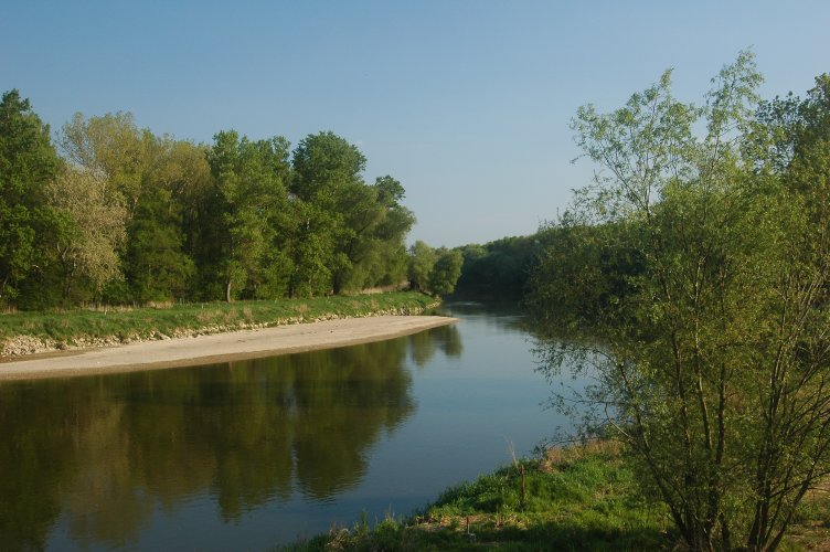
caption = The Morava River between Slovakia and Austria
location = WestSlovakia ,Záhorie
lat_degrees = 48
lat_minutes = 26
lat_seconds =
lat_direction = N
long_degrees = 16
long_minutes = 58
long_seconds =
long_direction = E
area = 275.22km² (106.26 mi²)
established = 9 November 1988
governing_body = "Správa CHKO Záhorie" (CHKO Záhorie Administration) inMalacky Záhorie Protected Landscape Area ( _sk. Chránená krajinná oblasť Záhorie) is the first
lowland protected landscape area inSlovakia . It is located in the non-administrativeZáhorie Region in West Slovakia. The Landscape Area protects 275.22km² (106.26mi² ) and is divided into two separate parts – western and north-eastern. The western part starts near the village ofKúty in the north, follows the borders between Slovakia andAustria alongside theMorava River and ends nearStupava in the south. The north-eastern part is bordered by the Military District of Záhorie in the east and south.Geography, geology and ecology
The western part of the Landscape Area is formed by the
Morava River and mainly consists of vastriparian zones andfloodplains . This area is well preserved because it had been a strictly prohibited border between theEastern Bloc and theWestern Bloc for 40 years, known as theIron Curtain . The area contains the largestwater-meadow s in Slovakia. The riparian forests contain trees similar to the originalold growth forests . A vast network of channels,wetland s and small lakes is spread in the riparian zones and floodplains. These rich and dynamic geographical features bring an extensive variety offlora andfauna . Plants are represented by, for example, large areas of "Clematis integrifolia". The waterhabitat is dominantly occupied by animal groups such ascrustaceans ,molluscs ,fish ,amphibians and a lot of species of aquatic birds. TheEuropean Beaver returned to this area from Austria, where it was reintroduced in the 1980s. [cite web | publisher = Slovak Environmental Agency | url = http://www.sazp.sk/slovak/periodika/enviromagazin/enviro5_2/bobor.html | title = "Bobor - opäť udomácnený druh v našej prírode" [Beaver - native to our nature again] | language = Slovak | accessdate = June 15 | accessyear = 2007] The north-eastern part contains sand deposited byaeolian processes , which createdunes . Because of its location, this area is an important route for migrating birds. The contrast between colder lower areas and warm sand dunes creates a bright variety of species. The warm and dry areas are home to theantlion andHoopoe . The fir forests are home to insect predators, which serve as a feeding ground for theEuropean Nightjar ,Woodlark andbats .Tourism
In the western part, the artificial
levee alongside the Morava River and adjacent newly built biking trail contains boards andposter s informing about wildlife and is also popular with hikers. The north-eastern part contains biking and hiking trails, offering unique sand dunes. Biking trails are interconnected with others outside the Landscape Area.ee also
Protected areas of Slovakia References
* [http://www.sopsr.sk/index.php?page=posobnost&id=11 Záhorie Protected Landscape Area at The Slovak Nature Conservancy] sk icon
External links
* [http://www.slovakia.travel/entitaview.aspx?l=2&smi=108035&ami=108035&llt=1&idp=2333 Záhorie Protected Landscape Area] at [http://www.slovakia.travel/intropage.aspx?l=2 Slovakia.travel]
Wikimedia Foundation. 2010.