- Phil Campbell, Alabama
Infobox Settlement
official_name = Phil Campbell, Alabama
settlement_type =Town
imagesize =
image_caption =
image_
imagesize =
image_caption =
image_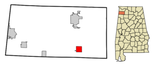
mapsize = 250px
map_caption = Location in Franklin County and the state ofAlabama
mapsize1 =
map_caption1 =
subdivision_type = Country
subdivision_type1 = State
subdivision_type2 = County
subdivision_name =United States
subdivision_name1 =Alabama
subdivision_name2 = Franklin
government_type =
leader_title =
leader_name =
established_date =
area_magnitude =
area_total_km2 = 10.6
area_total_sq_mi = 4.1
area_land_km2 = 10.6
area_land_sq_mi = 4.1
area_water_km2 = 0
area_water_sq_mi = 0
elevation_ft = 1040
elevation_m = 317
population_as_of = 2000
population_footnotes =
population_total = 1091
population_metro =
population_density_km2 = 102.9
population_density_sq_mi = 266.1
timezone = Central (CST)
utc_offset = -6
latd = 34 |latm = 21 |lats = 5 |latNS = N
longd = 87 |longm = 42 |longs = 27 |longEW = W
timezone_DST = CDT
utc_offset_DST = -5
postal_code_type =ZIP code
postal_code = 35581
area_code = 205
blank_name = FIPS code
blank_info = 01-59496
blank1_name = GNIS feature ID
blank1_info = 0124673
footnotes =
website =Phil Campbell is a town in Franklin County,
Alabama ,United States . At the 2000 census the population was 1,091.Geography
Phil Campbell is located at coor dms|34|21|5|N|87|42|27|W|city (34.351505, -87.707414)GR|1.
According to the
U.S. Census Bureau , the town has a total area of 4.1square mile s (10.6km² ), all of it land.Demographics
As of the
census GR|2 of 2000, there were 1,091 people, 458 households, and 317 families residing in the town. Thepopulation density was 267.4 people per square mile (103.2/km²). There were 535 housing units at an average density of 131.1/sq mi (50.6/km²). The racial makeup of the town was 98.99% White, 0.27% Native American, 0.18% from other races, and 0.55% from two or more races. 0.82% of the population were Hispanic or Latino of any race.There were 458 households out of which 30.8% had children under the age of 18 living with them, 50.4% were married couples living together, 15.7% had a female householder with no husband present, and 30.6% were non-families. 28.8% of all households were made up of individuals and 15.5% had someone living alone who was 65 years of age or older. The average household size was 2.38 and the average family size was 2.94.
In the town the population was spread out with 24.1% under the age of 18, 8.6% from 18 to 24, 26.7% from 25 to 44, 23.2% from 45 to 64, and 17.4% who were 65 years of age or older. The median age was 38 years. For every 100 females there were 94.1 males. For every 100 females age 18 and over, there were 84.0 males.
The median income for a household in the town was $24,598, and the median income for a family was $30,221. Males had a median income of $24,219 versus $17,316 for females. The
per capita income for the town was $16,053. About 14.2% of families and 20.2% of the population were below thepoverty line , including 27.9% of those under age 18 and 19.2% of those age 65 or over.Town History
In the 1880s, a railroad work crew leader and engineer by the name of Phillip Campbell (originally from England) established a work camp near the location of modern Phil Campbell. Mel Allen, a prominent local businessman, told Mr. Campbell if he would construct a railroad depot and add a side track to the stretch of railroad going through the area, he would name the subsequent town after Campbell. Mr. Campbell built both the depot and siding, which led to Phil Campbell being the only town in Alabama to have both the first and last names of an individual.
In June 1995 the writer Phil Campbell organized and wrote about a convention of people who shared their name with the town of Phil Campbell, Alabama. Twenty-two Phil Campbells and one Phyllis Campbell, hailing from all over America, attended. The story of the Phil Campbell convention was published in
Might Magazine , a San-Francisco-based publication founded byDave Eggers . The essay was later included in Might’s anthology,Shiny Adidas Tracksuits and the Death of Camp , and the convention itself was mentioned byRipley's Believe it or Not! A second “Phil Campbell Day” was organized the following year, but it was not as well attended, and no more were organized. Phil Campbell’s city hall, however, still maintains a file of all the Phil Campbells who visit.Phil Campbell High School
The first school in Phil Campbell was a two story frame building constructed in 1910. It was located at the back of the Phil Campbell Methodist Church. The school was subsequently destroyed by fire.
The second school was constructed in 1915 and was located at the site of the present school on AL HWY 13 in Phil Campbell. This school was a small wooden building. Like the previous school, this school was also destroyed by fire. The fire began at six o'clock in the evening on Christmas Day, 1924.
During the next two years, school was held in local church buildings, the town's former bank building, and the U.S. Post Office building located near the railroad.
Graduation services for the first accredited Phil Campbell High School class were conducted in the Phil Campbell Methodist Church. The year was 1926 and the class had eight graduating members.
The third Phil Campbell school was completed in 1926. There were two buildings, a main classroom building and a vocational school. After the main building was destroyed by fire in 1954, the present school buildings were constructed.
Local Features
The town was founded in 1857. Highlights of the downtown district include the Chat 'n' Chew restaurant, and Mrs D's. Other businesses include a Piggly Wiggly grocery store, H&R Block, and Dollar General. The town has a total of three traffic lights.
Every summer Phil Campbell hosts an annual celebration, The Downtown Hoedown (formerly Phil Campbell Day). During this celebration there are carnival rides, car shows, and arts-and-crafts items for sale. Local bands and singers perform during the evening.
The town is home to a campus of Northwest-Shoals Community College (the state's first junior college). Before Christmas every year, students from NWSCC perform "The Legend of Toyland". This is a live coreographed performance set to pre-recorded narration. Schools from surrounding counties bring students to watch the entertaining performance that has been running for 25+ years. Lanny McAlister (music director at NWSCC) is credited for the creation of the production as well as directing it all these years.
Phil Campbell is also home to Dismals Canyon. A privately owned, natural conservatory that has been designated a National Natural Landmark by the National Park Service. Dismals Canyon features a natural swimming pool, secluded areas for love making, natural shelters used by various Native American tribes for over 10,000 years, nature trails, rare luminous insects, and natural rock formations.
References
External links
* [http://www.franklincountychamber.org/about.html]
* [http://www.dismalscanyon.com/ Dismal Canyons]
Wikimedia Foundation. 2010.