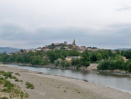
- Mallemort
-
Mallemort

Administration Country France Region Provence-Alpes-Côte d'Azur Department Bouches-du-Rhône Arrondissement Arles Canton Eyguières Intercommunality Salon-Étang de Berre-Durance Mayor Daniel Conte
(2008–2014)Statistics Elevation 99–225 m (325–738 ft)
(avg. 150 m/490 ft)Land area1 28.16 km2 (10.87 sq mi) Population2 5,809 (2008) - Density 206 /km2 (530 /sq mi) INSEE/Postal code 13053/ 13370 1 French Land Register data, which excludes lakes, ponds, glaciers > 1 km² (0.386 sq mi or 247 acres) and river estuaries. 2 Population without double counting: residents of multiple communes (e.g., students and military personnel) only counted once. Coordinates: 43°43′54″N 5°10′49″E / 43.7316666667°N 5.18027777778°E
Mallemort is a commune in the Bouches-du-Rhône department in southern France.
Mallemort is a quiet town located on the river Durance, south of the Luberon mountain range. The town itself is 10 km (6.2 mi) off the Autoroute du Soleil (the main motorway to the South and Marseille), within easy reach of Arles, Saint-Rémy, and Salon-de-Provence.
Population
Historical population of Mallemort 1793 1800 1806 1821 1831 1836 1841 1846 1851 1856 1757 1757 1727 1730 2123 2153 2165 2356 2416 2404 1861 1866 1872 1876 1881 1886 1891 1896 1901 1906 2395 2210 2195 2130 2149 2147 2059 2201 2215 2195 1911 1921 1926 1931 1936 1946 1954 1962 1968 1975 2259 1979 1867 1969 2141 2221 2427 3029 3090 3344 1982 1990 1999 2008 3946 4366 4984 5809 See also
References
Categories:- Communes of Bouches-du-Rhône
- Bouches-du-Rhône geography stubs
Wikimedia Foundation. 2010.


