- Dosthill
-
Coordinates: 52°35′53″N 1°41′02″W / 52.598°N 1.684°W
Dosthill
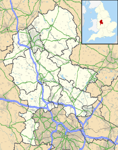
 Dosthill shown within Staffordshire
OS grid reference SK215001 District Tamworth Shire county Staffordshire Region West Midlands Country England Sovereign state United Kingdom Post town TAMWORTH Postcode district B77 Dialling code 01827 Police Staffordshire Fire Staffordshire Ambulance West Midlands EU Parliament West Midlands UK Parliament Tamworth[1] List of places: UK • England • Staffordshire Dosthill is an area of Tamworth, Staffordshire, 2.5 miles south of the town centre, and close to the River Tame. The area is mostly residential, centring around Dosthill High Street, with local employment on the adjoining Tame Valley Industrial Estate. The High Street includes a public house called ‘The Fox’ and Dosthill Primary School (photo) which dates back to 1887.
History
Dosthill is a small ancient hamlet and is mentioned in the Domesday Book. It has slowly grown in size up until recent decades, when a large number of housing developments have been constructed. The area will continue to grow in size in the near future, with many more planning proposals in the pipeline and the area becoming more desirable to young families.
Originally most of the buildings in the area were agricultural. In the late 18th and 19th centuries the village was developed with the building of a number of farms and cottages. By the 20th century Dosthill had been transformed into a coalmining and brick making village.
There are several important historical buildings in the village which form part of a conservation area.
The oldest building is Dosthill Chapel, which is a Norman building that dates from the 12th century, but has some later additional architectural features. The building is now used as a Sunday school, day nursery and parish room.
Cruck Barn is one of the most important timber framed buildings in the area and dates from the 15th century.
In 1872 St. Paul’s Church was opened and replaced Dosthill Chapel as the principal place of worship. The building was designed by Edward Holmes (architect) of Birmingham. The church continues to be a functioning parish church. The foundation stone was laid by the Cheatle family, one of the main four original families of Dosthill. The other three families are the Laytons, Tolsons and Tromans, descendants of whom still live in the village today.
Dosthill Hall is also a building of historic significance. It is a Georgian mansion originally owned by Sir Robert Peel and also by the Tolson family. The building and grounds have now been restored and converted into a number of apartments.
Leisure
Dosthill is a popular place for scuba divers, water skiers and bird watchers.
A former quarry is now a diving centre and is considered to be the oldest inland dive site in the country.[2] The quarry site consists of several submerged features for divers to explore, including numerous vans, caravans and other vehicles. There are also some good diving platforms for training. No other water activities such as fishing, water skiing, or the use of speed boats or jet skis are allowed on this site.
Greenhill Close, Dosthill was named after Florence Greenhill a local identity. She was the local nurse and midwife who became known for delivering babies while bombs fell around her and her patients. After World War II she served for a time on Tamworth Shire council.
Dosthill Lake is home to the West Midlands Water Ski Centre and has been designated as a Site of Importance for Nature Conservation (SINC) due to its winter waterfowl populations, swamp vegetation and marshy grassland. From 2020[when?] it is part of Dosthill Park Local Nature Reserve.
A public right of way to Middleton Lakes RSPB reserve, west of the river (and mostly in Warwickshire) exists, but the public bridge over the river collapsed and is awaiting replacement. Some pools east of the river are also part of the reserve.
References
Tamworth Borough Council
Tamworth Castle
The Corpus of Romanesque Sculpture in Britain and Ireland
North Warwickshire Borough Council- ^ "United Kingdom Parliament". http://www.parliament.uk/. Retrieved 18 September 2009.
- ^ Dive In Centre
Categories:- Tamworth
- Villages in Staffordshire
Wikimedia Foundation. 2010.

