- Southside, Alabama
Infobox Settlement
official_name = Southside, Alabama
settlement_type =City
imagesize =
image_caption =
image_
imagesize =
image_caption =
image_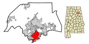
mapsize = 250px
map_caption = Location in Etowah County and the state ofAlabama
mapsize1 =
map_caption1 =
subdivision_type = Country
subdivision_type1 = State
subdivision_type2 = Counties
subdivision_name =United States
subdivision_name1 =Alabama
subdivision_name2 = Calhoun, Etowah
government_type =
leader_title =
leader_name =
established_date =
area_magnitude =
area_total_km2 = 49.5
area_total_sq_mi = 19.1
area_land_km2 = 49
area_land_sq_mi = 18.9
area_water_km2 = 0.5
area_water_sq_mi = 0.2
elevation_ft = 620
elevation_m = 189
population_as_of = 2000
population_footnotes =
population_total = 7036
population_metro =
population_density_km2 = 142.1
population_density_sq_mi = 368.4
timezone = Central (CST)
utc_offset = -6
latd = 33 |latm = 54 |lats = 13 |latNS = N
longd = 86 |longm = 1 |longs = 34 |longEW = W
timezone_DST = CDT
utc_offset_DST = -5
postal_code_type =ZIP code
postal_code = 35907
area_code = 256
blank_name = FIPS code
blank_info = 01-71832
blank1_name = GNIS feature ID
blank1_info = 0127146
footnotes =
website =Southside is a city in Etowah county in the
U.S. state ofAlabama . It is part of the 'Gadsden, Alabama Metropolitan Statistical Area '. The population was 7,036 at the 2000 census. This sprawling suburb of Gadsden is one of the fastest growing cities in Northeast Alabama.History
Southside was first settled in 1850 as a small rural community with townships such as Green Valley, Cedar Bend, and Pilgrims Rest, and the town of Southside was formed when they banded together. Early Southside's dominant source of income was farming.
Geography
Southside is located at coor dms|33|54|13|N|86|1|34|W|city (33.903597, -86.026105)GR|1.
According to the
U.S. Census Bureau , the city has a total area of 19.1square mile s (49.5km² ), of which, 18.9 square miles (49.0 km²) of it is land and 0.2 square miles (0.5 km²) of it (1.05%) is water.Southside occupies the southern part of Etowah County between the foothills of the
Appalachian Mountains andCoosa River .Government
Southside has a mayor-council form of government.
Current Mayor
*Wally BurnsCurrent Council Members
* Richard McGowan - Place 1
* John Hatley - Place 2
* Joey Jones - Place 3
* Don Steward - Place 4
* Randall Tallent - Place 5Education
The city is served by the Etowah County Board of Education. The city has one elementary school, one high school, and shares a middle school with neighboring
Rainbow City . Students also have the option of attending schools in the Gadsden City school system.Demographics
As of the
census GR|2 of 2000, there were 7,036 people, 2,653 households, and 2,170 families residing in the city. Thepopulation density was 372.2 people per square mile (143.7/km²). There were 2,783 housing units at an average density of 147.2/sq mi (56.9/km²). The racial makeup of the city was 98.11% White, 0.61% Black or African American, 0.23% Native American, 0.24% Asian, 0.13% from other races, and 0.68% from two or more races. 0.67% of the population were Hispanic or Latino of any race.There were 2,653 households out of which 35.6% had children under the age of 18 living with them, 72.6% were married couples living together, 6.6% had a female householder with no husband present, and 18.2% were non-families. 16.2% of all households were made up of individuals and 6.4% had someone living alone who was 65 years of age or older. The average household size was 2.62 and the average family size was 2.93.
In the city the population was spread out with 24.1% under the age of 18, 6.9% from 18 to 24, 30.1% from 25 to 44, 28.0% from 45 to 64, and 10.8% who were 65 years of age or older. The median age was 38 years. For every 100 females there were 98.4 males. For every 100 females age 18 and over, there were 95.6 males.
The median income for a household in the city was $52,464, and the median income for a family was $58,427. Males had a median income of $41,664 versus $29,375 for females. The
per capita income for the city was $21,936. About 2.2% of families and 3.6% of the population were below thepoverty line , including 3.1% of those under age 18 and 5.4% of those age 65 or over.References
External links
* [http://www.cityofsouthside.com/ City of Southside]
* [http://www.cityofsouthside.com/Default.asp?ID=5&pg=History Southside History]
Wikimedia Foundation. 2010.