- Charleston Light
-
Charleston Light 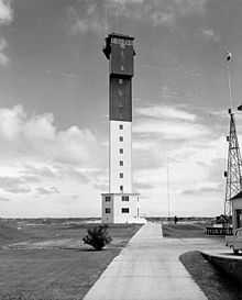
Charleston Light on Sullivan's Island Location Sullivan's Island, South Carolina Coordinates 32°45′28″N 79°50′35″W / 32.75778°N 79.84306°W Year first constructed 1960 Year first lit 1962 Automated 1975 Foundation Concrete Construction Steel with aluminum alloy skin Tower shape Triangular Markings / pattern Upper black and lower white Height 140 ft (42.7 m) Focal height 163 ft (49.7 m) Original lens DCB 24 Current lens DCB 24 Range 26 mi (42 km) Characteristic White, two short flashes every 30 s ARLHS number USA-825 Charleston Light on Sullivan's Island, South Carolina, which is the northern entrance to Charleston Harbor, was built to replace the defunct Morris Island Light on Morris Island. Construction was started in 1960, and it was first lit on June 15, 1962.
The lighthouse has a steel frame, an aluminum alloy skin, and a modern triangular cross section. It is 140 ft (42.7 m) tall. The focal plane of the light is 163 ft (49.7 m) above mean sea level. Originally painted white and red-orange, the daymark is now a black upper half and white lower half.[1] It is the only U.S. lighthouse with an elevator and was the last on shore manned lighthouse to be built. Only the Texas Tower Offshore Lighthouses were built later starting in 1961 with Buzzards Bay Entrance Light.
It has a DCB 24 light. It originally had 28 million candelas (candlepower) and was the second most powerful in the Western Hemisphere.[2] As the light was actually too dazzling, the power was lowered to 1.2 million candelas and could still be seen over 26 miles.[3] Its characteristic is two 0.2 s flashes separated by 4.8 s every 30 s. The light was automated in 1975.[4][5][6][7]
Coordinates: 32°45′28″N 79°50′35″W / 32.757778°N 79.843056°W
Images
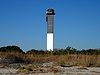
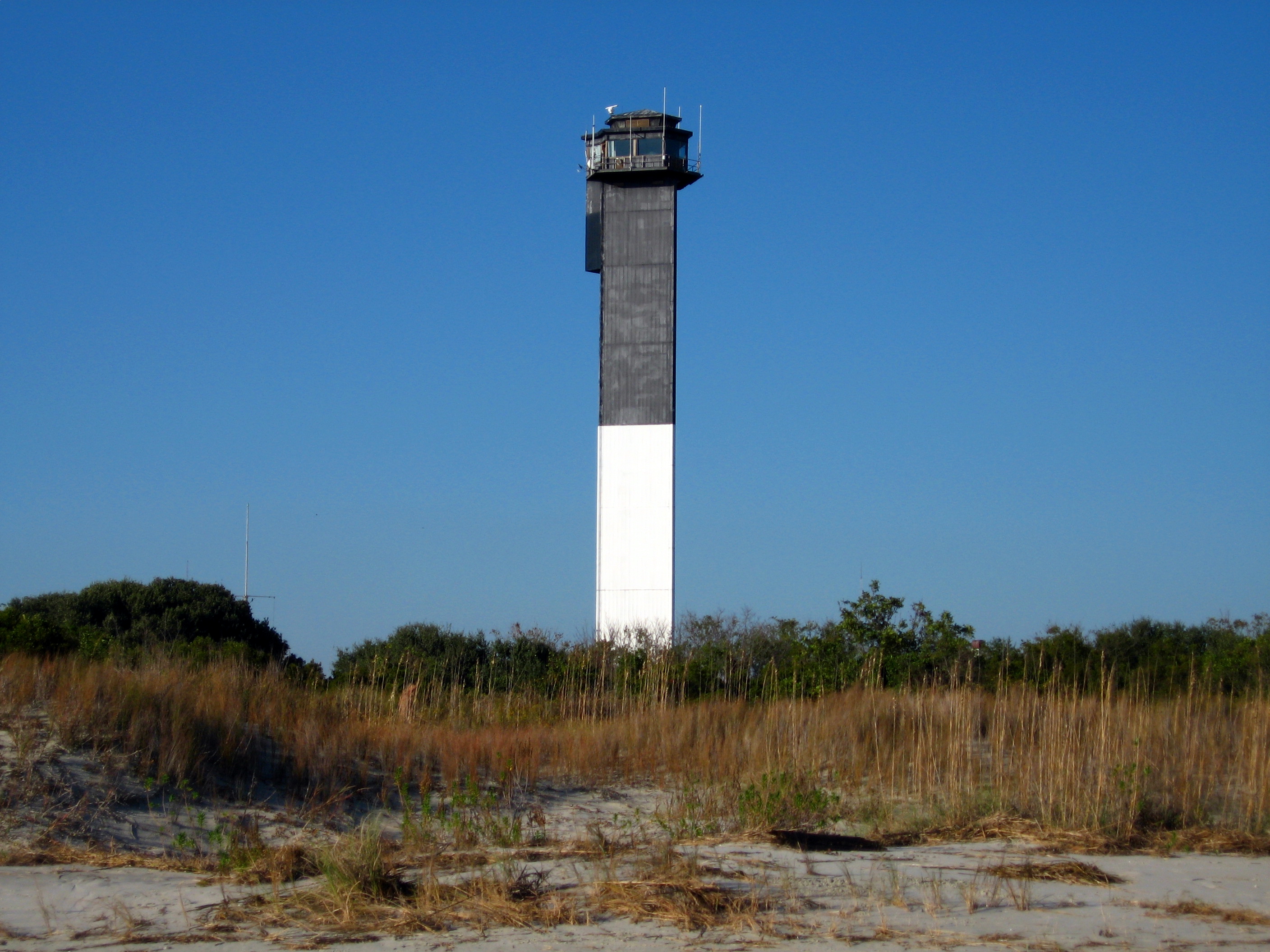
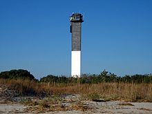 Charleston Light on Sullivan's Island.
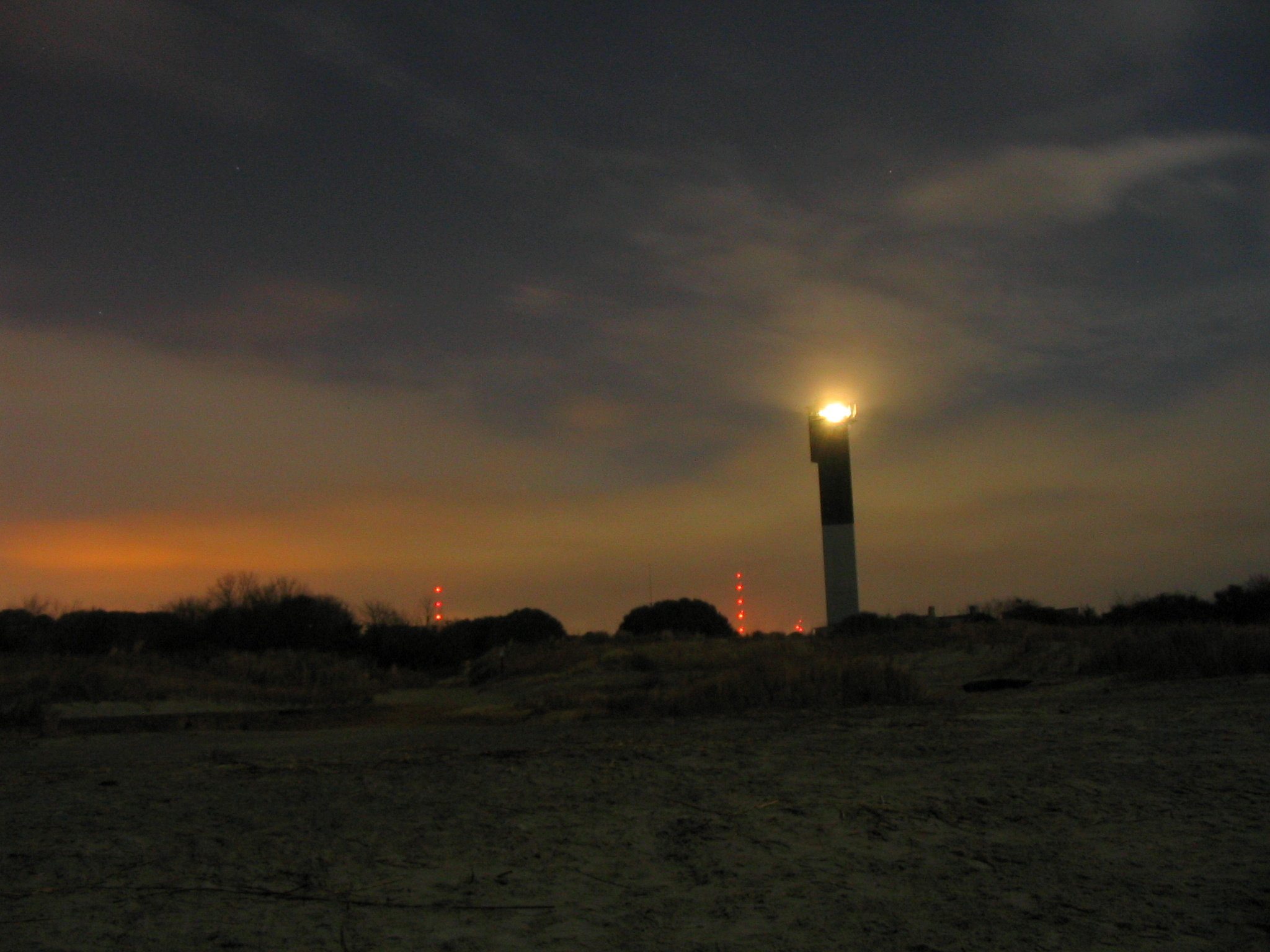
 Charleston Light viewed from the beach at dusk.
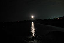 Charleston Light viewed from the beach at night.
References
- ^ http://www.lighthousefriends.com/light.asp?ID=334
- ^ http://www.lighthousefriends.com/light.asp?ID=334
- ^ http://www.lighthousefriends.com/light.asp?ID=334
- ^ (PDF) Light List, Volume III, Atlantic Coast, Little River, South Carolina to Econfina River, Florida. Light List. United States Coast Guard. 2006. p. 3. http://www.navcen.uscg.gov/pdf/lightLists/LightList%20V3.pdf.
- ^ Roberts, Bruce, and Jones, Ray, Southern Lighthouses: Outer Banks to Cape Florida, 3rd ed., Globe Pequot Press, Guilford, CT, 2002, p. 41, ISBN 0-7627-1243-0.
- ^ Hollands, F. Ross, Jr., Great American Lighthouses, Preservation Press, Washington, DC, p. 189, ISBN 0-89133-153-0.
- ^ Edgar, Walter, ed. The South Carolina Encyclopedia, University of South Carolina Press, 2006, pp. 556-557, ISBN 1-57003-598-2
External links
- Lighthousefriends - Charleston Light page
- NPS Inventory of Historic Light Stations - Charleston Light
 Categories:
- Lighthouses in South Carolina
- Charleston County, South Carolina


Wikimedia Foundation. 2010.