- Mole Creek Karst National Park
-
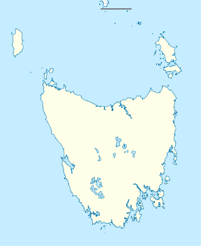
Mole Creek Karst National Park IUCN Category II (National Park)Nearest town/city Deloraine Coordinates 41°36′02″S 146°17′22″E / 41.60056°S 146.28944°E Area 13.45 km² Established 1996 Managing authorities Tasmania Parks and Wildlife Service Official site Mole Creek Karst National Park Mole Creek Karst is a national park in Tasmania, Australia, 168 km northwest of Hobart. It is the only national park in Tasmania created specifically to protect karst landforms. It is part of the Tasmanian Wilderness World Heritage Site.
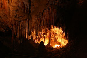
The national park was declared in 1996 to provide protection for an extensive system of over 300 known caves and sinkholes, including Marakoopa and King Solomons Cave.[1]
Marakoopa Cave features two underground streams, glow-worms, large caverns, rim pools, reflections and shawl and flowstone features. King Solomons Cave includes shawls, stalactites and stalagmites.[2]
See also
References
- ^ Mole Creek Karst National Park, Parks and Wildlife Service Tasmania, retrieved 27 November 2010
- ^ Mole Creek Karst National Park Activities Parks and Wildlife Service Tasmania
National parks of Tasmania Ben Lomond · Cradle Mountain-Lake St Clair · Douglas-Apsley · Franklin-Gordon Wild Rivers · Freycinet · Hartz Mountains · Kent Group · Maria Island · Mole Creek Karst · Mount Field · Mount William · Narawntapu · Rocky Cape · Savage River · South Bruny · Southwest · Strzelecki · Tasman · Walls of JerusalemCategories:- IUCN Category II
- Tasmania geography stubs
- Australian protected area stubs
- National parks of Tasmania
- Protected areas established in 1996
- Tasmania Wilderness sites
- 1996 establishments in Australia
Wikimedia Foundation. 2010.


