Winthrop Glacier

Winthrop Glacier

Infobox_Glacier | glacier_name = Winthrop Glacier
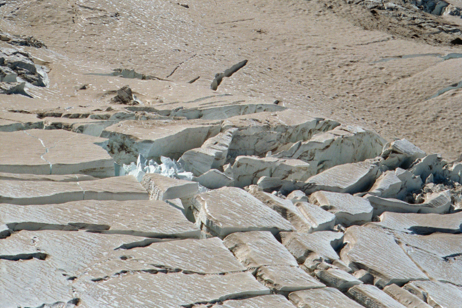


caption = Seracs near convert|10000|ft|m|-2 on the Winthrop Glacier in 2002
type = Mountain glacier
location = Mount Rainier, Washington, U.S.
coordinates = coord|46|52|34|N|121|44|31|W|type:glacier [Google Earth images.]
area = convert|3.5|sqmi|km2|1, 1983
length =
thickness =
terminus =
status =

The Winthrop Glacier is a large glacier on the northeastern side of Mount Rainier in Washington. Named after Theodore Winthrop, the body of ice covers 3.5 mile2 (9.1 km²) and has a volume of 18.5 billion feet3 (523 million m³).Cite web|title= DESCRIPTION: Mount Rainier Glaciers and Glaciations - Mount Rainier Glacier Hazards and Glacial Outburst Floods|publisher=USGS|url=http://vulcan.wr.usgs.gov/Volcanoes/Rainier/Glaciers/description_rainier_glaciers.html|accessdate=2007-11-19] Starting at over Convert|14300|ft|m|-2 at the Columbia Crest, the glacier heads north and descends steeply over the uneven topography of Rainier.Cite web|title=USGS Sunrise (WA) Topo Map|work=USGS Quad maps|url=http://www.topoquest.com/map.php?lat=46.88771&lon=-121.73751&datum=nad27&zoom=8|publisher=TopoQuest.com|accessdate=2008-05-15] Another glacier, the Emmons Glacier is directly connected to this glacier up to the Steamboat Prow. After passing the Prow, the glaciers split up; the Emmons heads east-northeastward and the Winthrop continues northeast. As the terrain becomes flatter, the Winthrop glacier becomes heavily rock-covered when it terminates in a forest at about Convert|4900|ft|m|-2|abbr=on|abbr=on. Meltwater from the glacier drains into the White River.

Debris flows

The glacier is one of four on Mount Rainier that are known to have released debris flows. Similar flows have stemmed from the Nisqually, Kautz, and South Tahoma glaciers as well.

ee also

*List of glaciers

References


Wikimedia Foundation. 2010.

Игры ⚽ Нужна курсовая?

Look at other dictionaries:

  • Nisqually Glacier — in center background Type Mountain glacier Location …   Wikipedia

  • Cowlitz Glacier — Upper Cowlitz Glacier (right center) Type Mountain glacier Location …   Wikipedia

  • Ohanapecosh Glacier — View SSW from Banshee Peak Type Mountain glacier Location …   Wikipedia

  • North Mowich Glacier — Type Mountain glacier Location Mount Rainier, Pierce County, Washington, USA Coordinates …   Wikipedia

  • Inter Glacier — Infobox Glacier | glacier name = Inter Glacier caption = type = Mountain glacier location = Mount Rainier, Washington, U.S. coordinates = coord|46|52|35|N|121|43|37|W|type:glacier [Google Earth images.] area = 0.3 mile² (0.8 km²), 1983 length =… …   Wikipedia

  • South Tahoma Glacier — Infobox Glacier | glacier name = South Tahoma Glacier caption = type = Mountain glacier location = Mount Rainier, Washington, U.S. coordinates = coord|46|49|27|N|121|48|17|W|type:glacier area = convert|1.1|sqmi|km2|1, 1983Cite web|title=… …   Wikipedia

  • Miage Glacier — The ends of the Miage Glacier s terminal lobes at sunset, as seen from northeastern Val Veny in August 2010 The Miage Glacier is a debris covered glacier in northwestern Italy. It is situated on the southwest flank of the Mont Blanc massif,… …   Wikipedia

  • Kautz Glacier — Infobox Glacier | glacier name = Kautz Glacier caption = type = Mountain glacier location = Mount Rainier, Washington, U.S. coordinates = coord|46|49|41|N|121|46|14|W|type:glacier [Google Earth images.] area = convert|1.8|sqmi|km2|1, 1983Cite… …   Wikipedia

  • Mont Blanc glacier flood — The Mont Blanc glacier flood was a damaging flood near Mont Blanc, France, that occurred in 1892. In the disaster, a subterranean glacial lake burst from beneath the Tête Rousse glacier[which?] on the mountain and flooded the Saint Gervais valley …   Wikipedia

  • Mount Rainier — This article is about the volcano. For other uses, see Mount Rainier (disambiguation) and Rainier. Mount Rainier Mount Rainier as viewed from the northeast …   Wikipedia

Share the article and excerpts

Direct link
Do a right-click on the link above
and select “Copy Link”