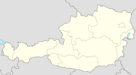
- Lanzenkirchen
-
Lanzenkirchen Country Austria State Lower Austria District Wiener Neustadt-Land Mayor Bernhard Karnthaler (ÖVP) Area 29.80 km2 (12 sq mi) Elevation 298 m (978 ft) Population 3,757 (1 January 2011)[1] - Density 126 /km² (327 /sq mi) Time zone CET/CEST (UTC+1/+2) Licence plate WB Postal code 2821 Area code 02627 Website www.lanzenkirchen.gv.at Coordinates: 47°44′50″N 16°14′50″E / 47.74722°N 16.24722°E
Lanzenkirchen is a village in Lower Austria, Austria.
Contents
Geography
Lanzenkirchen is located in the regions of Steinfeld and the Bucklige Welt and the Rosalienbirges ranges. Its main river is the Leitha and the Mühlbach Canal.
Here are 5 Katastralgemeinden of Lanzenkirchen:
- Lanzenkirchen
- Frohsdorf
- Haderswörth
- Keinwolkersdorf
- Ofenbach
History
Origin of the place names in Lanzenkirchen
- Lanzenkirchen
The name comes from a German settler who built a church. Its name was Anzo or Lanzo. The name Lanzenkirchen was first mentioned in 1130.
- Frohsdorf
The original name was Krottendorf because where many toads (German Kröte) were found. It became Froschdorf (German frosch frog + dorf village). Its present name was use in the beginning of the 19th century.
- Haderswörth
This name originates from Hadurich and wert. It was meant as Au des Hadurich of the Hadurich. The name was later known as Haiderswörth, then Haiderswerth, and then Häderswörth and now Haderswörth.
- Kleinwolkersdorf
The name might originate from Wolfkers. Thus this was known as Wolfkersdorf. It wasn't known as Kleinwolkersdorf until around 1800.
- Ofenbach
The place was originally Quenbach. The name Ofenbach wasn't clarified completely then. The name probably originates from Oven which also means furnace. Before the area was known as Ober- and Niederofenbach. In Ofenbach there is a bus terminal from the ViennaNewtownTown Works.
Sites of interest
- Schloss Frohsdorf, the Frohsdorf Fortress
- church
References
Bad Erlach · Bad Fischau-Brunn · Bad Schönau · Bromberg · Ebenfurth · Eggendorf · Felixdorf · Gutenstein · Hochneukirchen-Gschaidt · Hochwolkersdorf · Hohe Wand · Hollenthon · Katzelsdorf · Kirchschlag in der Buckligen Welt · Krumbach · Lanzenkirchen · Lichtenegg · Lichtenwörth · Markt Piesting · Matzendorf-Hölles · Miesenbach · Muggendorf · Pernitz · Rohr im Gebirge · Schwarzenbach · Sollenau · Theresienfeld · Waidmannsfeld · Waldegg · Walpersbach · Weikersdorf am Steinfelde · Wiesmath · Winzendorf-Muthmannsdorf · Wöllersdorf-Steinabrückl · Zillingdorf
Categories:- Cities and towns in Lower Austria
Wikimedia Foundation. 2010.


