- Muggendorf
-
This article is about the municipality in Lower Austria. For the village, see Muggendorf (Wiesenttal). For other uses, see Muggendorf (disambiguation).
Muggendorf 
 Muggendorf
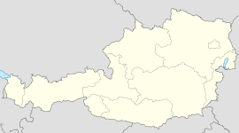
Country Austria State Lower Austria District Wiener Neustadt-Land Mayor Gottfried Brandstetter (ÖVP) Area 50.93 km2 (20 sq mi) Elevation 450 m (1476 ft) Population 529 (1 January 2011)[1] - Density 10 /km² (27 /sq mi) Time zone CET/CEST (UTC+1/+2) Licence plate WB Postal code 2763 Area code 02632 Website www.muggendorf.at Muggendorf is a municipality in the district of Wiener Neustadt-Land in Lower Austria, Austria.
References
Bad Erlach · Bad Fischau-Brunn · Bad Schönau · Bromberg · Ebenfurth · Eggendorf · Felixdorf · Gutenstein · Hochneukirchen-Gschaidt · Hochwolkersdorf · Hohe Wand · Hollenthon · Katzelsdorf · Kirchschlag in der Buckligen Welt · Krumbach · Lanzenkirchen · Lichtenegg · Lichtenwörth · Markt Piesting · Matzendorf-Hölles · Miesenbach · Muggendorf · Pernitz · Rohr im Gebirge · Schwarzenbach · Sollenau · Theresienfeld · Waidmannsfeld · Waldegg · Walpersbach · Weikersdorf am Steinfelde · Wiesmath · Winzendorf-Muthmannsdorf · Wöllersdorf-Steinabrückl · Zillingdorf
Categories:- Cities and towns in Lower Austria
- Lower Austria geography stubs


Wikimedia Foundation. 2010.