- East Earl Township, Pennsylvania
Infobox Settlement
official_name = Pagename
settlement_type = Township
nickname =
motto =
imagesize =
image_caption =
image_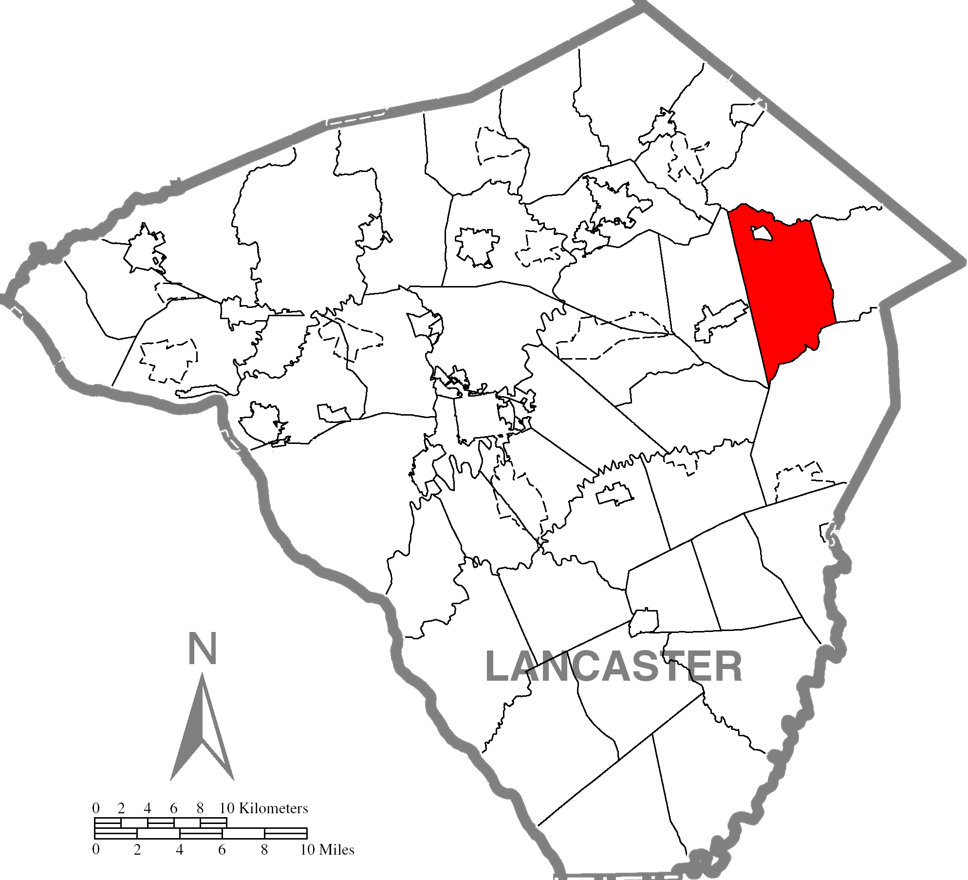
mapsize = 250x200px
map_caption = Map of Lancaster County, Pennsylvania highlighting East Earl Township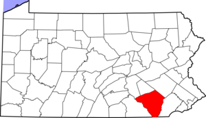
mapsize1 = 250x200px
map_caption1 = Map of Lancaster County, Pennsylvania
subdivision_type = Country
subdivision_name =United States
subdivision_type1 = State
subdivision_name1 =Pennsylvania
subdivision_type2 = County
subdivision_name2 = Lancaster
government_footnotes =
government_type = Board of Supervisors
leader_title =
leader_name =
leader_title1 =
leader_name1 =
leader_title2 =
leader_name2 =
established_title = Settled
established_date = 1722
established_title1 = Incorporated
established_date1 = 1851
unit_pref = Imperial
area_footnotes =
area_magnitude =
area_total_km2 =
area_land_km2 =
area_water_km2 =
area_total_sq_mi = 24.7
area_land_sq_mi = 24.6
area_water_sq_mi = 0.1
population_as_of = 2000
population_footnotes =
population_total = 5723
population_density_km2 =
population_density_sq_mi = 232.6
timezone = Eastern (EST)
utc_offset = -5
timezone_DST = EDT
utc_offset_DST = -4
postal_code_type =
postal_code =
area_code = 717
website =
footnotes =East Earl Township is a township in northeastern Lancaster County,
Pennsylvania ,United States . At the 2000 census the population was 5,723.Geography
According to the
U.S. Census Bureau , the township has a total area of 24.7square mile s (63.9km² ), of which, 24.6 square miles (63.7 km²) of it is land and 0.1 square miles (0.2 km²) of it (0.24%) is water.Demographics
As of the
census GR|2 of 2000, there were 5,723 people, 1,738 households, and 1,485 families residing in the township. Thepopulation density was 232.6 people per square mile (89.8/km²). There were 1,795 housing units at an average density of 73.0/sq mi (28.2/km²). The racial makeup of the township was 98.17% White, 0.58% Black or African American, 0.05% Native American, 0.37% Asian, 0.03% Pacific Islander, 0.12% from other races, and 0.68% from two or more races. 0.66% of the population were Hispanic or Latino of any race.There were 1,738 households out of which 42.2% had children under the age of 18 living with them, 75.8% were married couples living together, 6.3% had a female householder with no husband present, and 14.5% were non-families. 11.9% of all households were made up of individuals and 5.1% had someone living alone who was 65 years of age or older. The average household size was 3.28 and the average family size was 3.59.
In the township the population was spread out with 33.4% under the age of 18, 9.5% from 18 to 24, 25.1% from 25 to 44, 21.0% from 45 to 64, and 11.0% who were 65 years of age or older. The median age was 32 years. For every 100 females there were 99.8 males. For every 100 females age 18 and over, there were 97.8 males.
The median income for a household in the township was $48,118, and the median income for a family was $51,450. Males had a median income of $36,438 versus $20,923 for females. The
per capita income for the township was $17,127. About 3.2% of families and 5.2% of the population were below thepoverty line , including 9.1% of those under age 18 and 2.0% of those age 65 or over.Shady Maple Farm Market and Smorgasbord
East Earl Township is the home of Shady Maple Farm Market and Smorgasbord. The current Smorgasbord building, built in 2000, can seat 1,200 people. The building features a 30,000 square foot
gift shop andfast food restaurant called the Dutchette. A recently opened banquet facility seats up to 1,000, with plans on the way to add on to the farmers market. The complex is owned byMennonite s Marvin and Miriam Weaver. The Farm Market and the Smorgasbord employ approximately 600 people. [cite news
title = Shady Maple
url = http://www.shady-maple.com/history.html
accessdate = 2006-10-09 ]References

Wikimedia Foundation. 2010.