- Drumore Township, Pennsylvania
Infobox Settlement
official_name = Pagename
settlement_type = Township
nickname =
motto =
imagesize =
image_caption =
image_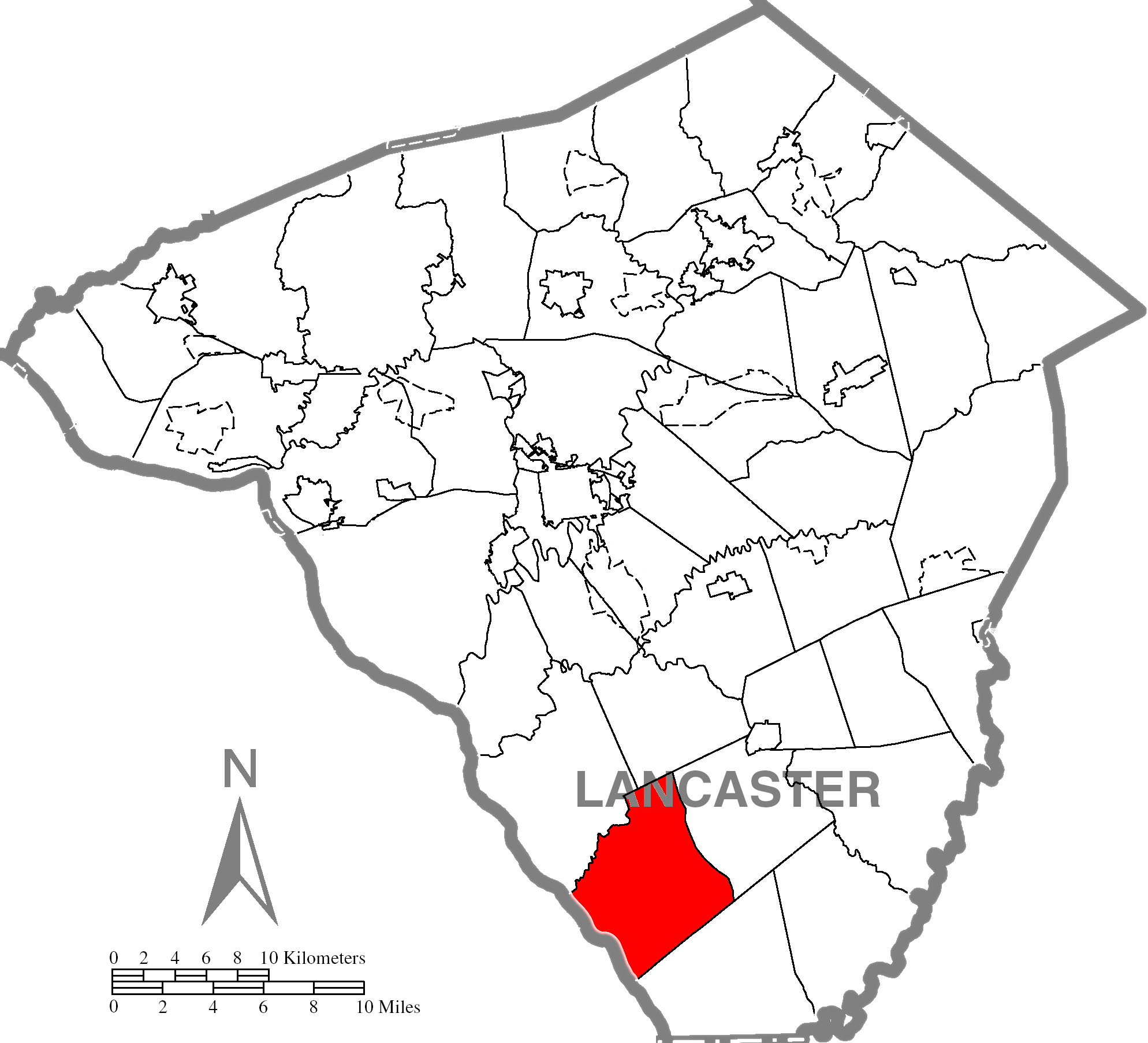
mapsize = 250x200px
map_caption = Map of Lancaster County, Pennsylvania highlighting Drumore Township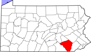
mapsize1 = 250x200px
map_caption1 = Map of Lancaster County, Pennsylvania
subdivision_type = Country
subdivision_name =United States
subdivision_type1 = State
subdivision_name1 =Pennsylvania
subdivision_type2 = County
subdivision_name2 = Lancaster
government_footnotes =
government_type = Board of Supervisors
leader_title = Chairperson
leader_name = Thomas W. Aaron
leader_title1 = Vice Chairman
leader_name1 = Kolin D. McCauley
leader_title2 = Roadmaster
leader_name2 = Robert S. Holzhauer
established_title = Settled
established_date =
established_title1 = Incorporated
established_date1 = 1729
unit_pref = Imperial
area_footnotes =
area_magnitude =
area_total_km2 =
area_land_km2 =
area_water_km2 =
area_total_sq_mi = 28.9
area_land_sq_mi = 23.9
area_water_sq_mi = 5.0
population_as_of = 2000
population_footnotes =
population_total = 2243
population_density_km2 =
population_density_sq_mi = 93.8
timezone = Eastern (EST)
utc_offset = -5
timezone_DST = EDT
utc_offset_DST = -4
postal_code_type =
postal_code =
area_code = 717
website = [http://www.co.lancaster.pa.us/drumore/site/default.asp Drumore Township]
footnotes =Drumore Township is a township in southwestern Lancaster County,
Pennsylvania ,United States . At the 2000 census the population was 2,243.Geography
According to the
U.S. Census Bureau , the township has a total area of 28.9square mile s (74.9km² ), of which, 23.9 square miles (61.9 km²) of it is land and 5.0 square miles (13.0 km²) of it (17.36%) is water.Demographics
As of the
census GR|2 of 2000, there were 2,243 people, 739 households, and 597 families residing in the township. Thepopulation density was 93.8 people per square mile (36.2/km²). There were 819 housing units at an average density of 34.3/sq mi (13.2/km²). The racial makeup of the township was 98.75% White, 0.27% Black or African American, 0.09% Native American, 0.09% Asian, 0.27% from other races, and 0.53% from two or more races. 0.71% of the population were Hispanic or Latino of any race.There were 739 households out of which 38.8% had children under the age of 18 living with them, 71.7% were married couples living together, 5.4% had a female householder with no husband present, and 19.2% were non-families. 16.4% of all households were made up of individuals and 6.2% had someone living alone who was 65 years of age or older. The average household size was 3.04 and the average family size was 3.44.
In the township the population was spread out with 32.0% under the age of 18, 8.6% from 18 to 24, 27.9% from 25 to 44, 22.5% from 45 to 64, and 9.1% who were 65 years of age or older. The median age was 34 years. For every 100 females there were 104.3 males. For every 100 females age 18 and over, there were 106.5 males.
The median income for a household in the township was $47,250, and the median income for a family was $51,645. Males had a median income of $36,366 versus $22,560 for females. The
per capita income for the township was $17,470. About 4.0% of families and 5.1% of the population were below thepoverty line , including 7.2% of those under age 18 and 6.5% of those age 65 or over.Parks and Recreation
Drumore Township Park
The Drumore Township Park is located at 1675 Furniss Road, Drumore, Pennsylvania and is located on 10 acres of land immediately in back of the Township Municipal Building. The land was purchased from the John O’Donnel farm with grant money from the County.
The Park is open to the public each day of the week from sun up to sun down.
usquehannock State Park
chools
Drumore Township is served by the
Solanco School District . Schools in the district are:Solanco High School 585 Solanco Road, Quarryville, PA 17566(717)786-2151George A. Smith Middle School645 Kirkwood Pike, Quarryville, PA 17566(717)786-2244
Swift Middle School1866 Robert Fulton Highway, Quarryville, PA 17566(717)548-2187
Providence Elementary School 137 Truce Road, New Providence, PA 17560(717)786-3582
Quarryille Elementary School211 South Hess Street, Quarryville, PA 17566(717)786-2546
Clermont Elementary School1868 Robert Fulton Highway, Quarryville, PA 17566(717)548-2742
Bart Colerain Elementary School1336 Noble Road, Christiana, PA 17509(717)529-2181
External links
* http://www.co.lancaster.pa.us/drumore
References

Wikimedia Foundation. 2010.