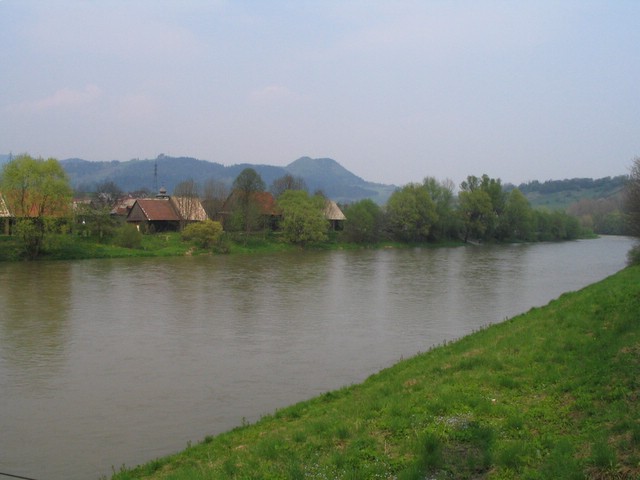
- Orava River
Geobox River
name = Orava
map_size =
map_caption =
other_name = _hu. Árva
other_name1 = langWithName|de|German|Arwa
other_name2 = _pl. Orawa
country = Slovakia
country1 =
region =
region1 =
city =
city1 =
length = 60.9
length_imperial =
watershed = 1991.8
watershed_imperial =
discharge_location = mouth
discharge_average = 34.5
discharge_average_imperial =
discharge_max_month =
discharge_max = 1120
discharge_max_imperial =
discharge_min_month =
discharge_min = 2.3
discharge_min_imperial =
discharge1_location =
discharge1_average =
discharge1_average_imperial =
source_name = Orava reservoir, taking water from "White Orava" in Slovakia and from "Black Orava" in Poland
source_location =
source_region =Orava
source_country =Slovakia
source_country1 =
source_elevation = 601
source_elevation_imperial =
source_lat_d = 49
source_lat_m = 23
source_lat_s =
source_lat_NS = N
source_long_d = 19
source_long_m = 33
source_long_s =
source_long_EW = E
mouth_name =Váh river
mouth_location =Kraľovany
mouth_country =
mouth_region =
mouth_country1 =
mouth_elevation = 430.7
mouth_elevation_imperial =
mouth_lat_d = 49
mouth_lat_m = 09
mouth_lat_s =
mouth_lat_NS = N
mouth_long_d = 19
mouth_long_m = 09
mouth_long_s =
mouth_long_EW = E
tributary_left =
tributary_left1 =
tributary_right =
tributary_right1 =

image_size =
image_caption = Orava River atDolný Kubín , showing houses of Záskalie neighborhoodOrava (coord|49|09|N|19|09|E|region:SK) is the name of a 60.9 km long
river in north-westernSlovakia passing through a picturesque country, in the Orava county. Its source is nowadays the Orava water reservoir whose waters flooded the confluence of Biela (White) Orava and Čierna (Black) Orava in 1953. It flows into the riverVáh near the village of Kraľovany.External links
* [http://gnswww.nga.mil/geonames/Gazetteer/Search/Results.jsp?Feature__Unique_Feature_ID=-844715&Diacritics=Yes&reload=1 Orava on Geonames]
Wikimedia Foundation. 2010.
