- Dalneigh
-
Coordinates: 57°28′22″N 4°14′34″W / 57.4728°N 4.2428°W
Dalneigh Scottish Gaelic: Dail an Eich 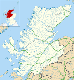
 Dalneigh
Dalneigh shown within the Highland council areaOS grid reference NH 656 447 Council area Highland Country Scotland Sovereign state United Kingdom Post town Inverness Postcode district IV3 5 Dialling code 01463 232 Police Northern Fire Highlands and Islands Ambulance Scottish EU Parliament Scotland List of places: UK • Scotland • Dalneigh (Gaelic: Dail an Eich) is an area in the city of Inverness in Scotland. Located in the west of the city, it lies between the River Ness and the Caledonian Canal. The name is derived from the Gaelic word Dail an Eich, meaning 'Field of the horse'[1]. As hinted by the name, it was originally a farm, but following the end of the Second World War, it was turned into a residential area to provide housing for the expected increase in demand. Over the following fifty years, successive waves of development saw Dalneigh transformed from farmland into home for thousands of people.
In 1937, Inverness High School was opened in the east of Dalneigh and is still the main secondary school for the area's children; the school roll has declined from over one thousand in the 1950s to just under half that today. Dalneigh Primary School is one of Inverness High's feeder primaries and is situated in central Dalneigh.
Prior to their merger with Inverness Thistle F.C. in 1994, Caledonian F.C. played at Telford Street Park in the north of Dalneigh, and drew a lot of their support from the area.
Politically, Dalneigh is part of the Highland Council ward of Inverness Central. For elections to the Scottish Parliament, Dalneigh is divided between the constituencies of Ross, Skye and Inverness West and Inverness East, Nairn and Lochaber, and the area is part of the Inverness, Nairn, Badenoch and Strathspey constituency for elections to the UK Parliament.
References
- ^ Maclean, Roddy (2004). The Gaelic Place Names and Heritage of Inverness. Inverness: Culcabock Pulishing. p. 71. ISBN 9780954892500.
External links
Areas of Inverness The Aird · Ballifeary · Balloch · Balnafettack · Beechwood · Bught · Carse · Castle Heather · Clachnaharry · Cradlehall · Crown · Culcabock · Culduthel · Culloden · Dalneigh · Drakies · Drummond · Haugh · Hilton · Holm · Inshes · Kinmylies · Leachkin · Lochardil · Longman · Merkinch · Millburn · Milton · Milton of Leys · Muirtown · Ness Castle · Ness-Side · Raigmore · Scorguie · Seafield · Slackbuie · Smithton · South Kessock · Torvean · Westhill
Categories:- Areas of Inverness
- Highland geography stubs

Wikimedia Foundation. 2010.