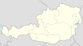
- Orth an der Donau
-
Orth an der Donau 
Country Austria State Lower Austria District Gänserndorf Mayor Johann Mayor Area 33.41 km2 (13 sq mi) Elevation 150 m (492 ft) Population 2,052 (1 January 2011)[1] - Density 61 /km² (159 /sq mi) Time zone CET/CEST (UTC+1/+2) Postal code 2304 Area code 02212 Website www.orth.at Orth an der Donau is a town in the district of Gänserndorf in the Austrian state of Lower Austria. It is located on the bank of the Danube River, about fifteen miles east of Vienna.[2]
In the 1880s its population was about 3,000.[2]
In 1170, Hartneid von Orthe purchased the village and estate surrounding it, founded a church, and erected a castle. It remained in the family for several successive generations, when the proprietor, about the close of the 17th century, sold out and moved to Moravia.[2]
References
- ^ Statistik Austria - Bevölkerung zu Jahres- und Quartalsanfang, 2011-01-01.
- ^ a b c Egle, William Henry (1886)). Genealogical Record of the Families of Beatty, Egle, Müller, Murray, Orth and Thomas. Harrisburg, PA: Lane S. Hart, Printer and Binder. pp. 85.
Municipalities in the district of Gänserndorf Aderklaa · Andlersdorf · Angern an der March · Auersthal · Bad Pirawarth · Deutsch-Wagram · Drösing · Dürnkrut · Ebenthal · Eckartsau · Engelhartstetten · Gänserndorf · Glinzendorf · Groß-Enzersdorf · Groß-Schweinbarth · Großhofen · Haringsee · Hauskirchen · Hohenau an der March · Hohenruppersdorf · Jedenspeigen · Lassee · Leopoldsdorf im Marchfelde · Mannsdorf an der Donau · Marchegg · Markgrafneusiedl · Matzen-Raggendorf · Neusiedl an der Zaya · Obersiebenbrunn · Orth an der Donau · Palterndorf-Dobermannsdorf · Parbasdorf · Prottes · Raasdorf · Ringelsdorf-Niederabsdorf · Schönkirchen-Reyersdorf · Spannberg · Strasshof an der Nordbahn · Sulz im Weinviertel · Untersiebenbrunn · Velm-Götzendorf · Weiden an der March · Weikendorf · Zistersdorf
Categories:- Cities and towns in Lower Austria
- Cities and towns in Gänserndorf District
- Populated places on the Danube
- Croatian communities in Austria
- Lower Austria geography stubs
- Croatia stubs
- European history stubs
Wikimedia Foundation. 2010.

