Sutherland Parish, Cumberland
- Sutherland Parish, Cumberland
Infobox Australian cadastral
name = Sutherland
state = New South Wales
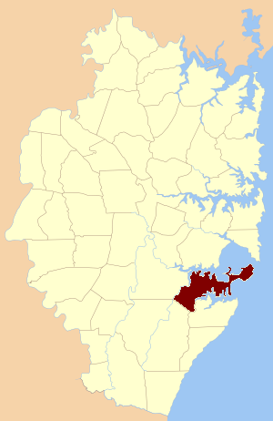
imagesize= 180
caption = Location of the parish within Cumberland
lga = Sutherland Shire
former hundred = Heathcote
county = Cumberland
est = 1835
near-nw = St. George
near-n = St. George
near-ne = Botany
near-e = Pacific Ocean
near-se = Pacific Ocean
near-s = Wattamolla
near-sw = Heathcote
near-w = Holsworthy
Sutherland Parish, Cumberland is one of the 57 parishes of Cumberland County, New South Wales, a cadastral unit for use on land titles. It was originally proclaimed as the parish of Southerland with an 'o', but was misspelled without it on the government gazette. It includes all of the Kurnell peninsula, with Botany Bay and the Georges River to the north; part of the Woronora River to the west; and Port Hacking to the south. Suburbs within the parish include Cronulla, Miranda, Woolooware, Caringbah, Gymea, Sutherland, Sylvania Waters and Oyster Bay.
References
* [http://www.sutherland.nsw.gov.au/ssc/rwpattach.nsf/viewasattachmentPersonal/shire_placenames_20041008.pdf/$file/shire_placenames_20041008.pdf Sutherland shire placenames]
* [http://www.lands.nsw.gov.au/survey_maps/maps_and_imagery/parish_maps Parish map of Sutherland, NSW Department of Lands]
* [http://www.gnb.nsw.gov.au/name_search/extract?id=TRlplMsEIt Geographic Names Board of New South Wales]
Wikimedia Foundation.
2010.
Look at other dictionaries:
Botany Parish, Cumberland — Infobox Australian cadastral name = Botany state = New South Wales imagesize = 180 caption = Location of the parish within Cumberland lga = City of Botany Bay county = Cumberland former hundred = Sydney est = 1835 near nw = Petersham near n =… … Wikipedia
St. George Parish, Cumberland — Infobox Australian cadastral name = St. George state = New South Wales imagesize = 180 caption = Location of the parish within Cumberland lga = Canterbury county = Cumberland former hundred = Sydney est = 1835 near nw = Concord near n = Petersham … Wikipedia
Cumberland County, New South Wales — Map of all coordinates from Google Map of all coordinates from Bing Export all coordinates as KML … Wikipedia
Clan Sutherland — Crest badge … Wikipedia
List of localities in Victoria (Australia) — Map of Local Government Areas in Victoria This is a list of locality names and populated place names in the state of Victoria, Australia, outside the Melbourne metropolitan area. It is organised by region from the south west of the state to the… … Wikipedia
Edinburgh — EDINBURGH, a city, the seat of a university, and the metropolis of the kingdom of Scotland, situated in longitude 3° 10 30 (W.), and latitude 55° 57 29 (N.), about a mile (S. by W.) from Leith, 40 miles (S.S.W.) from Dundee, 42 (E. by N.) from … A Topographical dictionary of Scotland
Scotland — /skot leuhnd/, n. a division of the United Kingdom in the N part of Great Britain. 5,205,000; 30,412 sq. mi. (78,772 sq. km). Cap.: Edinburgh. * * * I Northernmost country of the United Kingdom. Area: 30,421 sq mi (78,789 sq km). Population… … Universalium
Sir Robert Munro, 6th Baronet — For other people named Robert Munro, see Robert Munro (disambiguation). Robert Munro, 6th Baronet Born 1684 Died 1746 Falkirk Allegiance British … Wikipedia
Mansfield Park — Page de titre de la seconde édition de Mansfield Park Auteur Jane Austen Genre … Wikipédia en Français
The Irish (in Countries Other Than Ireland) — The Irish (in countries other than Ireland) † Catholic Encyclopedia ► The Irish (in countries other than Ireland) I. IN THE UNITED STATES Who were the first Irish to land on the American continent and the time of their arrival are … Catholic encyclopedia