Chocontá

Chocontá
Location of the town and municipality of Chocontá in Cundinamarca Department.

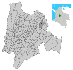
Chocontá is a municipality and town of Colombia in the department of Cundinamarca. It is located on the Pan-American Highway.

In 1938 Choconta had a population of 2,041.[1]

History

Foundation date: 06 September, 1538

A new town was founded in a hill on the other side of the Funza river, in front of the current site in 1563 by mandate of the Oidor Tomás Lópes, and it was moved to the current site in 1573.

Chocontá in Chibcha language means: “Cultivation of the good ally"/"Garden of the neighbour". In precolombian times, it was strong spot for the Zipas. Spaniards arrived on 9 June, 1537, Pentecostal day, when Father Fray Domingo de las Casas named it "Town of the Holy Spirit" ("Pueblo del Espíritu Santo") with a mass.

Gonzálo Jiménez de Quezada visited the town in 1537. In 1854 it was presidential headquarters and on 21 April, 1854 Tomás Herrera was proclaimed President in the Rectory of the town. On 9 August, 1819 at 2 pm The Liberator Simón Bolívar arrived to Chocontá and stayed to rest in what currently is the House of Culture after his trioumph, defining the fate of the Colombian Republic.[2]

References

  1. ^ Columbia-Lippincott Gazeteer. (New York: Columbia University Press, 1952) p. 403
  2. ^ (http://choconta-cundinamarca.gov.co/nuestromunicipio.shtml?apc=mIxx-1-&m=f#historia)

External links

Coordinates: 5°09′N 73°41′W / 5.15°N 73.683°W / 5.15; -73.683


Wikimedia Foundation. 2010.

Игры ⚽ Поможем решить контрольную работу

Look at other dictionaries:

  • Chocontá — Bandera …   Wikipedia Español

  • Chocontá — 5° 09′ 00″ N 73° 41′ 00″ W / 5.15, 73.68333333 …   Wikipédia en Français

  • Choconta — Original name in latin Chocont Name in other language Choconta, Chocont State code CO Continent/City America/Bogota longitude 5.14468 latitude 73.68578 altitude 2656 Population 7592 Date 2012 01 19 …   Cities with a population over 1000 database

  • Choconta — Admin ASC 2 Code Orig. name Chocontá Country and Admin Code CO.33.3686423 CO …   World countries Adminstrative division ASC I-II

  • Muiscas — Para otros artículos sobre este tema, véase muisca. Muisca Balsa Muisca, figura de la Leyenda de El Dorado …   Wikipedia Español

  • Tocancipá — Este artículo o sección necesita referencias que aparezcan en una publicación acreditada, como revistas especializadas, monografías, prensa diaria o páginas de Internet fidedignas. Puedes añadirlas así o avisar al auto …   Wikipedia Español

  • Municipios de Cundinamarca — Anexo:Municipios de Cundinamarca Saltar a navegación, búsqueda División municipal de Cundinamarca, con el Distrito Capital. Cundinamarca posee 116 municipios, distribuidos en 15 provincias, y el Distrito Capital de Bogotá. Son los siguientes …   Wikipedia Español

  • Anexo:Municipios de Cundinamarca — División municipal de Cundinamarca, aunque el Distrito Capital es una subdivisión del departamento, no le pertenece a Cundinamarca. Cundinamarca posee 116 municipios, distribuidos en 15 provincias. Listado de municipios …   Wikipedia Español

  • Troncal Central del Norte — Ruta Nacional 55  Colombia Nombre coloquial …   Wikipedia Español

  • Cundinamarca Department — For the one from 1820 see Cundinamarca Department (1820). For the one from 1824 see Cundinamarca Department (1824). Cundinamarca Department Departamento de Cundinamarca   Department   …   Wikipedia

Share the article and excerpts

Direct link
Do a right-click on the link above
and select “Copy Link”