- Muswellbrook, New South Wales
-
Muswellbrook
New South Wales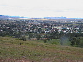
Muswellbrook South
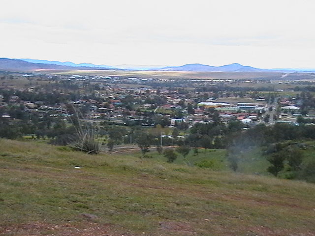
 Muswellbrook
Population: 10,707[1] Established: 1833 Postcode: 2333 Location: LGA: Muswellbrook Shire State District: Upper Hunter Federal Division: Hunter Muswellbrook, a corruption of 'Muscle Brook', is a town and Local Government Area (see Muswellbrook Shire) in New South Wales, Australia.[2] The original spelling and etymology of the town's name is a matter of some debate. "Mussel Creek" (now called "Muscle Creek") was first named by a party of surveyors who found mussels in the small stream while camping along its banks in the early 19th century. The present spelling of Muswellbrook is said[by whom?] to derive from the Muswell Hill area of London (England).
The town is located in the Upper Hunter Valley region, about 243 kilometres (151 mi) north of Sydney. The first European to discover the area was Chief Constable John Howe in 1819. It was declared a township in 1833. At the 2006 census, Muswellbrook had a population of 10,707.[1] The current population of the district, including Denman, is about 15,200.[3] Geologically, Muswellbrook is situated in the northern parts of the Sydney basin, bordering the New England region.[4]
The area is predominantly known for coal mining and horse breeding. Located to the south of the Muswellbrook township are two coal fuelled power stations, Liddell and Bayswater. They were commissioned in 1973 and mid 1980s respectively and employ approximately 500 people from the area.
Contents
Transport
Muswellbrook lies at the junction of the Main Northern railway line and the Merriwa line, part of a cross country rail line to Gulgong.[5] As such, it formed an important junction, as well as serving the numerous coal mining sidings found within a short distance from the main station building.[6]
The New England Highway currently passes through the town. A route was selected for a bypass in 2006 but the Australian Government suspended the project in August 2008.[7] Denman Road provides a connection to the Golden Highway.
Muswellbrook railway station, is serviced by Cityrail, Countrylink and Interstate Coaches as well as local bus services.
Notable persons
- The journalist Donald Horne was raised in Muswellbrook.
- The virtuoso guitarist Tommy Emmanuel was born in Muswellbrook in 1955.
- NRL Referee Shayne Hayne grew up and spent most of his life in Muswellbrook.
- Pro Scooter Rider Adam Ingles was born and raised in Muswellbrook.
- Rugby league player Jamie Feeney was born in Muswellbrook in 1978.
- PGA Golfer Kurt Barnes was born and raised in Muswellbrook in 1981.
- Artist James Clifford (1936 - 1987) was born and raised in Muswelbrook. [8][citation needed]
Popular culture
- Muswellbrook is mentioned in the Steely Dan song Black Friday from the 1975 Katy Lied album
- Muswellbrook is also mentioned in Thomas Keneally's book The Chant of Jimmie Blacksmith
- Muswellbrook is also mentioned in the 1980 Australian Film, "Fatty Finn", where one of the characters remarks, "Things are crook, in Muswellbrook".
Schools
- Muswellbrook South Public School
- Muswellbrook Public School
- St James Muswellbrook
- Muswellbrook High School
- Muswellbrook Pre School Kindergarten
- Muswellbrook Christian School
References
- ^ a b Australian Bureau of Statistics (25 October 2007). "Muswellbrook (State Suburb)". 2006 Census QuickStats. http://www.censusdata.abs.gov.au/ABSNavigation/prenav/LocationSearch?collection=Census&period=2006&areacode=SSC18273&producttype=QuickStats&breadcrumb=PL&action=401. Retrieved 2007-09-17.
- ^ "Geographical Names Register Extract: Muswellbrook". Geographical Names Register (GNR) of NSW. Geographical Names Board of New South Wales. http://www.gnb.nsw.gov.au/name_search/extract?id=ujKqWyrXTR. Retrieved 2009-03-26.
- ^ Australian Bureau of Statistics (25 October 2007). "Muswellbrook (A) (Local Government Area)". 2006 Census QuickStats. http://www.censusdata.abs.gov.au/ABSNavigation/prenav/LocationSearch?collection=Census&period=2006&areacode=LGA15650&producttype=QuickStats&breadcrumb=PL&action=401. Retrieved 29 October 2009.
- ^ http://www.dpi.nsw.gov.au/__data/assets/image/0007/96847/20758.gif
- ^ "Merriwa Branch". www.nswrail.net. http://www.nswrail.net/lines/show.php?name=NSW:merriwa. Retrieved 2006-12-03.
- ^ Muswellbrook up to the Early 1950s Estell, D. Australian Railway Historical Society Bulletin, April, 1997 pp99-106
- ^ "Muswellbrook Bypass". www.rta.nsw.gov.au. http://www.rta.nsw.gov.au/constructionmaintenance/majorconstructionprojectsregional/hunter/muswellbrook/index.html. Retrieved 2007-05-01.
- ^ Germaine, Max. Artists and Galleries of Australia. 1984, Booralong Publications Brisbane Australia. 1984.
See also
External links
Coordinates: 32°16′S 150°54′E / 32.267°S 150.9°E
Towns, suburbs and localities of Muswellbrook Shire | Hunter Region | New South Wales Towns, suburbs
& localitiesAlcheringa • Allan Cunningham • Antiene • Arrowfield • Baerami • Baerami Creek • Baerami South • Bengalla • Bureen • Castle Rock • Coxs Gap • Dalswinton • Dangar • Dartmouth • Denman • Dunbars Creek • Edderton • Edinglassie • Esdai • Giants Creek • Glen Gallic • Grass Tree • Grasstree • Hollydeen • Horseshoe • Horton Park • Jerrys Plains • Kayuga • Kerrabee • Koolbury • Liddell • Mangoola • Manobalai • Marketown • Martindale • McCullys Gap • Mount Dangar • Mount Rest • Muscle Creek • Muswellbrook • Muswellbrook North • Muswellbrook South • Myambat • Oakleigh Stud • Old Yarrawa • Pickering • Piercefield • Richmond Grove • Rosemount • Roxburgh • Sandy Hollow • The Horseshoe • Widden • Widden Valley • Wybong • Yarrawa
Other places &
points of interestBayswater Power Station • Goulburn River • Hunter River • Lake Liddell • Liddell Power Station • Pages River
Categories:- Towns in New South Wales
- Suburbs of the Hunter Region, New South Wales
- Towns in the Hunter Region, New South Wales

Wikimedia Foundation. 2010.