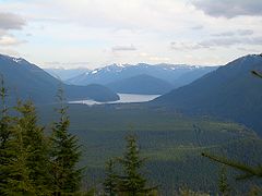
- Chester Morse Lake
-
Chester Morse Lake 
seen from Rattlesnake Mountain Location King County, Washington Coordinates 47°23′13″N 121°42′01″W / 47.38694°N 121.70028°WCoordinates: 47°23′13″N 121°42′01″W / 47.38694°N 121.70028°W Primary inflows North Fork of the Cedar River, South Fork of the Cedar River, and the Rex River Primary outflows Cedar River Basin countries United States Max. length 4 mi (6 km) Surface elevation 1,560 ft (475 m) Chester Morse Lake (originally Cedar Lake) is a lake in the upper region of the Cedar River watershed in the U.S. state of Washington. The original lake surface was 1,530 feet (466 m) above sea level, but when the river was dammed in 1900, the elevation was raised to 1,560 feet (475 m). Chester Morse Lake is more than four miles (6 km) long, and is primarily fed from the east by the north and south forks of the Cedar River, and from the south by the Rex River. The lake is part of the Seattle area water supply. Fishing is prohibited.
References
External links
 Media related to Chester Morse Lake at Wikimedia Commons
Categories:- Landforms of King County, Washington
- Lakes of Washington (state)
- King County, Washington geography stubs
Wikimedia Foundation. 2010.
