- Milton-next-Gravesend
-
Milton-next-Gravesend was, and still is, one of the ancient ecclesiastical parishes in the NW of the county of Kent, England. When Gravesend became a town under Royal Charter in the 13th century, Milton was included within it. Much of the parish was, until c. 1840, rural. The boundary between the two parishes is centred up Gravesend town High Street (which puts the old Town Hall in Milton, not Gravesend), continuing up Windmill Street and Singlewell Road. The spread of the town could only take place to the east - Northfleet lies to the west - so that much of the 'newer' parts of Gravesend built since 1840 lie within Milton parish.
Churches
There are two Church of England churches in Milton: the ancient parish church, dedicated to St Peter and Paul,51°26′21″N 0°23′08″E / 51.4391°N 0.3855°ECoordinates: 51°26′21″N 0°23′08″E / 51.4391°N 0.3855°E which is located in the original settlement;[1] and Christ Church, located at the western end of the original eccelesiastical parish. The latter was built in 1856 when the town of Gravesend began to grow eastwards.[2] There is also a United Reformed Church (St Paul's) and two small independent churches.
St Peter and St Paul had a ring of five bells cast in 1656 by John Hodson. A treble was added in 1810 (cast by Thomas Mears II) and the ring was further augmented to 8 by two new trebles in 1930 (cast by Mears & Stainbank). The tenor is just under 12 cwt, tuned to F#[3].
References
- ^ The History of St Peter and St Paul:The Paraish Church of Milton next Gravesend Robert H Hiscock ISBN 1901132-35-8
- ^ Christ Church Milton-next-Gravesend:One Hundred and Fifty Years of Service, 1856-2006, Peter D Shearan BA (publisher) ISBN 978-09552570-9-1
- ^ "Love's Guide". http://kent.lovesguide.com/milton.htm. Retrieved 14 September 2011.
Towns and villages in the Borough of Gravesham 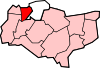 Chalk · Cobham · Culverstone Green · Dode · Harvel · Higham · Istead Rise · Luddesdown · Meopham · Meopham Green · Northfleet · Painters Ash · Singlewell or Ifield · Shorne · Sole Street · Springhead · Thong · VigoCategories:
- Gravesham
- Kent geography stubs

Wikimedia Foundation. 2010.