- Oulton Broad
-
Oulton Broad refers to both the lake and the suburb of Lowestoft in Suffolk, England located 2 miles (3 km) west of the centre of the town.
Coordinates: 52°28′01″N 1°43′01″E / 52.467°N 1.717°E
Oulton Broad 
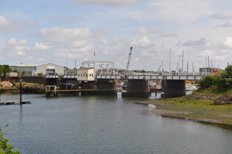
Oulton Broad Swingbridge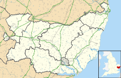
 Oulton Broad
Oulton Broad shown within SuffolkDistrict Waveney Shire county Suffolk Region East Country England Sovereign state United Kingdom Post town Lowestoft Postcode district NR33 Dialling code 01502 EU Parliament East of England List of places: UK • England • Suffolk Contents
Oulton Broad
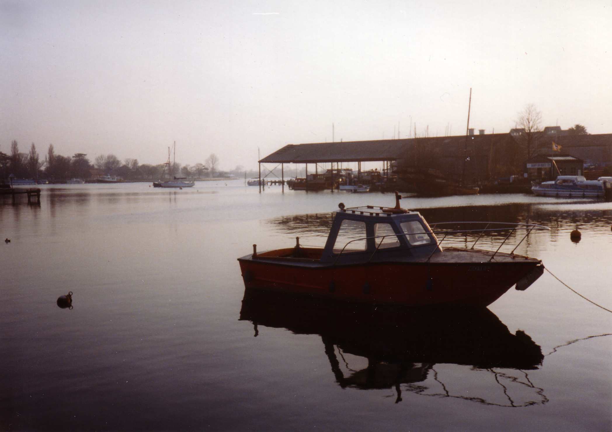
 Oulton Broad, September 1995. From the Commodore Road edge
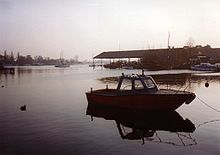
Oulton Broad is an expanse of water and marsh which forms part of the network of man-made bodies of water known as The Broads. It is believed to be the a remnant of medieval peat cutting.[1] To the east it is linked by a lock to Lake Lothing which passes through the centre of Lowestoft and opens into the North Sea. To the west it is linked by Oulton Dyke to the River Waveney.
The Broad is the most southern area of open water in the Broads system, and is a busy tourist and sporting centre. It is used for a variety of watersports, including powerboat racing, and as the base for boat hire.[2] Facilities include a yacht station and moorings as well as a 'village' of holiday chalets. Nicholas Everitt Park has an extensive water frontage. It is one of the few broads with residential areas adjacent, with houses to the north and flats to the east. The north side of the Broad is one of the most expensive residential area in Lowestoft, with large detached houses having lake frontage.
While the eastern and north shores of the Broad are built up, the west and south-west are quiet and natural. This part of the lake can be reached on foot by walking through Nicholas Everitt Park and then by public footpaths and field across White Cast Marshes, an important nature conservation area.[3]
Oulton Broad village
Oulton Broad was once a village separate from Lowestoft. Oulton Broad and Oulton Village were conurbated around the late 1950s with the building of the Rock estate.[citation needed] The original Oulton village covered all that land between the site of Oulton Broad South Railway station and the odd number side of what is now Sands Lane with the line of the Lowestoft-Ipswich railway separating Oulton as a whole from Kirkley and Lowestoft. Oulton Village was a somewhat smaller and largely amorphous village extending from the even number side of Sands Lane out across the fields to Somerleyton. The Oulton Broad conurbation eventually merged with Lowestoft with the development in the early 1990s of the new through-road system around Peto way on the north-east side of the village, which brought with it major development of what had remained until then very light residential and grassland.[citation needed] There is now no discernible boundary between Oulton Broad and Lowestoft, save for the presence of the two railway lines.
Bridge Road is Oulton Broad's main shopping street. Oulton Broad is served by two railway stations; Oulton Broad North on the Lowestoft-Norwich line, and Oulton Broad South on the Lowestoft-Ipswich line.
Nicholas Everitt Park
Nicholas Everitt Park fronts Oulton Broad.[4] Lowestoft Museum in the park was opened by Queen Elizabeth II.[citation needed] It houses one of the world's largest collections of Lowestoft porcelain.[5] The Waveney and Oulton Broad Yacht Club is also located in Nicholas Everitt Park.[citation needed]
George Borrow
After marrying in 1840 the writer, traveller, and walker George Borrow moved to his wife's estate in Oulton Broad.[6] In between travels he wrote several books there. During the 1850s he moved away, but returned to Oulton Broad in 1874 where he stayed until his death in 1881. An hotel in the area is named after him.[7]
References
- ^ Oulton Broad, Heritage gateway. Retrieved 2011-05-05.
- ^ Lowestoft and Oulton Broad Motor Boat Club Powerboat racing. Retrieved 2009-11-25.
- ^ "Broads Local Plan". Norfolk and Suffolk Broads Authority. Archived from the original on 6 February 2007. http://web.archive.org/web/20070206101218/http://www.broads-authority.gov.uk/broads/live/planning/planning-policy/Broads_Local_Plan_adpted_97.doc. Retrieved 2 August 2007.
- ^ "Nicholas Everitt Park". Waveney district government. http://www.waveney.gov.uk/Leisure/Outdoor+Facilities/nicholas_everitt_park.htm. Retrieved 2 August 2007.
- ^ "Lowestoft Heritage page". Visit Lowestoft. Archived from the original on 1 July 2007. http://web.archive.org/web/20070701084743/http://www.visit-lowestoft.co.uk/subpages_transparency/heritage_subpages/museums.htm. Retrieved 2 August 2007.
- ^ "George Borrow page". Bibliomania.com site. http://www.bibliomania.com/0/0/8/. Retrieved 2 August 2007.
- ^ "George Borrow Hotel page". travelpublishing.co.uk. http://www.travelpublishing.co.uk/HiddenPlacesEastAnglia/Suffolk/EAN28846.htm. Retrieved 2 August 2007.
External links
 Media related to Oulton Broad at Wikimedia Commons

Wikimedia Foundation. 2010.