- Oxhill, County Durham
-
For the village in Warwickshire, see Oxhill, Warwickshire.
Coordinates: 54°52′01″N 1°42′25″W / 54.867°N 1.707°W
Oxhill 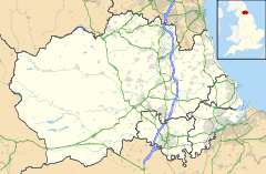
 Oxhill
Oxhill shown within County DurhamOS grid reference NZ189524 Shire county County Durham Region North East Country England Sovereign state United Kingdom Post town DURHAM Postcode district DH9 Police Durham Fire County Durham and Darlington Ambulance North East EU Parliament North East England List of places: UK • England • County Durham Oxhill is a small village in County Durham, in England. It is located to the west of Stanley, on the bottom of the hill which leads up to Annfield Plain. Down the hill to the north are East Kyo and Harperley. Oxhill contains very little: a few households, a pub called The Ox and the main nursery school for the Stanley area.
Oxhill used to be the site of a major level crossing, allowing access from the former nearby Stanhope and Tyne Railway line to a shunting yard adjacent to nearby South Moor, where coal was loaded for transport to the River Tyne for export.
References
External links
Categories:- Villages in County Durham
- County Durham geography stubs

Wikimedia Foundation. 2010.