- Forrest, Australian Capital Territory
Infobox Australian Place | type = suburb
name = Forrest
state = act
city = Canberra
caption =
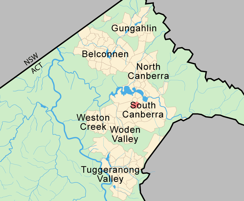
lga =South Canberra
postcode = 2603
est = 1928
propval = $515,000 (2005) [cite web
title =Forrest ACT
publisher =allhomes.com.au
url =http://allhomes.com.au/c/ah?a=uisu&i=317
accessdate = ]
pop = 1412 (2001 census)
ACTgov = Molonglo
fedgov = Canberra
near-nw = Yarralumla
near-n = Capital Hill
near-ne = Barton
near-e = Kingston
near-w = Deakin
near-sw = Red Hill
near-s = Red Hill
near-se = GriffithForrest (postcode: 2603) is a suburb of
Canberra ,Australian Capital Territory ,Australia . Forrest is named after Sir John Forrest, an explorer,legislator ,Federalist ,premier of Western Australia , and one of the fathers of theAustralian Constitution . Streets in Forrest are named after explorers and governors.Forrest is one of the few suburbs in Canberra built to the original Canberra plans. It contains many circular and geometric patterns in its streets and can be quite confusing to drive in. Forrest was originally part of the suburb Blanfordia which was gazetted as a suburb in 1928. The original residents of Forrest were mostly senior public servants who were moved up from Melbourne.
Demography
The population of Forrest on census night
2001 was 1412 people.School:
Forrest Primary School is situated in Hobart Avenue in Forrest. It caters for students in years P-6. The students wear red and yellow.Forrest celebrated it's 50th birthday on the 4th April 2008. (1958-2008)
Suburb amenities
The suburb includes part of the Manuka shopping centre. The suburb also contains a government run primary school.
Forrest together with the northern parts of Deakin and Red Hill (sometimes called "old Deakin" and "old Red Hill"), represent the most prestigious residential area in Canberra. Most of the area is detached dwellings in which a 1600m² block would be on the small side, and 2000 m² blocks are not untypical.
Notable places
Urban conservation area
The suburb is subject to conservation measures to preserve its character. Important values being preserved in the suburb are:
*The majority of the precinct was constructed in 1926 – 27 to meet the urgent need to provide housing for public servants prior to the opening of the provisional Parliament House in 1927.
*The Melbourne firmOakley, Parkes and Scarborough won a 1924 competition to design the housing for the precinct.
*The street layout is directly derived from Griffin’s 1913 plan which defined the major axes of Melbourne and Hobart Avenues radiating from Capital Hill and concentric circles. The road layout and subdivision pattern of the precinct is mirrored on the opposite side of Melbourne Avenue.
*The public domain landscaping of the precinct is associated withThomas Charles Weston , Superintendent of Parks, Gardens and Afforestation, Canberra 1913-1926. Weston’s use of Australian native species was an unusual practice for this period.
*The precinct is also a repository of a small number of compatible privately built dwellings designed by early local architects includingKenneth H Oliphant , one of Canberra’s first independent architects. Oliphant’s work has contributed notably to the character of the urban architecture of Canberra.cite web | year = 2003 | url = http://www.actpla.act.gov.au/actpla/tplan/variatio/dv173/Forrest.pdf | title = Forrest Garden City Heritage precinct | format = pdf | work = The Territory Plan online; Variation number 173 of November 2003 | publisher = ACT Planning and Land Authority | accessdate = 2006-05-28]Street furniture
The remnants of
street furniture , that is street signs, fire hydrants and footpath lighting and other elements including kerbs and gutters and examples of brick drains, are valued for their contribution to the aesthetic of a twentieth century 'Garden City' planned subdivision. The furniture is now protected.Forrest residences
These buildings are in the block bounded by Canberra Avenue, Empire Circuit, Manuka Circle and Fitzroy Street. They were completed in 1938 and include a former fire station. The buildings are considered important examples of Australian Early Modern Architecture and illustrate a distinctive comparison with the "Federal Capital Architecture" that dominated in Canberra in the 1920s and 30s.
Geology
Mount Painter Volcanics dark grey to green grey dacitic
tuff is found in all except the north east side. There are a few outcrops of sediments in amongst the volcanics containingshale andsandstone . On the North east a patch of Ordovician Pittman Formationgreywacke outcrops along Canberra Ave. Black Mountain Sandstone is near St Andrew's church in the north north east. Canberra Formation, calcareous shale is found in the north.The Deakin Fault runs from State Circle to Manuka separating the Mount Painter Volcanics from the other sediments.References
Wikimedia Foundation. 2010.