- Innerdalen
Infobox_protected_area
name = Innerdalen nature reserve
iucn_category = V
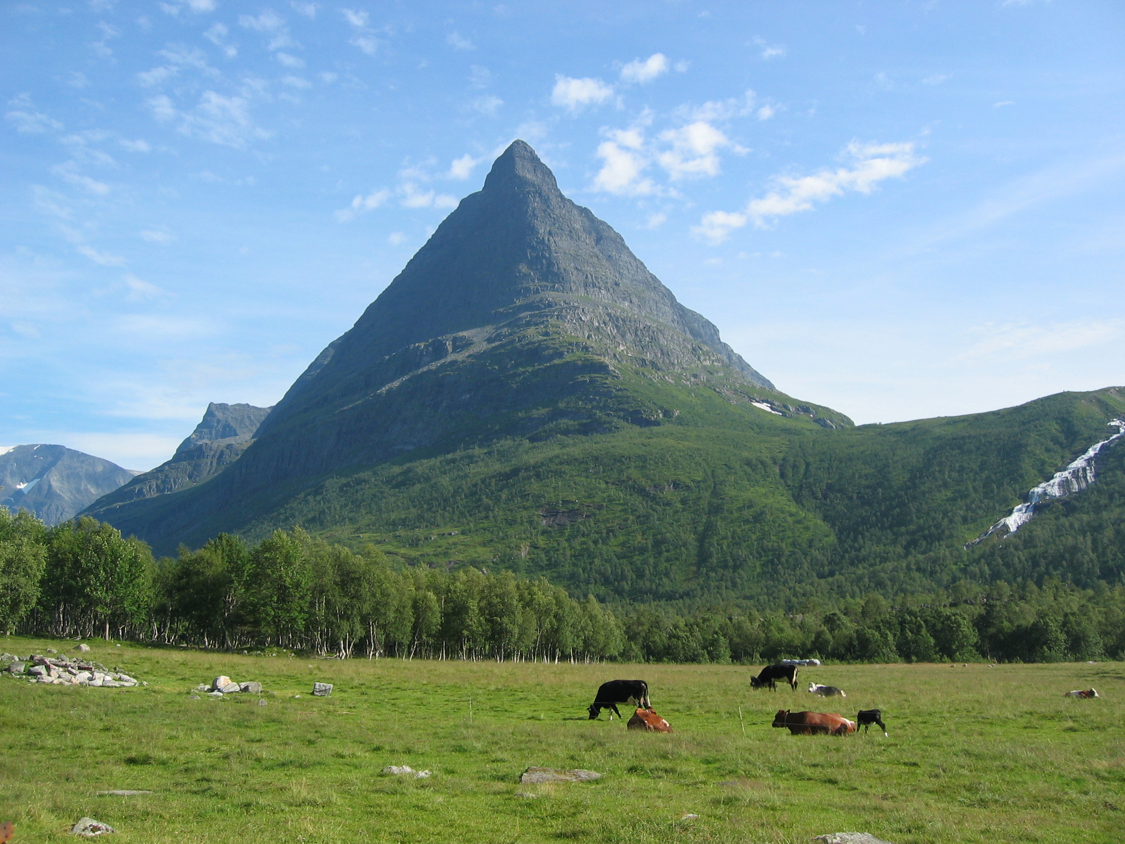
caption =Innerdalstårnet seen from the valley floor
locator_x =
locator_y =
location =Sunndal ,Møre og Romsdal ,Norway
nearest_city =Sunndalsøra
lat_degrees = 62
lat_minutes = 43
lat_seconds = 52
lat_direction = N
long_degrees = 8
long_minutes = 44
long_seconds = 43
long_direction = E
area = 73 km²
established =1967
visitation_num =
visitation_year =
governing_body =Norwegian Directorate for Nature Management Innerdalen is a valley in
Sunndal ,Møre og Romsdal ,Norway and is also Norway's first nature reserve.The valley and nature reserve goes fromÅlvundeid by highway 70 in the east, and approximately 25 km to the west to Innerdalsporten, and lies within the mountain rangeTrollheimen .The valley is known for its mountains and is regularly visited by
mountain climber s, for example the mountainsStore Trolla (1,850 m, highest inTrollheimen ),Skarfjellet (1,790 m), andInnerdalstårnet (1,452 m).Norsk Tindeklub (Norwegian Mountaineering Association) released in 2001 a mountain guide for Innerdalen (in Norwegian) and also has a private cabin, Giklingdalshytta beneath Innerdalstårnet.For glacier hiking, there is a glacier on top of
Kongskrona called Vinnufonna.The
Norwegian Mountain Touring Association has two cabins in the valley, Innerdalshytta (originally built 1889) and Renndølsetra.
Wikimedia Foundation. 2010.