- Media Township, Henderson County, Illinois
-
Media Township — Township — Location in Henderson County Henderson County's location in Illinois
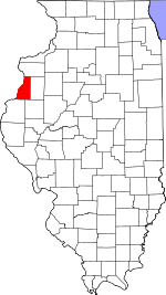
Coordinates: 40°45′56″N 90°50′20″W / 40.76556°N 90.83889°WCoordinates: 40°45′56″N 90°50′20″W / 40.76556°N 90.83889°W Country  United States
State  Illinois
County Henderson Established November 6, 1906 Area - Total 36.4 sq mi (94.29 km2) - Land 36.4 sq mi (94.29 km2) - Water 0 sq mi (0 km2) 0% Elevation 712 ft (217 m) Population (2000) - Total 468 - Density 12.9/sq mi (5/km2) Time zone CST (UTC-6) - Summer (DST) CDT (UTC-5) ZIP codes 61418, 61460, 61478, 61480 GNIS feature ID 0429349 Media Township is one of eleven townships in Henderson County, Illinois, USA. As of the 2000 census, its population was 468[1].
Contents
Geography
According to the United States Census Bureau, Media Township covers an area of 36.4 square miles (94 km2).
Cities, towns, villages
- Media
- Stronghurst (east quarter)
Cemeteries
The township contains these three cemeteries: Adair, Davidson and Walnut Grove.
Major highways
Airports and landing strips
- Neff Airport
School districts
- West Central Community Unit School District 235
Political districts
- Illinois's 17th congressional district
- State House District 94
- State Senate District 47
References
- United States Census Bureau 2008 TIGER/Line Shapefiles
- "Media Township". Geographic Names Information System, U.S. Geological Survey. http://geonames.usgs.gov/pls/gnispublic/f?p=gnispq:3:::NO::P3_FID:0429349. Retrieved 2009-09-19.
- United States National Atlas
External links
Municipalities and communities of Henderson County, Illinois County seat: Oquawka City 
Villages Biggsville | Gladstone | Gulf Port | Lomax | Media | Oquawka | Raritan | Stronghurst
Townships Bald Bluff | Biggsville | Carman | Gladstone | Lomax | Media | Oquawka | Raritan | Rozetta | Stronghurst | Terre Haute
Unincorporated
communitiesBald Bluff | Carman | Carthage Lake | Decorra | Heapsville | Hopper | Iowa Junction | Lone Tree | Milroy | Olena | Reeds | Rozetta | Shokokon | Terre Haute | Yellow Banks
Footnotes ‡This populated place also has portions in an adjacent county or counties
Categories:- Townships in Henderson County, Illinois
- 1906 establishments in the United States
- Populated places established in 1906


Wikimedia Foundation. 2010.