- Hardin County, Texas
Infobox U.S. County
county = Hardin County
state = Texas

map size = 250
founded = 1858
seat = Kountze | area_total_sq_mi =897
area_land_sq_mi =894
area_water_sq_mi =3
area percentage = 0.34%
census yr = 2000
pop = 48073
density_km2 =21
web = www.co.hardin.tx.us
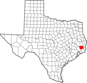
|Hardin County is a
county located in the state ofTexas ,United States . In 2000, its population was 48,073. The county is named for a family fromLiberty County, Texas . The seat of the county is KountzeGR|6. It is part of the Beaumont–Port Arthur Metropolitan Statistical Area.Geography
Hardin County is located on the flat coastal plains of
Southeast Texas , roughly thirty miles (50 km) north of theGulf of Mexico . The county is largely covered by the dense forest of theBig Thicket . It is crossed by numerous small streams and creeks which drain the county into theNeches River , which forms the eastern boundary of the county.According to the U.S. Census Bureau, the county has a total area of 897
square mile s (2,324km² ), of which, 894 square miles (2,316 km²) of it is land and 3 square miles (8 km²) of it (0.34%) is water.Major highways
*
*
**"See List of Highways in Hardin County for more roadways in Hardin County."
Adjacent counties
*Tyler County (north)
*Jasper County (east)
*Orange County (southeast)
*Jefferson County (south)
*Liberty County (southwest)
*Polk County (northwest)Its eastern boundaries with Jasper County and Orange County are formed by the Neches River. The southern boundary with Jefferson County is formed by
Pine Island Bayou .National
protected area *
Big Thicket National Preserve (part)Demographics
As of the
census GR|2 of 2000, there were 48,073 people, 17,805 households, and 13,638 families residing in the county. Thepopulation density was 54 people per square mile (21/km²). There were 19,836 housing units at an average density of 22 per square mile (9/km²). The racial makeup of the county was 90.86% White, 6.91% Black or African American, 0.32% Native American, 0.23% Asian, 0.01% Pacific Islander, 0.74% from other races, and 0.93% from two or more races. 2.54% of the population were Hispanic or Latino of any race.There were 17,805 households out of which 37.2% had children under the age of 18 living with them, 62.6% were married couples living together, 10.2% had a female householder with no husband present, and 23.4% were non-families. 20.7% of all households were made up of individuals and 9.2% had someone living alone who was 65 years of age or older. The average household size was 2.68 and the average family size was 3.09.
In the county, the population was spread out with 27.8% under the age of 18, 8.5% from 18 to 24, 28.3% from 25 to 44, 23.2% from 45 to 64, and 12.2% who were 65 years of age or older. The median age was 36 years. For every 100 females there were 96.7 males. For every 100 females age 18 and over, there were 92.4 males.
The median income for a household in the county was $37,612, and the median income for a family was $42,890. Males had a median income of $35,881 versus $22,823 for females. The
per capita income for the county was $17,962. About 8.8% of families and 11.20% of the population were below thepoverty line , including 13.3% of those under age 18 and 10.6% of those age 65 or over.Cities and towns
*Batson (unincorporated)
*Bragg (unincorporated)
*Honey Island (unincorporated)
*Kountze
*Lumberton
*Pinewood Estates (unincorporated)
*Rose Hill Acres
*Saratoga (unincorporated)
*Silsbee
*Sour Lake
*Thicket (unincorporated)
*Votaw (unincorporated)
*Village Mills (unincorporated)
*Wildwood (unincorporated)References
External links
* [http://www.co.hardin.tx.us/ Hardin County government's website]
* [http://www.tsha.utexas.edu/handbook/online/articles/view/HH/hch6.html Hardin County in "Handbook of Texas Online"] at the University of Texas
Wikimedia Foundation. 2010.