- Clover Township, Henry County, Illinois
-
Clover Township — Township — Location in Henry County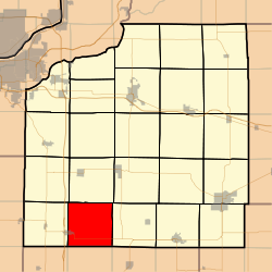 Henry County's location in Illinois
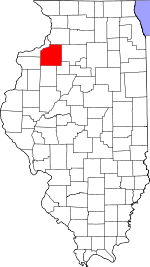
Coordinates: 41°11′43″N 90°16′06″W / 41.19528°N 90.26833°WCoordinates: 41°11′43″N 90°16′06″W / 41.19528°N 90.26833°W Country  United States
State  Illinois
County Henry Established November 4, 1856 Area - Total 34.93 sq mi (90.48 km2) - Land 34.93 sq mi (90.48 km2) - Water 0 sq mi (0 km2) 0% Elevation 748 ft (228 m) Population (2000) - Total 975 - Density 27.9/sq mi (10.8/km2) Time zone CST (UTC-6) - Summer (DST) CDT (UTC-5) ZIP codes 61238, 61262, 61413, 61414, 61490 GNIS feature ID 0428823 Clover Township is one of twenty-four townships in Henry County, Illinois, USA. As of the 2000 census, its population was 975[1]. Clover Township was originally known as Ashnelet Township, but was changed on an unknown date.
Contents
Geography
According to the United States Census Bureau, Clover Township covers an area of 34.93 square miles (90.5 km2).
Cities, towns, villages
- Woodhull (partial)
Adjacent townships
- Andover Township (north)
- Weller Township (east)
- Walnut Grove Township, Knox County (southeast)
- Ontario Township, Knox County (south)
- Rio Township, Knox County (southwest)
- Oxford Township (west)
- Lynn Township (northwest)
Cemeteries
The township contains these two cemeteries: Clover Chapel and Woodhull.
Major highways
School districts
- Alwood Community Unit School District 225
- Cambridge Community Unit School District 227
Political districts
- Illinois's 17th congressional district
- State House District 74
- State Senate District 37
References
- "Clover Township, Henry County, Illinois". Geographic Names Information System, U.S. Geological Survey. http://geonames.usgs.gov/pls/gnispublic/f?p=gnispq:3:::NO::P3_FID:0428823. Retrieved 2010-01-17.
- United States Census Bureau 2008 TIGER/Line Shapefiles
- United States National Atlas
External links

Lynn Township Andover Township Oxford Township 
Weller Township  Clover Township

Rio Township, Knox County Ontario Township, Knox County Walnut Grove Township, Knox County Municipalities and communities of Henry County, Illinois County seat: Cambridge Cities 
Town Villages Alpha | Andover | Atkinson | Bishop Hill | Cambridge | Cleveland | Coal Valley‡ | Hooppole | Orion | Woodhull
Townships Unincorporated
communitiesFootnotes ‡This populated place also has portions in an adjacent county or counties
Categories:- Townships in Henry County, Illinois


Wikimedia Foundation. 2010.