- Mount Sterling Township, Brown County, Illinois
-
Mount Sterling Township — Township — Location in Brown County Brown County's location in Illinois
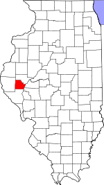
Coordinates: 39°58′22″N 90°44′54″W / 39.97278°N 90.74833°WCoordinates: 39°58′22″N 90°44′54″W / 39.97278°N 90.74833°W Country United States State Illinois County Brown Established November 8, 1853 Area – Total 37.21 sq mi (96.38 km2) – Land 37.15 sq mi (96.22 km2) – Water 0.06 sq mi (0.15 km2) 0.16% Elevation 705 ft (215 m) Population (2000) – Total 4,562 – Density 122.8/sq mi (47.4/km2) Time zone CST (UTC-6) – Summer (DST) CDT (UTC-5) ZIP codes 62353, 62378 GNIS feature ID 0429409 Mount Sterling Township is one of nine townships in Brown County, Illinois, USA. As of the 2000 census, its population was 4,562[1].
Contents
Geography
According to the United States Census Bureau, Mount Sterling Township covers an area of 37.21 square miles (96.4 km2); of this, 0.06 square miles (0.16 km2) or 0.16 percent is water.
Cities
Unincorporated towns
- Hersman
(This list is based on USGS data and may include former settlements.)
Cemeteries
The township contains these ten cemeteries: Greenwell, Harbour, Hersman, Icabod Perry, Keifer, Means, Mount Sterling Catholic, Mount Sterling City, Putnam and Wilson.
Major highways
 US Route 24
 Illinois Route 99
 Illinois Route 107
Landmarks
- Fairground
School districts
- Brown County Community Unit School District 1
Political districts
- Illinois' 18th congressional district
- State House District 93
- State Senate District 47
References
- "Mount Sterling Township, Brown County, Illinois". Geographic Names Information System, U.S. Geological Survey. http://geonames.usgs.gov/pls/gnispublic/f?p=gnispq:3:::NO::P3_FID:0429409. Retrieved 2010-01-04.
- United States Census Bureau 2007 TIGER/Line Shapefiles
- United States National Atlas
External links

Pea Ridge Township Missouri Township Ripley Township Lee Township 
Cooperstown Township  Mount Sterling Township

Buckhorn Township Elkhorn Township Versailles Township Municipalities and communities of Brown County, Illinois Cities 
Villages Townships Buckhorn | Cooperstown | Elkhorn | Lee | Missouri | Mount Sterling | Pea Ridge | Ripley | Versailles
Unincorporated
communitiesBenville | Buckhorn | Cooperstown | Damon | Fargo | Gilbirds | Hersman | Jaques | La Grange | Morrelville | Siloam
Ghost towns Milton | White Oak Springs
Categories:- Townships in Brown County, Illinois
- Populated places established in 1853


Wikimedia Foundation. 2010.