- Demir Hisar (town)
-
Demir Hisar (town)
Демир Хисар— Town —  Location within Macedonia
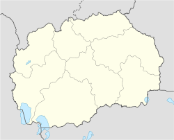
 Demir Hisar (town)
Coordinates: 41°16′0″N 21°12′0″E / 41.266667°N 21.2°ECoordinates: 41°16′0″N 21°12′0″E / 41.266667°N 21.2°E Country  Macedonia
Municipality Demir Hisar municipality Government - Mayor Population (2002) - Total 2,593 Time zone CET (UTC+1) - Summer (DST) CEST (UTC+2) Postal code Area code(s) +389 Car plates BT Demir Hisar (Macedonian: Демир Хисар [dɛˈmir‿xisar] (
 listen)) is a town in Republic of Macedonia. It is the seat of Demir Hisar Municipality. This small settlement has an absolute Macedonian ethnic majority. The name of the town translates to "Iron Castle" in Turkish, and dates back to the time when Macedonia was ruled by the Ottoman Empire.
The settlement is situated along the main road between the important Macedonian cities of Bitola and Kičevo.
Demographics
The town of Demir Hisar has 2,593 residents.
Number % TOTAL 2,593 100 Macedonians 2,473 95.37 others 120 4.62 References
Cities and towns in the Republic of Macedonia Berovo · Bitola · Bogdanci · Debar · Delčevo · Demir Hisar · Demir Kapija · Gevgelija · Gostivar · Kavadarci · Kičevo · Kočani · Kratovo · Kriva Palanka · Kruševo · Kumanovo · Makedonska Kamenica · Makedonski Brod · Negotino · Ohrid · Pehčevo · Prilep · Probištip · Radoviš · Resen · Skopje · Struga · Strumica · Sveti Nikole · Štip · Tetovo · Valandovo · Veles · Vinica Categories:
- Towns in the Republic of Macedonia
- Republic of Macedonia geography stubs

Wikimedia Foundation. 2010.