- Oberreute
-
Oberreute 

 OberreuteLocation of Oberreute within Lindau district
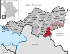
Coordinates 47°34′N 9°56′E / 47.56667°N 9.93333°ECoordinates: 47°34′N 9°56′E / 47.56667°N 9.93333°E Administration Country Germany State Bavaria Admin. region Swabia District Lindau Municipal assoc. Stiefenhofen Mayor Gerhard Olexiuk (CSU) Basic statistics Area 13.49 km2 (5.21 sq mi) Elevation 860-1,041 m Population 1,641 (31 December 2010)[1] - Density 122 /km2 (315 /sq mi) Other information Time zone CET/CEST (UTC+1/+2) Licence plate LI Postal code 88179 Area code 08387 Website www.gemeinde.oberreute.de Oberreute is a municipality in the district of Lindau in Bavaria in Germany and member of the municipal association of Stiefenhofen. It is an acknowledged air health resort.
Contents
Geography
Oberreute is located in the Allgäu region.
History
The contemporary districts of Stadels and Schönebühl once were seat of a court. Oberreute was not formed until the end of the 18th century. In 1797 the first church was built by inhabitants. The town had been part of the Austrian authority of Bregenz-Hohenegg. Since the signing of the peace treaties of Brünn and Preßburg in 1805 the municipality belongs to Bavaria.
Population development
In 1970 1,040, in 1987 1,283 and in 2000 1,471 inhabitants were living in the municipality of Oberreute.
Politics
The mayor of the town is Gerhard Olexiuk.
The revenue from the municipal tax added up to 693,000 € in 1999, of which the net business tax amounted to 101,000 €.
Economy and infrastructure
Economy, agriculture and forestry
According to the official statistics, in 1998 there were neither employees who were subject to social insurance contribution in the industrial sector, nor in the sector of trade and transport at place of work. At place of domicile there were 459 employees altogether. In the industrial sector there were six, in the main construction trade two businesses. Moreover, there were 54 agricultural businesses in 1999 with a total area of 881 ha.
Education
In 1999 there were the following institutions:
- Kindergartens: 50 kindergarten places and 49 children
- An elementary school with four teachers and 82 students
Bodolz | Gestratz | Grünenbach | Heimenkirch | Hergatz | Hergensweiler | Lindau | Lindenberg im Allgäu | Maierhöfen | Nonnenhorn | Oberreute | Opfenbach | Röthenbach | Scheidegg | Sigmarszell | Stiefenhofen | Wasserburg am Bodensee | Weiler-Simmerberg | Weißensberg
References
- ^ "Fortschreibung des Bevölkerungsstandes" (in German). Bayerisches Landesamt für Statistik und Datenverarbeitung. 31 December 2010. https://www.statistikdaten.bayern.de/genesis/online?language=de&sequenz=tabelleErgebnis&selectionname=12411-009r&sachmerkmal=QUASTI&sachschluessel=SQUART04&startjahr=2010&endjahr=2010.
Categories:- Municipalities in Bavaria
- Lindau district
- Swabia geography stubs


Wikimedia Foundation. 2010.