- Bobonaro
Infobox East Timor District
name = Bobonaro
tetum =
capital =Maliana
area = 1,368
arearank = 5th
population = 83,034
population_as_of = 2004
populationrank = 4th
density = 60.7
densityrank = 7th
households = 18,397
households_as_of = 2004
householdsrank = 4th
isocode = TL-BO
subdistricts =Atabae ,Balibó , Bobonaro,
Cailaco ,Lolotoi ,Maliana
map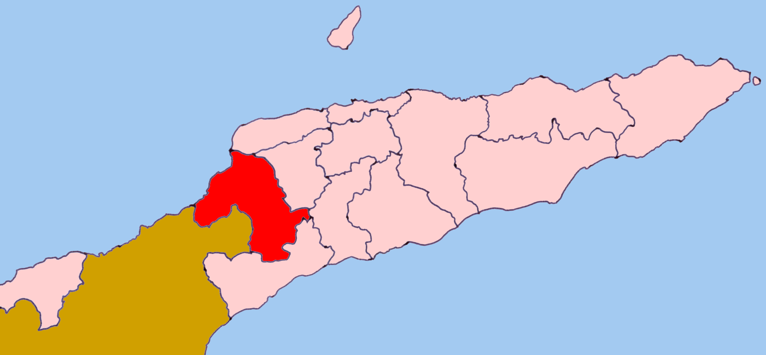
The Bobonaro district ( _pt. Distrito Bobonaro) is one of 13 administrative districts within the Democratic Republic of Timor-Leste commonly known asEast Timor . It is the second-most western district on the east half of the island. It has a population of 82,385 (Census 2004) and an area of 1,368 km². Its subdistricts areAtabae ,Balibó , Bobonaro,Cailaco ,Lolotoi (also spelled Lolotoe) andMaliana . InPortuguese Timor , the district was the same; however its capital was at Vila Armindo Monteiro, which is now called Bobonaro.The
Savu Sea lies to the north of Bobonaro. The district borders the districts of Liquiçá to the northeast,Ermera to the east, Ainaro to the southeast, andCova-Lima to the south. To the west lies theIndonesia n provinceNusa Tenggara Timur .The capital of Bobonaro is East Timor's fourth largest city,
Maliana .As of 2004 it has a population of 13,200. It sits at 9.00°S and 125.22°E, 149 km from to the southwest of the national capital,Dili . The next two largest cities in the district areAubá , with 6,700 people; andLolotoi with a population of 3,800.The district had been a popular destination in Timor, due to its mountains and hot springs, but it suffered much violence in the war for independence.
Balibó , located about 10 miles from the Indonesian border, was estimated by Human Rights Watch to be 70% destroyed during the militia violence that preceded the referendum for East Timorese independence. It was also the site of the killing of five Australian-based journalists (theBalibo Five ) by Indonesian forces onOctober 16 ,1975 during an incursion by Indonesia into what was thenPortuguese Timor .In addition to the official languages of
Tetum and Portuguese, a large part of Bobonaro speaks theMalayo-Polynesian languages Bunak and Kemak, which are designated "national languages" by the constitution.
Wikimedia Foundation. 2010.