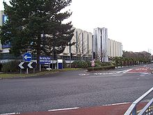
- County Gates
-
Coordinates: 50°43′25″N 1°54′27″W / 50.72361°N 1.9075°W
County Gates is the historic crossing point between the shire counties of Dorset and Hampshire. On April 1, 1974 when Bournemouth and Christchurch were incorporated into Dorset, it became the main crossing point between the Borough of Poole and the Borough of Bournemouth. County Gates sits on the A35 road.
Today, County Gates is a busy gyratory that sits on the Poole side of the border with Bournemouth. In the centre of the roundabout is the Liverpool Victoria (LV) head quarters. The roundabout feeds to and from Poole Road (A35), Wessex Way (A338), Lindsay Road, The Avenue which leads to Branksome Park, Canford Cliffs and Sandbanks, and Seamoor Road which leads into Westbourne.
Categories:- Districts of Poole
- Dorset geography stubs
Wikimedia Foundation. 2010.

