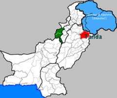
- Tanda, Gujrat
-
NOMAN.KHALID$ CH BRADRAN — village chechian p/o baru 03006225489 — Coordinates: 32°25′N 74°13′E / 32.42°N 74.22°ECoordinates: 32°25′N 74°13′E / 32.42°N 74.22°E Country  Pakistan
Province Government – haji Area – Total 5km km2 (Expression error: Unrecognised word "km" sq mi) Population – Total 100,000 Time zone PST (UTC+5) Calling code 092 053 Tanda is a town in Gujrat District in the Pakistani province of Punjab. It is a Union council, an administrative subdivision of Gujrat Tehsil.[1]
Contents
History
The word Tanda means "traveling body or gangs" in the Labanki language.[citation needed] Before the Partition of Punjab in 1947 the town had a large population of Sikhs belonging to the Labana community. Labanas were brought in by Choudhery of Mota(an adjacent village)to protect them from the gangs of thiefs use to come down from Kashmir mountain to loot the villagers. After partition they migrated to East Punjab, conversely Gujjar, Malik and Mirza tribes from Kashmir and East Punjab migrated into the Tanda area at the same time. Labanas established a community school in Tanda for the free education of their community,for this cause their tribe decided that no women will wear jewelry and all held should be deposited for the establishment of school. This school with boarding house very quickly established its repo and even before partition considered as one of the best school in the zone.
Geography
Tanda is located at 32°42′N 74°22′E / 32.70°N 74.36°E. Tanda is the name of a small locality, which is a well known small city of Gujrat.
Demography
The population is over 99% Muslim. Most people in the town speak Punjabi, though almost all of them can also speak national language of Pakistan, Urdu. English is spoken by educated elite.
Education
The higher secondery school in the town, Government Higher Secondery School, has nurtured many brilliant students over the years which have gone to make a name is larger Pakistani cities and overseas.
References
Categories:
Wikimedia Foundation. 2010.

