New Bight Airport

New Bight Airport
New Bight Airport
IATA: TBIICAO: MYCB
Summary
Airport type Public
Serves New Bight, Cat Island, Bahamas
Elevation AMSL 5 ft / 2 m
Coordinates 24°18′55″N 075°27′08″W / 24.31528°N 75.45222°W / 24.31528; -75.45222Coordinates: 24°18′55″N 075°27′08″W / 24.31528°N 75.45222°W / 24.31528; -75.45222
Map
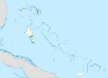
MYCB is located in Bahamas
MYCB
Location in The Bahamas
Runways
Direction Length Surface
m ft
09/27 1,539 5,049 Asphalt
Source: DAFIF[1][2]

New Bight Airport (IATA: TBIICAO: MYCB) is an airport in New Bight on Cat Island in The Bahamas.[1]

Contents

Facilities

The airport resides at an elevation of 5 ft (1.5 m) above mean sea level. It has one runway designated 09/27 with an asphalt surface measuring 1,539 × 30 m (5,049 × 98 ft).[1]

Airlines and destinations

Airlines Destinations
Bahamasair Nassau
Continental Connection operated by Gulfstream International Airlines Fort Lauderdale
Lynx Air Express operate by Florida Coastal Airlines Fort Lauderdale

See also

References

  1. ^ a b c Airport information for MYCB at World Aero Data. Data current as of October 2006.Source: DAFIF.
  2. ^ Airport information for TBI at Great Circle Mapper. Source: DAFIF (effective Oct. 2006).

External links


Wikimedia Foundation. 2010.

Игры ⚽ Нужна курсовая?

Look at other dictionaries:

  • New York — Cet article concerne la plus grande ville américaine. Pour l État homonyme, voir État de New York. Pour les autres significations, voir New York (homonymie). New York …   Wikipédia en Français

  • New Zealand State Highway 3 — Straßenschild des SH3 Verlauf des SH3 Der State Highway 3 …   Deutsch Wikipedia

  • New Zealand State Highway 3 — State Highway 3 Route information Maintained by …   Wikipedia

  • New York State Route 25 — NY 25 redirects here. NY 25 may also refer to New York s 25th congressional district. NYS Route 25 Map of Long Island with NY 25 highlighted in red …   Wikipedia

  • Lynden Pindling International Airport — IATA: NAS – ICAO: MYNN Summary Airport type Publ …   Wikipedia

  • Fort Lauderdale-Hollywood International Airport — Infobox Airport name = Fort Lauderdale Hollywood International Airport caption = IATA = FLL ICAO = KFLL FAA = FLL type = Public owner = Broward County operator = Broward County city served = South Florida location = Fort Lauderdale, Florida… …   Wikipedia

  • Geography of New York Harbor — [ Upper New York Bay,2. Lower New York Bay,3. Newark Bay, 4. Hudson River, 5. East River, 6. Raritan Bay, 7. Jamaica Bay, 8. Long Island Sound.9. New York Bight (North Atlantic Ocean), 10. Ambrose Channel11. Mud Dump Site12. Hudson CanyonMajor… …   Wikipedia

  • Géographie de New York — Image satellite de New York …   Wikipédia en Français

  • Cockatoo Island (New South Wales) — Cockatoo Island Sydney, New South Wales Cockatoo Island Population …   Wikipedia

  • Gulfstream International Airlines — Infobox Airline airline=Gulfstream International logo=LogoGIA.jpg logo size=250 fleet size=35 destinations=21 IATA=3M ICAO=GFT callsign=GULF FLIGHT parent=Gulfstream International Group founded=1988 headquarters=Fort Lauderdale, Florida key… …   Wikipedia

Share the article and excerpts

Direct link
Do a right-click on the link above
and select “Copy Link”